![]()
The History of Botesdale

![]()
The History of Botesdale
BOTESDALE is a small town, consisting of BOTESDALE, with portions of the parishes of RICKINGHALL INFERIOR and RICKINGHALL SUPERIOR adjoining, forming one street of nearly a mile in length, on the road from Bury to Norwich, and is a polling place for the North Eastern division of the county, 4½ miles west from Mellis station, 6 south-west from Diss in Norfolk, 8 west-by-north from Eye, 15 from Bury St. Edmunds and 87 from London, in Hartismere hundred, petty sessional division and union, county court district of Eye, rural deanery of Hartismere, archdeaconry of Suffolk and diocese of Norwich. This place, for ecclesiastical purposes, is in the parish of Redgrave. The town is supplied with gas from works, the property of Samuel Robinson esq. situated at the back of Botesdale street, and erected in 1862. The water supply is obtained from wells. The church of St. Botolph, originally built about 1500, as a memorial chapel to the Sheriffe family, as appears from an inscription over the doorway, is a structure of flint with one bell, and in 1884 was purchased by Miss Wilson and conveyed to trustees, and has since been used for Church of England services: ....... [Kelly’s Directory of Cambridgeshire, Norfolk & Suffolk - MDCCCXCII.]
The sections below will take you to what we currently have about the history of Botesdale.
Currently available data for Botesdale
(Use the searches to find individual records ►)
External sites and information with relevance to Botesdale
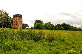
Photos of Botesdale as it is now .....
Page last updated: 12 Jul 2022
© Diss Family History Group & Nigel Peacock 2022