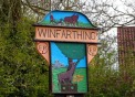
Winfarthing
Tithe Apportionment (1840)
Winfarthing
Tithe Apportionment (1840)
( Show general information )
| Records found = 1571 from 128579 | |||||
| ID | Date | Name | Role | Notes | |
| 92516 | 08.06.1840 | ABBOTT Charles | Occupier | Occupied with PAIN Leticia, GREEN Christopher, HAVERS William, ELSEY Edward and GREEN Levi; Plot No.: 338; Landowner: MACRO Abraham; Description: Cottages and Gardens, Pasture; Area: R:1 P:10, 0.313acres, 0.126 hectares | |
| 92726 | 08.06.1840 | ASHLEY Jacob | Occupier | Occupied with HOLMES William; Plot No.: 428; Landowner: GLANFIELD John; Description: The Jolly Farmers Public House, Cottages and Gardens, Pasture; Area: P:36, 0.225acres, 0.091 hectares | |
| 92512 | 08.06.1840 | BAKER Edward | Occupier | Plot No.: 336; Landowner: POTTER Henry; Description: Further Cookes, Arable; Area: A:4 R:1 P:33, 4.456acres, 1.803 hectares | |
| 92514 | 08.06.1840 | BAKER Edward | Occupier | Plot No.: 337; Landowner: POTTER Henry; Description: First Cookes, Arable; Area: A:5 P:5, 5.031acres, 2.036 hectares | |
| 92773 | 08.06.1840 | BAKER Edward | Occupier | Plot No.: 451; Landowner: POTTER Henry; Description: Farm House, Yards, Gardens and Premises, Pasture; Area: A:1 R:3 P:27, 1.919acres, 0.777 hectares | |
| 92775 | 08.06.1840 | BAKER Edward | Occupier | Plot No.: 452; Landowner: POTTER Henry; Description: Barn Meadow, Pasture; Area: A:3 R:3 P:28, 3.925acres, 1.588 hectares | |
| 92777 | 08.06.1840 | BAKER Edward | Occupier | Plot No.: 453; Landowner: POTTER Henry; Description: Little Meadow, Pasture; Area: A:3 R:1 P:10, 3.313acres, 1.341 hectares | |
| 92779 | 08.06.1840 | BAKER Edward | Occupier | Plot No.: 454; Landowner: POTTER Henry; Description: First Four Acres, Arable; Area: A:4 R:1 P:18, 4.363acres, 1.765 hectares | |
| 92781 | 08.06.1840 | BAKER Edward | Occupier | Plot No.: 455; Landowner: POTTER Henry; Description: Colemans Hempland, Arable; Area: A:1 R:1 P:18, 1.363acres, 0.551 hectares | |
| 93015 | 08.06.1840 | BAKER Edward | Occupier | Plot No.: 566; Landowner: POTTER Henry; Description: Further Four Acres, Arable; Area: A:4 R:1 P:22, 4.388acres, 1.776 hectares | |
| 93017 | 08.06.1840 | BAKER Edward | Occupier | Plot No.: 567; Landowner: POTTER Henry; Description: First Three Acres, Arable; Area: A:3 R:3 P:4, 3.775acres, 1.528 hectares | |
| 93019 | 08.06.1840 | BAKER Edward | Occupier | Plot No.: 568; Landowner: POTTER Henry; Description: First Grove Meadow, Pasture; Area: A:3 R:3 P:31, 3.944acres, 1.596 hectares | |
| 93021 | 08.06.1840 | BAKER Edward | Occupier | Plot No.: 569; Landowner: POTTER Henry; Description: Green Drift, Pasture; Area: R:3 P:26, 0.913acres, 0.369 hectares | |
| 93023 | 08.06.1840 | BAKER Edward | Occupier | Plot No.: 570; Landowner: POTTER Henry; Description: First Nine Acres, Arable; Area: A:4 R:3 P:1, 4.756acres, 1.925 hectares | |
| 93025 | 08.06.1840 | BAKER Edward | Occupier | Plot No.: 571; Landowner: POTTER Henry; Description: Further Nine Acres, Arable; Area: A:4 R:1 P:36, 4.475acres, 1.811 hectares | |
| 93041 | 08.06.1840 | BAKER Edward | Occupier | Plot No.: 579; Landowner: POTTER Henry; Description: First Harbour Close, Arable; Area: A:2 R:3 P:2, 2.763acres, 1.118 hectares | |
| 93043 | 08.06.1840 | BAKER Edward | Occupier | Plot No.: 580; Landowner: POTTER Henry; Description: Further Grove Meadow, Pasture; Area: A:3 R:3 P:9, 3.806acres, 1.54 hectares | |
| 93045 | 08.06.1840 | BAKER Edward | Occupier | Plot No.: 581; Landowner: POTTER Henry; Description: Further Harbour Close, Arable; Area: A:3 R:4 P:2, 4.013acres, 1.624 hectares | |
| 93047 | 08.06.1840 | BAKER Edward | Occupier | Plot No.: 582; Landowner: POTTER Henry; Description: Further Three Acres, Arable; Area: A:3 R:3 P:37, 3.981acres, 1.611 hectares | |
| 92463 | 08.06.1840 | BAKER Stephen | Occupier | Occupied with JESSUP Solomon, REEVE Thomas and GARRARD John; Plot No.: 312; Landowner: WELLS Sarah; Description: Cottages and Gardens, Pasture; Area: A:1 P:3, 1.019acres, 0.412 hectares | |
| 92165 | 08.06.1840 | BALES Edmund | Occupier | Plot No.: 169; Landowner: BUXTON Sir John Jacob; Description: First Winfarthing Field, Arable; Area: A:6 R:1 P:32, 6.45acres, 2.61 hectares | |
| 92167 | 08.06.1840 | BALES Edmund | Occupier | Plot No.: 170; Landowner: BUXTON Sir John Jacob; Description: Second Winfarthing Field, Arable; Area: A:5 P:19, 5.119acres, 2.072 hectares | |
| 92169 | 08.06.1840 | BALES Edmund | Occupier | Plot No.: 171; Landowner: BUXTON Sir John Jacob; Description: Third Winfarthing Field, Arable; Area: A:4 R:2 P:20, 4.625acres, 1.872 hectares | |
| 92171 | 08.06.1840 | BALES Edmund | Occupier | Plot No.: 172; Landowner: BUXTON Sir John Jacob; Description: Fourth Winfarthing Field, Arable; Area: A:5 R:1 P:34, 5.463acres, 2.211 hectares | |
| 92573 | 08.06.1840 | BALES John | Occupier | Occupied with MILLER John; Plot No.: 361; Landowner: Earl of Albemarle; Description: Cottages and Gardens, Pasture; Area: R:1 P:1, 0.256acres, 0.104 hectares | |
| 92027 | 08.06.1840 | BANHAM George | Occupier | Plot No.: 100; Landowner: Winfarthing Churchwardens & Overseers; Description: Huckmore Piece, Arable; Area: A:6 P:25, 6.156acres, 2.491 hectares | |
| 92833 | 08.06.1840 | BANHAM George | Owner | Plot No.: 478; Occupier: himself; Description: Hemplands, Pasture; Area: R:2 P:24, 0.65acres, 0.263 hectares | |
| 92834 | 08.06.1840 | BANHAM George | Occupier | Plot No.: 478; Landowner: himself; Description: Hemplands, Pasture; Area: R:2 P:24, 0.65acres, 0.263 hectares | |
| 92835 | 08.06.1840 | BANHAM George | Owner | Plot No.: 479; Occupier: himself and ELLIS William; Description: Meadow, Cottage, Barn and Yard, Pasture; Area: R:2 P:4, 0.525acres, 0.212 hectares | |
| 92836 | 08.06.1840 | BANHAM George | Occupier | Occupied with ELLIS William; Plot No.: 479; Landowner: himself; Description: Meadow, Cottage, Barn and Yard, Pasture; Area: R:2 P:4, 0.525acres, 0.212 hectares | |
| 92838 | 08.06.1840 | BANHAM George | Owner | Plot No.: 480; Occupier: BANHAM George; Description: Orchard, Pasture; Area: R:1 P:15, 0.344acres, 0.139 hectares | |
| 92839 | 08.06.1840 | BANHAM George | Occupier | Plot No.: 480; Landowner: BANHAM George; Description: Orchard, Pasture; Area: R:1 P:15, 0.344acres, 0.139 hectares | |
| 92842 | 08.06.1840 | BANHAM George | Owner | Plot No.: 482; Occupier: himself and COLEMAN Robert; Description: Cottages and Gardens, Pasture; Area: R:1 P:4, 0.275acres, 0.111 hectares | |
| 92843 | 08.06.1840 | BANHAM George | Occupier | Occupied with COLEMAN Robert; Plot No.: 482; Landowner: himself; Description: Cottages and Gardens, Pasture; Area: R:1 P:4, 0.275acres, 0.111 hectares | |
| 92908 | 08.06.1840 | BANHAM George | Occupier | Plot No.: 513; Landowner: Winfarthing Churchwardens & Overseers; Description: Great Meadow, Pasture; Area: A:2 R:2 P:20, 2.625acres, 1.062 hectares | |
| 92910 | 08.06.1840 | BANHAM George | Occupier | Plot No.: 514; Landowner: Winfarthing Churchwardens & Overseers; Description: Little Meadow, Pasture; Area: A:1 R:3 P:20, 1.875acres, 0.759 hectares | |
| 92916 | 08.06.1840 | BANHAM George | Occupier | Plot No.: 517; Landowner: Winfarthing Churchwardens & Overseers; Description: Five Acres and Half, Arable; Area: A:5 R:2 P:19, 5.619acres, 2.274 hectares | |
| 92928 | 08.06.1840 | BANHAM George | Occupier | Plot No.: 523; Landowner: Winfarthing Churchwardens & Overseers; Description: Winding Field, Arable; Area: A:2 R:2 P:12, 2.575acres, 1.042 hectares | |
| 92930 | 08.06.1840 | BANHAM George | Occupier | Plot No.: 524; Landowner: Winfarthing Churchwardens & Overseers; Description: Six Acres, Arable; Area: A:6 R:1 P:3, 6.269acres, 2.537 hectares | |
| 92558 | 08.06.1840 | BARKER Robert | Owner | Plot No.: 356; Occupier: GARDNER John , GARRUND Robert and RUDD William; Description: Cottages and Gardens, Pasture; Area: R:2, 0.5acres, 0.202 hectares | |
| 92570 | 08.06.1840 | BARKER Robert | Owner | Plot No.: 360; Occupier: himself; Description: Piece by Hall Lane, Arable; Area: A:3 P:23, 3.144acres, 1.272 hectares | |
| 92571 | 08.06.1840 | BARKER Robert | Occupier | Plot No.: 360; Landowner: himself; Description: Piece by Hall Lane, Arable; Area: A:3 P:23, 3.144acres, 1.272 hectares | |
| 93188 | 08.06.1840 | BARKER Robert | Owner | Plot No.: 653; Occupier: himself; Description: Lower Field, Arable; Area: A:2 P:21, 2.131acres, 0.863 hectares | |
| 93189 | 08.06.1840 | BARKER Robert | Occupier | Plot No.: 653; Landowner: himself; Description: Lower Field, Arable; Area: A:2 P:21, 2.131acres, 0.863 hectares | |
| 93190 | 08.06.1840 | BARKER Robert | Owner | Plot No.: 654; Occupier: himself; Description: Stackyard Piece, Arable; Area: A:1 R:2 P:11, 1.569acres, 0.635 hectares | |
| 93191 | 08.06.1840 | BARKER Robert | Occupier | Plot No.: 654; Landowner: himself; Description: Stackyard Piece, Arable; Area: A:1 R:2 P:11, 1.569acres, 0.635 hectares | |
| 93192 | 08.06.1840 | BARKER Robert | Owner | Plot No.: 655; Occupier: himself; Description: Farm House, Yards. Gardens and Premises, Pasture; Area: R:1 P:8, 0.3acres, 0.121 hectares | |
| 93193 | 08.06.1840 | BARKER Robert | Occupier | Plot No.: 655; Landowner: himself; Description: Farm House, Yards. Gardens and Premises, Pasture; Area: R:1 P:8, 0.3acres, 0.121 hectares | |
| 93194 | 08.06.1840 | BARKER Robert | Owner | Plot No.: 656; Occupier: himself; Description: Salters Meadow, Pasture; Area: A:1 R:1 P:27, 1.419acres, 0.574 hectares | |
| 93195 | 08.06.1840 | BARKER Robert | Occupier | Plot No.: 656; Landowner: himself; Description: Salters Meadow, Pasture; Area: A:1 R:1 P:27, 1.419acres, 0.574 hectares | |
| 93245 | 08.06.1840 | BARKER Robert | Occupier | Plot No.: 681; Landowner: BOLTON George; Description: Upper Field, Arable; Area: R:2 P:35, 0.719acres, 0.291 hectares | |
| 93247 | 08.06.1840 | BARKER Robert | Occupier | Plot No.: 682; Landowner: BOLTON George; Description: Lower Field, Arable; Area: R:1 P:29, 0.431acres, 0.175 hectares | |
| 93252 | 08.06.1840 | BARKER Robert | Owner | Plot No.: 685; Occupier: himself; Description: Upper Field, Arable; Area: A:1 P:8, 1.05acres, 0.425 hectares | |
| 93253 | 08.06.1840 | BARKER Robert | Occupier | Plot No.: 685; Landowner: himself; Description: Upper Field, Arable; Area: A:1 P:8, 1.05acres, 0.425 hectares | |
| 93254 | 08.06.1840 | BARKER Robert | Owner | Plot No.: 686; Occupier: himself; Description: Little Meadow, Pasture; Area: R:2 P:21, 0.631acres, 0.255 hectares | |
| 93255 | 08.06.1840 | BARKER Robert | Occupier | Plot No.: 686; Landowner: himself; Description: Little Meadow, Pasture; Area: R:2 P:21, 0.631acres, 0.255 hectares | |
| 93256 | 08.06.1840 | BARKER Robert | Owner | Plot No.: 687; Occupier: himself; Description: Cottage Field, Arable; Area: R:3 P:5, 0.781acres, 0.316 hectares | |
| 93257 | 08.06.1840 | BARKER Robert | Occupier | Plot No.: 687; Landowner: himself; Description: Cottage Field, Arable; Area: R:3 P:5, 0.781acres, 0.316 hectares | |
| 93258 | 08.06.1840 | BARKER Robert | Owner | Plot No.: 688; Occupier: GRATER Daniel; Description: Cottages and Gardens, Pasture; Area: P:16, 0.1acres, 0.04 hectares | |
| 93300 | 08.06.1840 | BARKER Robert | Occupier | Plot No.: 708; Landowner: Winfarthing Churchwardens & Overseers; Description: Town Piece, Arable; Area: A:3 R:1 P:33, 3.456acres, 1.399 hectares | |
| 93304 | 08.06.1840 | BARKER Robert | Occupier | Plot No.: 710; Landowner: Winfarthing Churchwardens & Overseers; Description: Town Meadow, Pasture; Area: R:2 P:8, 0.55acres, 0.223 hectares | |
| 93306 | 08.06.1840 | BARKER Robert | Occupier | Plot No.: 711; Landowner: Winfarthing Churchwardens & Overseers; Description: Town Meadow, Pasture; Area: R:3 P:35, 0.969acres, 0.392 hectares | |
| 93326 | 08.06.1840 | BARKER Robert | Occupier | Plot No.: 721; Landowner: CARVER Rev. William James; Description: Part of Coppings Pightle, Arable; Area: R:2 P:15, 0.594acres, 0.24 hectares | |
| 93350 | 08.06.1840 | BARKER Robert | Occupier | Plot No.: 733; Landowner: CARVER Rev. William James; Description: Mill Piece, Arable; Area: A:3 R:2 P:36, 3.725acres, 1.507 hectares | |
| 93356 | 08.06.1840 | BARKER Robert | Occupier | Plot No.: 736; Landowner: CARVER Rev. William James; Description: Part of Cross Pightle, Arable; Area: R:3 P:25, 0.906acres, 0.367 hectares | |
| 93362 | 08.06.1840 | BARKER Robert | Occupier | Plot No.: 739; Landowner: CARVER Rev. William James; Description: Part of Low Meadow, Pasture; Area: R:2 P:9, 0.556acres, 0.225 hectares | |
| 93364 | 08.06.1840 | BARKER Robert | Occupier | Plot No.: 740; Landowner: CARVER Rev. William James; Description: Part of Little Meadow, Pasture; Area: R:2 P:35, 0.719acres, 0.291 hectares | |
| 93369 | 08.06.1840 | BARKER Robert | Owner | Plot No.: 743; Occupier: ELSEY Aldous and FULCHER William; Description: Cottages and Gardens, Pasture; Area: P:31, 0.194acres, 0.078 hectares | |
| 91983 | 08.06.1840 | BATTRUM Charles | Occupier | Plot No.: 78; Landowner: RUDD Henry; Description: Coleseed Field, Arable; Area: A:2 R:3 P:25, 2.906acres, 1.176 hectares | |
| 91991 | 08.06.1840 | BATTRUM Charles | Occupier | Plot No.: 82; Landowner: RUDD Henry; Description: First Buckenham Field, Arable; Area: A:3 R:3 P:16, 3.85acres, 1.558 hectares | |
| 91993 | 08.06.1840 | BATTRUM Charles | Occupier | Plot No.: 83; Landowner: RUDD Henry; Description: Second Buckenham Field, Arable; Area: A:3 R:2 P:9, 3.556acres, 1.439 hectares | |
| 91995 | 08.06.1840 | BATTRUM Charles | Occupier | Plot No.: 84; Landowner: RUDD Henry; Description: Further Banham Field, Arable; Area: A:2 R:3 P:30, 2.938acres, 1.189 hectares | |
| 92009 | 08.06.1840 | BATTRUM Charles | Occupier | Plot No.: 91; Landowner: RUDD Henry; Description: Banham Field, Arable; Area: A:2 R:3 P:30, 2.938acres, 1.189 hectares | |
| 92841 | 08.06.1840 | BATTRUM Charles | Occupier | Plot No.: 481; Landowner: RUDD Henry; Description: Orchard, Pasture; Area: R:2 P:8, 0.55acres, 0.223 hectares | |
| 92846 | 08.06.1840 | BATTRUM Charles | Occupier | Plot No.: 483; Landowner: RUDD Henry; Description: Farm House, Pightle, Garden and Premises, Pasture; Area: R:3 P:37, 0.981acres, 0.397 hectares | |
| 92850 | 08.06.1840 | BATTRUM Charles | Occupier | Plot No.: 485; Landowner: RUDD Henry; Description: Front Meadow, Pasture; Area: A:1 P:17, 1.106acres, 0.448 hectares | |
| 92940 | 08.06.1840 | BATTRUM Charles | Occupier | Plot No.: 529; Landowner: RUDD Henry; Description: Part of Brush Close, Arable; Area: A:3 R:2 P:19, 3.619acres, 1.464 hectares | |
| 92944 | 08.06.1840 | BATTRUM Charles | Occupier | Plot No.: 531; Landowner: RUDD Henry; Description: Home Field, Arable; Area: A:4 P:5, 4.031acres, 1.631 hectares | |
| 92946 | 08.06.1840 | BATTRUM Charles | Occupier | Plot No.: 532; Landowner: RUDD Henry; Description: Home Meadow, Pasture; Area: A:2 R:1 P:3, 2.269acres, 0.918 hectares | |
| 93379 | 08.06.1840 | BENNETT Jonathan | Occupier | Plot No.: 746; Landowner: FOX John; Description: Cottage and Garden, Pasture; Area: P:8, 0.05acres, 0.02 hectares | |
| 91984 | 08.06.1840 | BOBBY John | Owner | Plot No.: 79; Occupier: FINCHAM Joseph; Description: The Five Acres, Arable; Area: A:5 P:14, 5.088acres, 2.059 hectares | |
| 91986 | 08.06.1840 | BOBBY John | Owner | Plot No.: 80; Occupier: FINCHAM Joseph; Description: Further Buckenham Road Field, Arable; Area: A:2 R:2 P:12, 2.575acres, 1.042 hectares | |
| 91988 | 08.06.1840 | BOBBY John | Owner | Plot No.: 81; Occupier: FINCHAM Joseph; Description: First Buckenham Road Field, Arable; Area: A:2 R:2 P:23, 2.644acres, 1.07 hectares | |
| 92947 | 08.06.1840 | BOBBY John | Owner | Plot No.: 533; Occupier: FINCHAM Joseph; Description: Foot Path Meadow, Pasture; Area: A:1 P:23, 1.144acres, 0.463 hectares | |
| 92949 | 08.06.1840 | BOBBY John | Owner | Plot No.: 534; Occupier: FINCHAM Joseph; Description: Farm House, Yards, Garden and Premises, Pasture; Area: R:2 P:32, 0.7acres, 0.283 hectares | |
| 92951 | 08.06.1840 | BOBBY John | Owner | Plot No.: 535; Occupier: FINCHAM Joseph; Description: Rook Yards, Pasture; Area: R:2 P:6, 0.538acres, 0.218 hectares | |
| 92953 | 08.06.1840 | BOBBY John | Owner | Plot No.: 536; Occupier: FINCHAM Joseph; Description: Walnut Tree Meadow, Pasture; Area: A:1, 1acres, 0.405 hectares | |
| 92955 | 08.06.1840 | BOBBY John | Owner | Plot No.: 537; Occupier: FINCHAM Joseph; Description: Foot Path Field, Arable; Area: A:2 P:28, 2.175acres, 0.88 hectares | |
| 92957 | 08.06.1840 | BOBBY John | Owner | Plot No.: 538; Occupier: FINCHAM Joseph; Description: Four Acres, Arable; Area: A:4 R:1 P:14, 4.338acres, 1.755 hectares | |
| 92965 | 08.06.1840 | BOBBY John | Owner | Plot No.: 542; Occupier: FINCHAM Joseph; Description: Home Meadow, Pasture; Area: A:2 R:2 P:22, 2.638acres, 1.067 hectares | |
| 92981 | 08.06.1840 | BOBBY John | Owner | Plot No.: 550; Occupier: FINCHAM Joseph; Description: Dugmore, Arable; Area: A:1 R:2 P:14, 1.588acres, 0.642 hectares | |
| 92983 | 08.06.1840 | BOBBY John | Owner | Plot No.: 551; Occupier: FINCHAM Joseph; Description: Dugmore Meadow, Pasture; Area: A:1 R:2 P:9, 1.556acres, 0.63 hectares | |
| 91896 | 08.06.1840 | BOBBY Thomas | Owner | Plot No.: 35; Occupier: PRETTY Robert; Description: Farm House, Gardens and Premises, Pasture; Area: R:2 P:4, 0.525acres, 0.212 hectares | |
| 91898 | 08.06.1840 | BOBBY Thomas | Owner | Plot No.: 36; Occupier: PRETTY Robert; Description: Barn Piece, Arable; Area: A:3 P:10, 3.063acres, 1.239 hectares | |
| 91900 | 08.06.1840 | BOBBY Thomas | Owner | Plot No.: 37; Occupier: PRETTY Robert; Description: The Four Acres, Arable; Area: A:3 R:3 P:8, 3.8acres, 1.538 hectares | |
| 91902 | 08.06.1840 | BOBBY Thomas | Owner | Plot No.: 38; Occupier: PRETTY Robert; Description: First Heath Piece, Arable; Area: A:4 P:17, 4.106acres, 1.662 hectares | |
| 91904 | 08.06.1840 | BOBBY Thomas | Owner | Plot No.: 39; Occupier: PRETTY Robert; Description: Second Heath Piece, Arable; Area: A:3 R:2 P:11, 3.569acres, 1.444 hectares | |
| 91906 | 08.06.1840 | BOBBY Thomas | Owner | Plot No.: 40; Occupier: PRETTY Robert; Description: Third Heath Piece, Arable; Area: A:3 R:1 P:14, 3.338acres, 1.351 hectares | |
| 91908 | 08.06.1840 | BOBBY Thomas | Owner | Plot No.: 41; Occupier: PRETTY Robert; Description: Fourth Heath Piece, Arable; Area: A:4 P:13, 4.081acres, 1.652 hectares | |
| 93242 | 08.06.1840 | BOLTON George | Owner | Plot No.: 680; Occupier: EBBING William; Description: Cottage and Garden, Pasture; Area: P:4, 0.025acres, 0.01 hectares | |
| 93244 | 08.06.1840 | BOLTON George | Owner | Plot No.: 681; Occupier: BARKER Robert; Description: Upper Field, Arable; Area: R:2 P:35, 0.719acres, 0.291 hectares | |
| 93246 | 08.06.1840 | BOLTON George | Owner | Plot No.: 682; Occupier: BARKER Robert; Description: Lower Field, Arable; Area: R:1 P:29, 0.431acres, 0.175 hectares | |
| 93292 | 08.06.1840 | BOOTY Rhoda | Occupier | Plot No.: 704; Landowner: HARBOUR William; Description: Further Downs, Arable; Area: A:5 R:2 P:4, 5.525acres, 2.236 hectares | |
| 93312 | 08.06.1840 | BOOTY Rhoda | Occupier | Plot No.: 714; Landowner: HARBOUR William; Description: First Downs, Arable; Area: A:4 R:3 P:38, 4.988acres, 2.018 hectares | |
| 93318 | 08.06.1840 | BOOTY Rhoda | Occupier | Plot No.: 717; Landowner: HARBOUR William; Description: First Part of Nine Acres, Arable; Area: A:4 R:1 P:28, 4.425acres, 1.791 hectares | |
| 93320 | 08.06.1840 | BOOTY Rhoda | Occupier | Plot No.: 718; Landowner: HARBOUR William; Description: Second Part of Nine Acres, Arable; Area: A:5 P:37, 5.231acres, 2.117 hectares | |
| 93322 | 08.06.1840 | BOOTY Rhoda | Occupier | Plot No.: 719; Landowner: HARBOUR William; Description: The Seven Acres, Arable; Area: A:6 R:3 P:35, 6.969acres, 2.82 hectares | |
| 92986 | 08.06.1840 | BOWELLS Robert | Occupier | Occupied with JESSUP Jesse; Plot No.: 552; Landowner: GEORGE Samuel; Description: Cottages, Garden and part of Orchard, Pasture; Area: P:16, 0.1acres, 0.04 hectares | |
| 92988 | 08.06.1840 | BRAZIER Robert | Owner | Plot No.: 553; Occupier: himself; Description: Cottage and Garden, Pasture; Area: P:10, 0.063acres, 0.025 hectares | |
| 92989 | 08.06.1840 | BRAZIER Robert | Occupier | Plot No.: 553; Landowner: himself; Description: Cottage and Garden, Pasture; Area: P:10, 0.063acres, 0.025 hectares | |
| 92668 | 08.06.1840 | BROWN Harrt | Occupier | Occupied with LEECH Benjamin, CRISP John and REEVE Righteous; Plot No.: 405; Landowner: Winfarthing Churchwardens & Overseers; Description: Cottages, Committee Rooms and Gardens, Pasture; Area: R:1 P:19, 0.369acres, 0.149 hectares | |
| 92880 | 08.06.1840 | BROWNE Henry | Occupier | Plot No.: 500; Landowner: FOX John; Description: Cottage and Garden, Pasture; Area: P:22, 0.138acres, 0.056 hectares | |
| 92038 | 08.06.1840 | BURCH James | Owner | Plot No.: 106; Occupier: himself; Description: Four Acres and Half, Arable; Area: A:4 R:3 P:14, 4.838acres, 1.958 hectares | |
| 92039 | 08.06.1840 | BURCH James | Occupier | Plot No.: 106; Landowner: himself; Description: Four Acres and Half, Arable; Area: A:4 R:3 P:14, 4.838acres, 1.958 hectares | |
| 92044 | 08.06.1840 | BURCH James | Owner | Plot No.: 109; Occupier: himself; Description: Four Acres, Arable; Area: A:4 R:2 P:2, 4.513acres, 1.826 hectares | |
| 92045 | 08.06.1840 | BURCH James | Occupier | Plot No.: 109; Landowner: himself; Description: Four Acres, Arable; Area: A:4 R:2 P:2, 4.513acres, 1.826 hectares | |
| 92046 | 08.06.1840 | BURCH James | Owner | Plot No.: 110; Occupier: himself; Description: Three Acres and Half, Arable; Area: A:3 R:2 P:33, 3.706acres, 1.5 hectares | |
| 92047 | 08.06.1840 | BURCH James | Occupier | Plot No.: 110; Landowner: himself; Description: Three Acres and Half, Arable; Area: A:3 R:2 P:33, 3.706acres, 1.5 hectares | |
| 93124 | 08.06.1840 | BURCH James | Owner | Plot No.: 621; Occupier: himself; Description: Backhouse Piece, Arable; Area: A:3 P:16, 3.1acres, 1.255 hectares | |
| 93125 | 08.06.1840 | BURCH James | Occupier | Plot No.: 621; Landowner: himself; Description: Backhouse Piece, Arable; Area: A:3 P:16, 3.1acres, 1.255 hectares | |
| 93128 | 08.06.1840 | BURCH James | Owner | Plot No.: 623; Occupier: himself; Description: Farm House, Yards, Gardens and Premises, Pasture; Area: R:3 P:18, 0.863acres, 0.349 hectares | |
| 93129 | 08.06.1840 | BURCH James | Occupier | Plot No.: 623; Landowner: himself; Description: Farm House, Yards, Gardens and Premises, Pasture; Area: R:3 P:18, 0.863acres, 0.349 hectares | |
| 93148 | 08.06.1840 | BURCH James | Owner | Plot No.: 633; Occupier: himself; Description: The Meadow, Pasture; Area: A:2 P:26, 2.163acres, 0.875 hectares | |
| 93149 | 08.06.1840 | BURCH James | Occupier | Plot No.: 633; Landowner: himself; Description: The Meadow, Pasture; Area: A:2 P:26, 2.163acres, 0.875 hectares | |
| 93150 | 08.06.1840 | BURCH James | Owner | Plot No.: 634; Occupier: himself; Description: First Meadow, Pasture; Area: A:1 R:1 P:9, 1.306acres, 0.529 hectares | |
| 93151 | 08.06.1840 | BURCH James | Occupier | Plot No.: 634; Landowner: himself; Description: First Meadow, Pasture; Area: A:1 R:1 P:9, 1.306acres, 0.529 hectares | |
| 93152 | 08.06.1840 | BURCH James | Owner | Plot No.: 635; Occupier: himself; Description: Lands Close, Arable; Area: A:2 R:3 P:16, 2.85acres, 1.153 hectares | |
| 93153 | 08.06.1840 | BURCH James | Occupier | Plot No.: 635; Landowner: himself; Description: Lands Close, Arable; Area: A:2 R:3 P:16, 2.85acres, 1.153 hectares | |
| 93154 | 08.06.1840 | BURCH James | Owner | Plot No.: 636; Occupier: himself; Description: Lower Close, Arable; Area: A:2 R:3 P:4, 2.775acres, 1.123 hectares | |
| 93155 | 08.06.1840 | BURCH James | Occupier | Plot No.: 636; Landowner: himself; Description: Lower Close, Arable; Area: A:2 R:3 P:4, 2.775acres, 1.123 hectares | |
| 93202 | 08.06.1840 | BURCH James | Owner | Plot No.: 660; Occupier: himself; Description: Glandfields, Arable; Area: A:3 R:2 P:37, 3.731acres, 1.51 hectares | |
| 93203 | 08.06.1840 | BURCH James | Occupier | Plot No.: 660; Landowner: himself; Description: Glandfields, Arable; Area: A:3 R:2 P:37, 3.731acres, 1.51 hectares | |
| 91841 | 08.06.1840 | BUXTON Sir John Jacob | Owner | Plot No.: 9; Occupier: CATCHPOLE Nathaniel; Description: Lower Mill Field, Arable; Area: A:5 R:3 P:17, 5.856acres, 2.37 hectares | |
| 91843 | 08.06.1840 | BUXTON Sir John Jacob | Owner | Plot No.: 10; Occupier: CATCHPOLE Nathaniel; Description: Mill Field, Arable; Area: A:5 R:1 P:19, 5.369acres, 2.173 hectares | |
| 92148 | 08.06.1840 | BUXTON Sir John Jacob | Owner | Plot No.: 161; Occupier: CATCHPOLE Nathaniel; Description: Broad Meadow, Pasture; Area: A:3 R:2 P:3, 3.519acres, 1.424 hectares | |
| 92150 | 08.06.1840 | BUXTON Sir John Jacob | Owner | Plot No.: 162; Occupier: CATCHPOLE Nathaniel; Description: Rookery Meadow, Pasture; Area: A:2 P:5, 2.031acres, 0.822 hectares | |
| 92152 | 08.06.1840 | BUXTON Sir John Jacob | Owner | Plot No.: 163; Occupier: CATCHPOLE Nathaniel; Description: Farm House, Yards, Gardens and Premises, Pasture; Area: A:1 R:1 P:37, 1.481acres, 0.599 hectares | |
| 92154 | 08.06.1840 | BUXTON Sir John Jacob | Owner | Plot No.: 164; Occupier: CATCHPOLE Nathaniel; Description: Part of the Hempland, Arable; Area: A:1 P:13, 1.081acres, 0.438 hectares | |
| 92164 | 08.06.1840 | BUXTON Sir John Jacob | Owner | Plot No.: 169; Occupier: BALES Edmund; Description: First Winfarthing Field, Arable; Area: A:6 R:1 P:32, 6.45acres, 2.61 hectares | |
| 92166 | 08.06.1840 | BUXTON Sir John Jacob | Owner | Plot No.: 170; Occupier: BALES Edmund; Description: Second Winfarthing Field, Arable; Area: A:5 P:19, 5.119acres, 2.072 hectares | |
| 92168 | 08.06.1840 | BUXTON Sir John Jacob | Owner | Plot No.: 171; Occupier: BALES Edmund; Description: Third Winfarthing Field, Arable; Area: A:4 R:2 P:20, 4.625acres, 1.872 hectares | |
| 92170 | 08.06.1840 | BUXTON Sir John Jacob | Owner | Plot No.: 172; Occupier: BALES Edmund; Description: Fourth Winfarthing Field, Arable; Area: A:5 R:1 P:34, 5.463acres, 2.211 hectares | |
| 92340 | 08.06.1840 | CAPES George | Occupier | Occupied with CAPES Robert; Plot No.: 254; Landowner: TINLING Charles S and ROGERS Edward M; Description: Cottages and Gardens, Pasture; Area: R:3 P:3, 0.769acres, 0.311 hectares | |
| 92893 | 08.06.1840 | CAPES John | Owner | Plot No.: 507; Occupier: himself and MULLENGER George; Description: Cottages, Weavers Shop, Gardens and Orchard, Pasture; Area: R:1 P:24, 0.4acres, 0.162 hectares | |
| 92894 | 08.06.1840 | CAPES John | Occupier | Occupied with MULLENGER George; Plot No.: 507; Landowner: CAPES John; Description: Cottages, Weavers Shop, Gardens and Orchard, Pasture; Area: R:1 P:24, 0.4acres, 0.162 hectares | |
| 92341 | 08.06.1840 | CAPES Robert | Occupier | Occupied with CAPES George; Plot No.: 254; Landowner: TINLING Charles S and ROGERS Edward M; Description: Cottages and Gardens, Pasture; Area: R:3 P:3, 0.769acres, 0.311 hectares | |
| 91890 | 08.06.1840 | CARLESS Lydia | Owner | Plot No.: 32; Occupier: HART Samuel; Description: Further Sheepskins, Arable; Area: A:8 R:2 P:32, 8.7acres, 3.521 hectares | |
| 91892 | 08.06.1840 | CARLESS Lydia | Owner | Plot No.: 33; Occupier: HART Samuel; Description: Middle Sheepskins, Arable; Area: A:6 R:3 P:9, 6.806acres, 2.754 hectares | |
| 91894 | 08.06.1840 | CARLESS Lydia | Owner | Plot No.: 34; Occupier: HART Samuel; Description: First Sheepskins, Arable; Area: A:6 R:3 P:21, 6.881acres, 2.785 hectares | |
| 92160 | 08.06.1840 | CARLESS Lydia | Owner | Plot No.: 167; Occupier: HART Samuel; Description: The Ten Acres, Arable; Area: A:10 R:3 P:1, 10.756acres, 4.353 hectares | |
| 92162 | 08.06.1840 | CARLESS Lydia | Owner | Plot No.: 168; Occupier: HART Samuel; Description: The Seven Acres, Arable; Area: A:7 R:3 P:13, 7.831acres, 3.169 hectares | |
| 92190 | 08.06.1840 | CARLESS Lydia | Owner | Plot No.: 182; Occupier: HART Samuel; Description: Four Acres, Arable; Area: A:4 R:3 P:36, 4.975acres, 2.013 hectares | |
| 92192 | 08.06.1840 | CARLESS Lydia | Owner | Plot No.: 183; Occupier: HART Samuel; Description: Middle Acres, Pasture; Area: A:4 R:1 P:35, 4.469acres, 1.808 hectares | |
| 92194 | 08.06.1840 | CARLESS Lydia | Owner | Plot No.: 184; Occupier: HART Samuel; Description: Five Acres by Catchpole, Arable; Area: A:4 R:3 P:31, 4.944acres, 2.001 hectares | |
| 92330 | 08.06.1840 | CARLESS Lydia | Owner | Plot No.: 250; Occupier: HART Samuel; Description: New Land Piece, Arable; Area: A:7 P:39, 7.244acres, 2.932 hectares | |
| 92332 | 08.06.1840 | CARLESS Lydia | Owner | Plot No.: 251; Occupier: HART Samuel; Description: Burnt House Yards, Pasture; Area: R:3 P:22, 0.888acres, 0.359 hectares | |
| 92334 | 08.06.1840 | CARLESS Lydia | Owner | Plot No.: 252; Occupier: HART Samuel; Description: Great Burnt House Yards, Pasture; Area: A:3 R:3 P:16, 3.85acres, 1.558 hectares | |
| 92336 | 08.06.1840 | CARLESS Lydia | Owner | Plot No.: 253; Occupier: HART Samuel; Description: Farm House, Yards and Premises, Pasture; Area: R:3 P:16, 0.85acres, 0.344 hectares | |
| 92562 | 08.06.1840 | CARLESS Lydia | Owner | Plot No.: 357; Occupier: MUNFORD John , MILLER Thomas and LIVOCK Mark; Description: Cottages and Gardens, Pasture; Area: R:2 P:5, 0.531acres, 0.215 hectares | |
| 92566 | 08.06.1840 | CARLESS Lydia | Owner | Plot No.: 358; Occupier: HART Samuel; Description: First Church Meadow, Pasture; Area: A:2 P:15, 2.094acres, 0.847 hectares | |
| 92568 | 08.06.1840 | CARLESS Lydia | Owner | Plot No.: 359; Occupier: HART Samuel; Description: First Church Field, Arable; Area: A:3 R:3 P:7, 3.794acres, 1.535 hectares | |
| 92699 | 08.06.1840 | CARLESS Lydia | Owner | Plot No.: 417; Occupier: HART Samuel; Description: Further Church Field, Arable; Area: A:2 R:2 P:36, 2.725acres, 1.103 hectares | |
| 92705 | 08.06.1840 | CARLESS Lydia | Owner | Plot No.: 420; Occupier: HART Samuel; Description: Further Church Meadow, Pasture; Area: A:3 R:2 P:24, 3.65acres, 1.477 hectares | |
| 91831 | 08.06.1840 | CARVER Rev. William James | Owner | Plot No.: 4; Occupier: CATCHPOLE Nathaniel; Description: Further Glebe Piece, Arable; Area: A:7 P:29, 7.181acres, 2.906 hectares | |
| 91835 | 08.06.1840 | CARVER Rev. William James | Owner | Plot No.: 6; Occupier: CATCHPOLE Nathaniel; Description: First Glebe Piece, Arable; Area: A:7 R:1 P:18, 7.363acres, 2.98 hectares | |
| 92657 | 08.06.1840 | CARVER Rev. William James | Owner | Plot No.: 403; Occupier: SNELLING Robert and Rev. GOODWIN; Description: Farm House, Parsonage and Gardens, Pasture; Area: R:1 P:31, 0.444acres, 0.18 hectares | |
| 92971 | 08.06.1840 | CARVER Rev. William James | Owner | Plot No.: 545; Occupier: COLEMAN Robert (sen); Description: Backhouse Field, Arable; Area: A:2 P:17, 2.106acres, 0.852 hectares | |
| 93130 | 08.06.1840 | CARVER Rev. William James | Owner | Plot No.: 624; Occupier: SNELLING Robert; Description: Hempland, Pasture; Area: R:1 P:26, 0.413acres, 0.167 hectares | |
| 93132 | 08.06.1840 | CARVER Rev. William James | Owner | Plot No.: 625; Occupier: SNELLING Robert; Description: Glebe Pightle, Arable; Area: R:3 P:14, 0.838acres, 0.339 hectares | |
| 93134 | 08.06.1840 | CARVER Rev. William James | Owner | Plot No.: 626; Occupier: SNELLING Robert; Description: Barn, Yards and Premises, Pasture; Area: R:1 P:22, 0.388acres, 0.157 hectares | |
| 93136 | 08.06.1840 | CARVER Rev. William James | Owner | Plot No.: 627; Occupier: SNELLING Robert; Description: Churchyard, Pasture; Area: A:1 P:4, 1.025acres, 0.415 hectares | |
| 93138 | 08.06.1840 | CARVER Rev. William James | Owner | Plot No.: 628; Occupier: SNELLING Robert; Description: Church Field, Arable; Area: A:2 R:3 P:5, 2.781acres, 1.126 hectares | |
| 93142 | 08.06.1840 | CARVER Rev. William James | Owner | Plot No.: 630; Occupier: SNELLING Robert; Description: Three Acres, Arable; Area: A:2 R:1 P:27, 2.419acres, 0.979 hectares | |
| 93273 | 08.06.1840 | CARVER Rev. William James | Owner | Plot No.: 695; Occupier: SNELLING Robert; Description: Low Field, Arable; Area: R:1 P:37, 0.481acres, 0.195 hectares | |
| 93275 | 08.06.1840 | CARVER Rev. William James | Owner | Plot No.: 696; Occupier: SNELLING Robert; Description: Low Meadow, Pasture; Area: A:1 R:1, 1.25acres, 0.506 hectares | |
| 93325 | 08.06.1840 | CARVER Rev. William James | Owner | Plot No.: 721; Occupier: BARKER Robert; Description: Part of Coppings Pightle, Arable; Area: R:2 P:15, 0.594acres, 0.24 hectares | |
| 93349 | 08.06.1840 | CARVER Rev. William James | Owner | Plot No.: 733; Occupier: BARKER Robert; Description: Mill Piece, Arable; Area: A:3 R:2 P:36, 3.725acres, 1.507 hectares | |
| 93355 | 08.06.1840 | CARVER Rev. William James | Owner | Plot No.: 736; Occupier: BARKER Robert; Description: Part of Cross Pightle, Arable; Area: R:3 P:25, 0.906acres, 0.367 hectares | |
| 93361 | 08.06.1840 | CARVER Rev. William James | Owner | Plot No.: 739; Occupier: BARKER Robert; Description: Part of Low Meadow, Pasture; Area: R:2 P:9, 0.556acres, 0.225 hectares | |
| 93363 | 08.06.1840 | CARVER Rev. William James | Owner | Plot No.: 740; Occupier: BARKER Robert; Description: Part of Little Meadow, Pasture; Area: R:2 P:35, 0.719acres, 0.291 hectares | |
| 91882 | 08.06.1840 | CATCHPOLE John | Owner | Plot No.: 28; Occupier: himself; Description: First Heath Piece, Arable; Area: A:4 R:3 P:12, 4.825acres, 1.953 hectares | |
| 91883 | 08.06.1840 | CATCHPOLE John | Occupier | Plot No.: 28; Landowner: himself; Description: First Heath Piece, Arable; Area: A:4 R:3 P:12, 4.825acres, 1.953 hectares | |
| 91884 | 08.06.1840 | CATCHPOLE John | Owner | Plot No.: 29; Occupier: himself; Description: Second Heath Piece, Arable; Area: A:4 R:1 P:5, 4.281acres, 1.733 hectares | |
| 91885 | 08.06.1840 | CATCHPOLE John | Occupier | Plot No.: 29; Landowner: himself; Description: Second Heath Piece, Arable; Area: A:4 R:1 P:5, 4.281acres, 1.733 hectares | |
| 91886 | 08.06.1840 | CATCHPOLE John | Owner | Plot No.: 30; Occupier: himself; Description: Third Heath Piece, Arable; Area: A:3 P:14, 3.088acres, 1.249 hectares | |
| 91887 | 08.06.1840 | CATCHPOLE John | Occupier | Plot No.: 30; Landowner: himself; Description: Third Heath Piece, Arable; Area: A:3 P:14, 3.088acres, 1.249 hectares | |
| 91888 | 08.06.1840 | CATCHPOLE John | Owner | Plot No.: 31; Occupier: himself; Description: Fourth Heath Piece, Arable; Area: A:3 R:1 P:11, 3.319acres, 1.343 hectares | |
| 91889 | 08.06.1840 | CATCHPOLE John | Occupier | Plot No.: 31; Landowner: himself; Description: Fourth Heath Piece, Arable; Area: A:3 R:1 P:11, 3.319acres, 1.343 hectares | |
| 92202 | 08.06.1840 | CATCHPOLE John | Owner | Plot No.: 188; Occupier: MUNFORD John; Description: Barn Plough, Arable; Area: A:1 R:3 P:31, 1.944acres, 0.787 hectares | |
| 92206 | 08.06.1840 | CATCHPOLE John | Owner | Plot No.: 189; Occupier: MUNFORD John; Description: Farm House, Yards, Gardens and Premises, Pasture; Area: A:1 R:3 P:39, 1.994acres, 0.807 hectares | |
| 92210 | 08.06.1840 | CATCHPOLE John | Owner | Plot No.: 190; Occupier: himself; Description: Left Hand Barn Meadow, Pasture; Area: A:2 R:2 P:11, 2.569acres, 1.04 hectares | |
| 92211 | 08.06.1840 | CATCHPOLE John | Occupier | Plot No.: 190; Landowner: himself; Description: Left Hand Barn Meadow, Pasture; Area: A:2 R:2 P:11, 2.569acres, 1.04 hectares | |
| 92212 | 08.06.1840 | CATCHPOLE John | Owner | Plot No.: 191; Occupier: himself; Description: Right Hand Barn Meadow, Pasture; Area: A:2 R:3 P:18, 2.863acres, 1.158 hectares | |
| 92213 | 08.06.1840 | CATCHPOLE John | Occupier | Plot No.: 191; Landowner: himself; Description: Right Hand Barn Meadow, Pasture; Area: A:2 R:3 P:18, 2.863acres, 1.158 hectares | |
| 92214 | 08.06.1840 | CATCHPOLE John | Owner | Plot No.: 192; Occupier: himself; Description: Backyard Field, Arable; Area: A:2 R:3 P:4, 2.775acres, 1.123 hectares | |
| 92215 | 08.06.1840 | CATCHPOLE John | Occupier | Plot No.: 192; Landowner: himself; Description: Backyard Field, Arable; Area: A:2 R:3 P:4, 2.775acres, 1.123 hectares | |
| 92216 | 08.06.1840 | CATCHPOLE John | Owner | Plot No.: 193; Occupier: himself; Description: Tibenham Field, Arable; Area: A:2 R:2 P:26, 2.663acres, 1.077 hectares | |
| 92217 | 08.06.1840 | CATCHPOLE John | Occupier | Plot No.: 193; Landowner: himself; Description: Tibenham Field, Arable; Area: A:2 R:2 P:26, 2.663acres, 1.077 hectares | |
| 92218 | 08.06.1840 | CATCHPOLE John | Owner | Plot No.: 194; Occupier: himself; Description: Three Acres, Arable; Area: A:3 R:1 P:2, 3.263acres, 1.32 hectares | |
| 92219 | 08.06.1840 | CATCHPOLE John | Occupier | Plot No.: 194; Landowner: himself; Description: Three Acres, Arable; Area: A:3 R:1 P:2, 3.263acres, 1.32 hectares | |
| 92300 | 08.06.1840 | CATCHPOLE John | Owner | Plot No.: 235; Occupier: himself; Description: Malehams Plough, Arable; Area: A:1 R:2 P:33, 1.706acres, 0.691 hectares | |
| 92301 | 08.06.1840 | CATCHPOLE John | Occupier | Plot No.: 235; Landowner: himself; Description: Malehams Plough, Arable; Area: A:1 R:2 P:33, 1.706acres, 0.691 hectares | |
| 92302 | 08.06.1840 | CATCHPOLE John | Owner | Plot No.: 236; Occupier: himself; Description: Four Acres, Arable; Area: A:4 R:2 P:5, 4.531acres, 1.834 hectares | |
| 92303 | 08.06.1840 | CATCHPOLE John | Occupier | Plot No.: 236; Landowner: himself; Description: Four Acres, Arable; Area: A:4 R:2 P:5, 4.531acres, 1.834 hectares | |
| 92304 | 08.06.1840 | CATCHPOLE John | Owner | Plot No.: 237; Occupier: himself; Description: Broad Meadow, Pasture; Area: A:6 R:2 P:23, 6.644acres, 2.689 hectares | |
| 92305 | 08.06.1840 | CATCHPOLE John | Occupier | Plot No.: 237; Landowner: himself; Description: Broad Meadow, Pasture; Area: A:6 R:2 P:23, 6.644acres, 2.689 hectares | |
| 92306 | 08.06.1840 | CATCHPOLE John | Owner | Plot No.: 238; Occupier: himself; Description: Green Oak Piece, Arable; Area: A:2 P:21, 2.131acres, 0.863 hectares | |
| 92307 | 08.06.1840 | CATCHPOLE John | Occupier | Plot No.: 238; Landowner: himself; Description: Green Oak Piece, Arable; Area: A:2 P:21, 2.131acres, 0.863 hectares | |
| 92308 | 08.06.1840 | CATCHPOLE John | Owner | Plot No.: 239; Occupier: himself; Description: Second Rush Close, Arable; Area: A:2 R:2 P:9, 2.556acres, 1.035 hectares | |
| 92309 | 08.06.1840 | CATCHPOLE John | Occupier | Plot No.: 239; Landowner: himself; Description: Second Rush Close, Arable; Area: A:2 R:2 P:9, 2.556acres, 1.035 hectares | |
| 92310 | 08.06.1840 | CATCHPOLE John | Owner | Plot No.: 240; Occupier: himself; Description: First Rush Close, Arable; Area: A:2 R:3 P:38, 2.988acres, 1.209 hectares | |
| 92311 | 08.06.1840 | CATCHPOLE John | Occupier | Plot No.: 240; Landowner: himself; Description: First Rush Close, Arable; Area: A:2 R:3 P:38, 2.988acres, 1.209 hectares | |
| 91832 | 08.06.1840 | CATCHPOLE Nathaniel | Occupier | Plot No.: 4; Landowner: CARVER Rev. William James; Description: Further Glebe Piece, Arable; Area: A:7 P:29, 7.181acres, 2.906 hectares | |
| 91836 | 08.06.1840 | CATCHPOLE Nathaniel | Occupier | Plot No.: 6; Landowner: CARVER Rev. William James; Description: First Glebe Piece, Arable; Area: A:7 R:1 P:18, 7.363acres, 2.98 hectares | |
| 91842 | 08.06.1840 | CATCHPOLE Nathaniel | Occupier | Plot No.: 9; Landowner: BUXTON Sir John Jacob; Description: Lower Mill Field, Arable; Area: A:5 R:3 P:17, 5.856acres, 2.37 hectares | |
| 91844 | 08.06.1840 | CATCHPOLE Nathaniel | Occupier | Plot No.: 10; Landowner: BUXTON Sir John Jacob; Description: Mill Field, Arable; Area: A:5 R:1 P:19, 5.369acres, 2.173 hectares | |
| 92149 | 08.06.1840 | CATCHPOLE Nathaniel | Occupier | Plot No.: 161; Landowner: BUXTON Sir John Jacob; Description: Broad Meadow, Pasture; Area: A:3 R:2 P:3, 3.519acres, 1.424 hectares | |
| 92151 | 08.06.1840 | CATCHPOLE Nathaniel | Occupier | Plot No.: 162; Landowner: BUXTON Sir John Jacob; Description: Rookery Meadow, Pasture; Area: A:2 P:5, 2.031acres, 0.822 hectares | |
| 92153 | 08.06.1840 | CATCHPOLE Nathaniel | Occupier | Plot No.: 163; Landowner: BUXTON Sir John Jacob; Description: Farm House, Yards, Gardens and Premises, Pasture; Area: A:1 R:1 P:37, 1.481acres, 0.599 hectares | |
| 92155 | 08.06.1840 | CATCHPOLE Nathaniel | Occupier | Plot No.: 164; Landowner: BUXTON Sir John Jacob; Description: Part of the Hempland, Arable; Area: A:1 P:13, 1.081acres, 0.438 hectares | |
| 92049 | 08.06.1840 | CHAPMAN Christopher | Occupier | Plot No.: 111; Landowner: SPARROW Jeremiah; Description: Piece by Drift, Arable; Area: A:4 R:2 P:23, 4.644acres, 1.879 hectares | |
| 92051 | 08.06.1840 | CHAPMAN Christopher | Occupier | Plot No.: 112; Landowner: SPARROW Jeremiah; Description: Middle Piece, Arable; Area: A:6 R:2 P:24, 6.65acres, 2.691 hectares | |
| 92057 | 08.06.1840 | CHAPMAN Christopher | Occupier | Plot No.: 115; Landowner: SPARROW Jeremiah; Description: Piece near Buckenham Road, Arable; Area: A:4 P:33, 4.206acres, 1.702 hectares | |
| 92810 | 08.06.1840 | CHAPMAN Christopher | Occupier | Plot No.: 466; Landowner: SPARROW Jeremiah; Description: Front Meadow, Pasture; Area: R:3 P:3, 0.769acres, 0.311 hectares | |
| 92812 | 08.06.1840 | CHAPMAN Christopher | Occupier | Plot No.: 467; Landowner: SPARROW Jeremiah; Description: Garden, Pasture; Area: P:36, 0.225acres, 0.091 hectares | |
| 92814 | 08.06.1840 | CHAPMAN Christopher | Occupier | Plot No.: 468; Landowner: SPARROW Jeremiah; Description: Drift, Pasture; Area: P:31, 0.194acres, 0.078 hectares | |
| 92816 | 08.06.1840 | CHAPMAN Christopher | Occupier | Plot No.: 469; Landowner: SPARROW Jeremiah; Description: Farm House, Orchard, Garden and Premises, Pasture; Area: A:1 R:3 P:13, 1.831acres, 0.741 hectares | |
| 92974 | 08.06.1840 | CHAPMAN Christopher | Occupier | Plot No.: 546; Landowner: SPARROW Jeremiah; Description: The Four Acres, Arable; Area: A:4 P:34, 4.213acres, 1.705 hectares | |
| 92976 | 08.06.1840 | CHAPMAN Christopher | Occupier | Plot No.: 547; Landowner: SPARROW Jeremiah; Description: Back Lane Meadow, Pasture; Area: A:4 R:2 P:29, 4.681acres, 1.894 hectares | |
| 92978 | 08.06.1840 | CHAPMAN Christopher | Occupier | Plot No.: 548; Landowner: SPARROW Jeremiah; Description: Back Lane Three Acres, Arable; Area: A:3 R:3 P:3, 3.769acres, 1.525 hectares | |
| 92980 | 08.06.1840 | CHAPMAN Christopher | Occupier | Plot No.: 549; Landowner: SPARROW Jeremiah; Description: Boundary Three Acres, Arable; Area: A:3 R:1 P:14, 3.338acres, 1.351 hectares | |
| 92993 | 08.06.1840 | CHAPMAN Christopher | Occupier | Plot No.: 555; Landowner: SPARROW Jeremiah; Description: The Home Three Acres, Arable; Area: A:3 R:2 P:19, 3.619acres, 1.464 hectares | |
| 92999 | 08.06.1840 | CHAPMAN Christopher | Occupier | Plot No.: 558; Landowner: SPARROW Jeremiah; Description: The Clay Pit Three Acres, Arable; Area: A:3 P:1, 3.006acres, 1.217 hectares | |
| 93007 | 08.06.1840 | CHAPMAN Christopher | Occupier | Plot No.: 562; Landowner: SPARROW Jeremiah; Description: Back Meadow, Pasture; Area: A:3 R:1 P:4, 3.275acres, 1.325 hectares | |
| 93009 | 08.06.1840 | CHAPMAN Christopher | Occupier | Plot No.: 563; Landowner: SPARROW Jeremiah; Description: Drift, Pasture; Area: A:1 R:1 P:7, 1.294acres, 0.524 hectares | |
| 93049 | 08.06.1840 | CHAPMAN Christopher | Occupier | Plot No.: 583; Landowner: SPARROW Jeremiah; Description: Three Acres by Bakers, Arable; Area: A:3 R:3 P:10, 3.813acres, 1.543 hectares | |
| 93051 | 08.06.1840 | CHAPMAN Christopher | Occupier | Plot No.: 584; Landowner: SPARROW Jeremiah; Description: Lower Four Acres, Arable; Area: A:4 R:1 P:24, 4.4acres, 1.781 hectares | |
| 93053 | 08.06.1840 | CHAPMAN Christopher | Occupier | Plot No.: 585; Landowner: SPARROW Jeremiah; Description: Five Acres, Arable; Area: A:5 P:6, 5.038acres, 2.039 hectares | |
| 91865 | 08.06.1840 | CHAPMAN George | Occupier | Plot No.: 19; Landowner: TINLING Charles S and ROGERS Edward M; Description: The Heath Field, Arable; Area: A:5 P:25, 5.156acres, 2.087 hectares | |
| 92344 | 08.06.1840 | CHAPMAN George | Occupier | Plot No.: 255; Landowner: TINLING Charles S and ROGERS Edward M; Description: Capes Pightle, Arable; Area: R:3 P:1, 0.756acres, 0.306 hectares | |
| 92347 | 08.06.1840 | CHAPMAN George | Occupier | Plot No.: 256; Landowner: TINLING Charles S and ROGERS Edward M; Description: Capes Meadow, Pasture; Area: A:5 R:3, 5.75acres, 2.327 hectares | |
| 93177 | 08.06.1840 | CHATTEN Zackariah | Occupier | Plot No.: 647; Landowner: LUCCOCK James; Description: Hart Piece, Arable; Area: A:4 R:3 P:4, 4.775acres, 1.932 hectares | |
| 93179 | 08.06.1840 | CHATTEN Zackariah | Occupier | Plot No.: 648; Landowner: LUCCOCK James; Description: Lower Piece, Arable; Area: A:3 R:3 P:20, 3.875acres, 1.568 hectares | |
| 93249 | 08.06.1840 | CHATTEN Zackariah | Occupier | Plot No.: 683; Landowner: LUCCOCK James; Description: First Low Meadow, Arable; Area: A:1 P:3, 1.019acres, 0.412 hectares | |
| 93251 | 08.06.1840 | CHATTEN Zackariah | Occupier | Plot No.: 684; Landowner: LUCCOCK James; Description: Second Low Meadow, Arable; Area: A:1 P:30, 1.188acres, 0.481 hectares | |
| 93262 | 08.06.1840 | CHATTEN Zackariah | Occupier | Plot No.: 689; Landowner: LUCCOCK James; Description: Lower Grove Piece, Arable; Area: A:4 P:8, 4.05acres, 1.639 hectares | |
| 93264 | 08.06.1840 | CHATTEN Zackariah | Occupier | Plot No.: 690; Landowner: LUCCOCK James; Description: Grove Piece, Arable; Area: A:3 R:2 P:3, 3.519acres, 1.424 hectares | |
| 92663 | 08.06.1840 | CHEANEY Dinah | Occupier | Occupied with DAVEY Thomas and DIXON Elizabeth; Plot No.: 404; Landowner: DAVY Thomas; Description: Cottages and Gardens, Pasture; Area: P:33, 0.206acres, 0.083 hectares | |
| 91996 | 08.06.1840 | CLIFTON Susan | Owner | Plot No.: 85; Occupier: GOODERHAM James; Description: Further Field, Arable; Area: A:3 P:5, 3.031acres, 1.227 hectares | |
| 91998 | 08.06.1840 | CLIFTON Susan | Owner | Plot No.: 86; Occupier: GOODERHAM James; Description: Macros Field, Arable; Area: A:2 R:3 P:36, 2.975acres, 1.204 hectares | |
| 92000 | 08.06.1840 | CLIFTON Susan | Owner | Plot No.: 87; Occupier: GOODERHAM James; Description: Upper Field, Arable; Area: A:2 R:3 P:15, 2.844acres, 1.151 hectares | |
| 92002 | 08.06.1840 | CLIFTON Susan | Owner | Plot No.: 88; Occupier: GOODERHAM James; Description: Clay Pit Field, Arable; Area: A:4 R:1 P:18, 4.363acres, 1.765 hectares | |
| 92004 | 08.06.1840 | CLIFTON Susan | Owner | Plot No.: 89; Occupier: GOODERHAM James; Description: Middle Field, Arable; Area: A:2 R:3 P:13, 2.831acres, 1.146 hectares | |
| 92006 | 08.06.1840 | CLIFTON Susan | Owner | Plot No.: 90; Occupier: GOODERHAM James; Description: Further Banham Field, Arable; Area: A:3 P:22, 3.138acres, 1.27 hectares | |
| 92020 | 08.06.1840 | CLIFTON Susan | Owner | Plot No.: 97; Occupier: GOODERHAM James; Description: Hulverwood Meadow, Pasture; Area: A:1 R:3 P:16, 1.85acres, 0.749 hectares | |
| 92022 | 08.06.1840 | CLIFTON Susan | Owner | Plot No.: 98; Occupier: GOODERHAM James; Description: Farm House, Yards, Gardens and Premises, Pasture; Area: R:2 P:12, 0.575acres, 0.233 hectares | |
| 92913 | 08.06.1840 | CLIFTON Susan | Owner | Plot No.: 516; Occupier: GOODERHAM James; Description: Back Meadow, Pasture; Area: A:1 R:1 P:39, 1.494acres, 0.605 hectares | |
| 93372 | 08.06.1840 | CLIFTON Susan | Owner | Plot No.: 744; Occupier: GOODERHAM James; Description: Home Meadow, Pasture; Area: A:1 R:3 P:3, 1.769acres, 0.716 hectares | |
| 92784 | 08.06.1840 | COLEMAN John | Occupier | Occupied with COLEMAN Robert (jun); Plot No.: 456; Landowner: COLEMAN Robert (sen); Description: House, Cottage, Orchard, Gardens and Shed in Road, Pasture; Area: R:2 P:13, 0.581acres, 0.235 hectares | |
| 92028 | 08.06.1840 | COLEMAN Robert | Owner | Plot No.: 101; Occupier: himself; Description: Prettys Piece, Arable; Area: A:5 R:3 P:37, 5.981acres, 2.421 hectares | |
| 92029 | 08.06.1840 | COLEMAN Robert | Occupier | Plot No.: 101; Landowner: himself; Description: Prettys Piece, Arable; Area: A:5 R:3 P:37, 5.981acres, 2.421 hectares | |
| 92795 | 08.06.1840 | COLEMAN Robert | Occupier | Plot No.: 461; Landowner: FARROW Samuel; Description: Home Field, Arable; Area: A:1 R:2 P:11, 1.569acres, 0.635 hectares | |
| 92844 | 08.06.1840 | COLEMAN Robert | Occupier | Occupied with BANHAM George; Plot No.: 482; Landowner: BANHAM George; Description: Cottages and Gardens, Pasture; Area: R:1 P:4, 0.275acres, 0.111 hectares | |
| 92901 | 08.06.1840 | COLEMAN Robert | Occupier | Plot No.: 510; Landowner: Winfarthing Churchwardens & Overseers; Description: Town Meadow, Pasture; Area: A:4 R:1 P:19, 4.369acres, 1.768 hectares | |
| 92783 | 08.06.1840 | COLEMAN Robert (jun) | Occupier | Occupied with COLEMAN John; Plot No.: 456; Landowner: COLEMAN Robert (sen); Description: House, Cottage, Orchard, Gardens and Shed in Road, Pasture; Area: R:2 P:13, 0.581acres, 0.235 hectares | |
| 92782 | 08.06.1840 | COLEMAN Robert (sen) | Owner | Plot No.: 456; Occupier: COLEMAN Robert (jun) and COLEMAN John; Description: House, Cottage, Orchard, Gardens and Shed in Road, Pasture; Area: R:2 P:13, 0.581acres, 0.235 hectares | |
| 92797 | 08.06.1840 | COLEMAN Robert (sen) | Occupier | Occupied with LANSDELL Isaac; Plot No.: 462; Landowner: FARROW Samuel; Description: The Old Oak Inn, Blacksmiths Shop and P{remises, Pasture; Area: R:1 P:17, 0.356acres, 0.144 hectares | |
| 92800 | 08.06.1840 | COLEMAN Robert (sen) | Occupier | Plot No.: 463; Landowner: SPARROW Jeremiah; Description: Orchard and Garden, Pasture; Area: R:1 P:39, 0.494acres, 0.2 hectares | |
| 92972 | 08.06.1840 | COLEMAN Robert (sen) | Occupier | Plot No.: 545; Landowner: CARVER Rev. William James; Description: Backhouse Field, Arable; Area: A:2 P:17, 2.106acres, 0.852 hectares | |
| 93011 | 08.06.1840 | COLEMAN Robert (sen) | Occupier | Plot No.: 564; Landowner: SPARROW Jeremiah; Description: Upper Field, Arable; Area: A:3 P:36, 3.225acres, 1.305 hectares | |
| 93013 | 08.06.1840 | COLEMAN Robert (sen) | Occupier | Plot No.: 565; Landowner: SPARROW Jeremiah; Description: Lower Field, Arable; Area: A:3 P:19, 3.119acres, 1.262 hectares | |
| 92666 | 08.06.1840 | CRISP John | Occupier | Occupied with LEECH Benjamin, REEVE Righteous and BROWN Hart; Plot No.: 405; Landowner: Winfarthing Churchwardens & Overseers; Description: Cottages, Committee Rooms and Gardens, Pasture; Area: R:1 P:19, 0.369acres, 0.149 hectares | |
| 92541 | 08.06.1840 | CROWE John | Occupier | Occupied with SHARMAN John and HART Samuel; Plot No.: 347; Landowner: SHARMAN John; Description: House, Cottages, Yards and Gardens, Pasture; Area: R:2 P:21, 0.631acres, 0.255 hectares | |
| 92670 | 08.06.1840 | DAVY Nelson | Occupier | Plot No.: 406; Landowner: Winfarthing Churchwardens & Overseers; Description: Town Meadow, Pasture; Area: R:2 P:38, 0.738acres, 0.298 hectares | |
| 92672 | 08.06.1840 | DAVY Nelson | Occupier | Plot No.: 407; Landowner: Winfarthing Churchwardens & Overseers; Description: Cottage and Garden, Pasture; Area: P:39, 0.244acres, 0.099 hectares | |
| 92660 | 08.06.1840 | DAVY Thomas | Owner | Plot No.: 404; Occupier: DIXON Elizabeth , CHEANEY Dinah and himself; Description: Cottages and Gardens, Pasture; Area: P:33, 0.206acres, 0.083 hectares | |
| 92661 | 08.06.1840 | DAVY Thomas | Occupier | Occupied with DIXON Elizabeth and CHEANEY Didah; Plot No.: 404; Landowner: himself; Description: Cottages and Gardens, Pasture; Area: P:33, 0.206acres, 0.083 hectares | |
| 91922 | 08.06.1840 | DENT Mrs Sarah | Owner | Plot No.: 48; Occupier: TAYLOR John; Description: Three Cornered Field, Arable; Area: A:5 R:3 P:37, 5.981acres, 2.421 hectares | |
| 91924 | 08.06.1840 | DENT Mrs Sarah | Owner | Plot No.: 49; Occupier: TAYLOR John; Description: Five Acres, Arable; Area: A:5 R:1 P:18, 5.363acres, 2.17 hectares | |
| 92961 | 08.06.1840 | DENT Mrs Sarah | Owner | Plot No.: 540; Occupier: LOVACK Robert; Description: Upper Half Acre, Arable; Area: R:2 P:8, 0.55acres, 0.223 hectares | |
| 92963 | 08.06.1840 | DENT Mrs Sarah | Owner | Plot No.: 541; Occupier: LOVACK Robert; Description: Acre Piece, Arable; Area: A:1 P:35, 1.219acres, 0.493 hectares | |
| 92967 | 08.06.1840 | DENT Mrs Sarah | Owner | Plot No.: 543; Occupier: LOVACK Robert; Description: Cottage Meadow, Pasture; Area: R:3 P:22, 0.888acres, 0.359 hectares | |
| 92969 | 08.06.1840 | DENT Mrs Sarah | Owner | Plot No.: 544; Occupier: KERRY Robert; Description: Cottage and Garden, Pasture; Area: P:15, 0.094acres, 0.038 hectares | |
| 92662 | 08.06.1840 | DIXON Elizabeth | Occupier | Occupied with DAVEY Thomas and CHEANEY Didah; Plot No.: 404; Landowner: DAVY Thomas; Description: Cottages and Gardens, Pasture; Area: P:33, 0.206acres, 0.083 hectares | |
| 92683 | 08.06.1840 | DIXON Robert | Occupier | Occupied with GARDNER Henry, KERRY John, JOLLY Alice, LANSDELL Jeremiah and HOLMES Thomas; Plot No.: 411; Landowner: LANSDELL Isaac; Description: Cottages, Blacksmiths Shop and Gardens, Pasture; Area: R:1 P:13, 0.331acres, 0.134 hectares | |
| 93093 | 08.06.1840 | DODD William | Occupier | Plot No.: 605; Landowner: NOBS Stephens; Description: Further Peplands, Arable; Area: A:4 R:2 P:30, 4.688acres, 1.897 hectares | |
| 93095 | 08.06.1840 | DODD William | Occupier | Plot No.: 606; Landowner: NOBS Stephens; Description: First Peplands, Arable; Area: A:4 R:1 P:14, 4.338acres, 1.755 hectares | |
| 93097 | 08.06.1840 | DODD William | Occupier | Plot No.: 607; Landowner: NOBS Stephens; Description: Middle Peplands, Arable; Area: A:8 R:3 P:1, 8.756acres, 3.544 hectares | |
| 93099 | 08.06.1840 | DODD William | Occupier | Plot No.: 608; Landowner: NOBS Stephens; Description: Part of Lower Peplands, Arable; Area: A:6 R:2 P:4, 6.525acres, 2.641 hectares | |
| 93101 | 08.06.1840 | DODD William | Occupier | Plot No.: 609; Landowner: NOBS Stephens; Description: Part of Three Cornered Field, Arable; Area: A:1 R:2 P:37, 1.731acres, 0.701 hectares | |
| 92127 | 08.06.1840 | DOGGETT Daniel | Occupier | Plot No.: 150; Landowner: Earl of Albemarle; Description: Double Fence, Wood; Area: R:3 P:21, 0.881acres, 0.357 hectares | |
| 92129 | 08.06.1840 | DOGGETT Daniel | Occupier | Plot No.: 151; Landowner: Earl of Albemarle; Description: Further Musslewater, Arable; Area: A:9 P:30, 9.188acres, 3.718 hectares | |
| 92133 | 08.06.1840 | DOGGETT Daniel | Occupier | Plot No.: 153; Landowner: Earl of Albemarle; Description: Double Fence, Wood; Area: R:2 P:37, 0.731acres, 0.296 hectares | |
| 92135 | 08.06.1840 | DOGGETT Daniel | Occupier | Plot No.: 154; Landowner: Earl of Albemarle; Description: Further Buckenham Field, Arable; Area: A:8 R:3 P:24, 8.9acres, 3.602 hectares | |
| 92137 | 08.06.1840 | DOGGETT Daniel | Occupier | Plot No.: 155; Landowner: Earl of Albemarle; Description: Buckenham Field, Arable; Area: A:7 R:1 P:36, 7.475acres, 3.025 hectares | |
| 92139 | 08.06.1840 | DOGGETT Daniel | Occupier | Plot No.: 156; Landowner: Earl of Albemarle; Description: New Land Piece, Arable; Area: A:8 R:2 P:36, 8.725acres, 3.531 hectares | |
| 92141 | 08.06.1840 | DOGGETT Daniel | Occupier | Plot No.: 157; Landowner: Earl of Albemarle; Description: Ten Acres, Arable; Area: A:9 R:1 P:17, 9.356acres, 3.786 hectares | |
| 92145 | 08.06.1840 | DOGGETT Daniel | Occupier | Plot No.: 159; Landowner: Earl of Albemarle; Description: Eight Acres, Arable; Area: A:8 R:2 P:35, 8.719acres, 3.528 hectares | |
| 92221 | 08.06.1840 | DOGGETT Daniel | Occupier | Plot No.: 195; Landowner: Earl of Albemarle; Description: Squires Field, Arable; Area: A:7 P:36, 7.225acres, 2.924 hectares | |
| 92223 | 08.06.1840 | DOGGETT Daniel | Occupier | Plot No.: 196; Landowner: Earl of Albemarle; Description: Squires Field, Arable; Area: A:8 P:10, 8.063acres, 3.263 hectares | |
| 92225 | 08.06.1840 | DOGGETT Daniel | Occupier | Plot No.: 197; Landowner: Earl of Albemarle; Description: Squires Meadow, M; Area: A:7 R:3 P:26, 7.913acres, 3.202 hectares | |
| 92227 | 08.06.1840 | DOGGETT Daniel | Occupier | Plot No.: 198; Landowner: Earl of Albemarle; Description: Rush Field, Arable; Area: A:10 R:3 P:17, 10.856acres, 4.393 hectares | |
| 92229 | 08.06.1840 | DOGGETT Daniel | Occupier | Plot No.: 199; Landowner: Earl of Albemarle; Description: First Musslewater, Arable; Area: A:7 R:1 P:39, 7.494acres, 3.033 hectares | |
| 92231 | 08.06.1840 | DOGGETT Daniel | Occupier | Plot No.: 200; Landowner: Earl of Albemarle; Description: Round Riggs, Arable; Area: A:4 R:3 P:29, 4.931acres, 1.996 hectares | |
| 92233 | 08.06.1840 | DOGGETT Daniel | Occupier | Plot No.: 201; Landowner: Earl of Albemarle; Description: Round Riggs, Arable; Area: A:5 P:38, 5.238acres, 2.12 hectares | |
| 92235 | 08.06.1840 | DOGGETT Daniel | Occupier | Plot No.: 202; Landowner: Earl of Albemarle; Description: Banham Field, Arable; Area: A:7 R:3 P:16, 7.85acres, 3.177 hectares | |
| 92255 | 08.06.1840 | DOGGETT Daniel | Occupier | Plot No.: 212; Landowner: Earl of Albemarle; Description: Double Fence, Wood; Area: R:1 P:28, 0.425acres, 0.172 hectares | |
| 92257 | 08.06.1840 | DOGGETT Daniel | Occupier | Plot No.: 213; Landowner: Earl of Albemarle; Description: Banham Field, Arable; Area: A:5 R:3 P:29, 5.931acres, 2.4 hectares | |
| 92259 | 08.06.1840 | DOGGETT Daniel | Occupier | Plot No.: 214; Landowner: Earl of Albemarle; Description: Six Acres, Arable; Area: A:5 R:1 P:33, 5.456acres, 2.208 hectares | |
| 92261 | 08.06.1840 | DOGGETT Daniel | Occupier | Plot No.: 215; Landowner: Earl of Albemarle; Description: Four Acres, Arable; Area: A:4 R:3 P:4, 4.775acres, 1.932 hectares | |
| 92263 | 08.06.1840 | DOGGETT Daniel | Occupier | Plot No.: 216; Landowner: Earl of Albemarle; Description: Oak Half Moon, Pasture; Area: A:13 P:27, 13.169acres, 5.329 hectares | |
| 92265 | 08.06.1840 | DOGGETT Daniel | Occupier | Plot No.: 217; Landowner: Earl of Albemarle; Description: Further Washhouse Meadow, Pasture; Area: A:5 R:2 P:27, 5.669acres, 2.294 hectares | |
| 92267 | 08.06.1840 | DOGGETT Daniel | Occupier | Plot No.: 218; Landowner: Earl of Albemarle; Description: First Washhouse Meadow, Pasture; Area: A:4 R:3 P:3, 4.769acres, 1.93 hectares | |
| 92269 | 08.06.1840 | DOGGETT Daniel | Occupier | Plot No.: 219; Landowner: Earl of Albemarle; Description: Stackyard, Pasture; Area: P:38, 0.238acres, 0.096 hectares | |
| 92271 | 08.06.1840 | DOGGETT Daniel | Occupier | Plot No.: 220; Landowner: Earl of Albemarle; Description: Drove, Pasture; Area: A:1 P:6, 1.038acres, 0.42 hectares | |
| 92273 | 08.06.1840 | DOGGETT Daniel | Occupier | Plot No.: 221; Landowner: Earl of Albemarle; Description: Further Washhouse Piece, Arable; Area: A:7 R:2 P:14, 7.588acres, 3.071 hectares | |
| 92275 | 08.06.1840 | DOGGETT Daniel | Occupier | Plot No.: 222; Landowner: Earl of Albemarle; Description: Washhouse Piece, Arable; Area: A:5 R:3 P:29, 5.931acres, 2.4 hectares | |
| 92277 | 08.06.1840 | DOGGETT Daniel | Occupier | Plot No.: 223; Landowner: Earl of Albemarle; Description: Calver Pightle, Arable; Area: A:5 R:3 P:5, 5.781acres, 2.34 hectares | |
| 92279 | 08.06.1840 | DOGGETT Daniel | Occupier | Plot No.: 224; Landowner: Earl of Albemarle; Description: Winfarthing Lodge, Barn Yards, Gardens, Orchard Drift,Plantation Ozier, Ground and Premises, Pasture; Area: A:7 R:2 P:5, 7.531acres, 3.048 hectares | |
| 92281 | 08.06.1840 | DOGGETT Daniel | Occupier | Plot No.: 225; Landowner: Earl of Albemarle; Description: Backhouse Meadow, Pasture; Area: A:1 R:2 P:39, 1.744acres, 0.706 hectares | |
| 92283 | 08.06.1840 | DOGGETT Daniel | Occupier | Plot No.: 226; Landowner: Earl of Albemarle; Description: Warners Meadow, Pasture; Area: A:4 R:2 P:28, 4.675acres, 1.892 hectares | |
| 92390 | 08.06.1840 | DOGGETT Daniel | Occupier | Plot No.: 277; Landowner: Earl of Albemarle; Description: Warners Field, Arable; Area: A:6 P:34, 6.213acres, 2.514 hectares | |
| 92392 | 08.06.1840 | DOGGETT Daniel | Occupier | Plot No.: 278; Landowner: Earl of Albemarle; Description: Neat House Piece, Arable; Area: A:7 R:2 P:6, 7.538acres, 3.05 hectares | |
| 92394 | 08.06.1840 | DOGGETT Daniel | Occupier | Plot No.: 279; Landowner: Earl of Albemarle; Description: Blacksmith Close, Arable; Area: A:8 P:37, 8.231acres, 3.331 hectares | |
| 92398 | 08.06.1840 | DOGGETT Daniel | Occupier | Plot No.: 281; Landowner: Earl of Albemarle; Description: Plantation, Wood; Area: P:30, 0.188acres, 0.076 hectares | |
| 92400 | 08.06.1840 | DOGGETT Daniel | Occupier | Plot No.: 282; Landowner: Earl of Albemarle; Description: Plantation, Wood; Area: P:30, 0.188acres, 0.076 hectares | |
| 92405 | 08.06.1840 | DOGGETT Daniel | Occupier | Plot No.: 284; Landowner: Earl of Albemarle; Description: Hall Yard, Pasture; Area: A:6 P:16, 6.1acres, 2.469 hectares | |
| 92407 | 08.06.1840 | DOGGETT Daniel | Occupier | Plot No.: 285; Landowner: Earl of Albemarle; Description: Burnt Oak Close, Arable; Area: A:8 P:10, 8.063acres, 3.263 hectares | |
| 92409 | 08.06.1840 | DOGGETT Daniel | Occupier | Plot No.: 286; Landowner: Earl of Albemarle; Description: Plantation, Wood; Area: P:18, 0.113acres, 0.046 hectares | |
| 92411 | 08.06.1840 | DOGGETT Daniel | Occupier | Plot No.: 287; Landowner: Earl of Albemarle; Description: Hop Meadow, Pasture; Area: A:7 R:3 P:6, 7.788acres, 3.152 hectares | |
| 92413 | 08.06.1840 | DOGGETT Daniel | Occupier | Plot No.: 288; Landowner: Earl of Albemarle; Description: Mowing Half Moon, Pasture; Area: A:7 R:2 P:4, 7.525acres, 3.045 hectares | |
| 92415 | 08.06.1840 | DOGGETT Daniel | Occupier | Plot No.: 289; Landowner: Earl of Albemarle; Description: Little Meadow, Pasture; Area: A:1 R:3 P:9, 1.806acres, 0.731 hectares | |
| 92417 | 08.06.1840 | DOGGETT Daniel | Occupier | Plot No.: 290; Landowner: Earl of Albemarle; Description: Middle Half Moon, Pasture; Area: A:8 P:31, 8.194acres, 3.316 hectares | |
| 92419 | 08.06.1840 | DOGGETT Daniel | Occupier | Plot No.: 291; Landowner: Earl of Albemarle; Description: Paddock, Arable; Area: A:10 R:1 P:34, 10.463acres, 4.234 hectares | |
| 92421 | 08.06.1840 | DOGGETT Daniel | Occupier | Plot No.: 292; Landowner: Earl of Albemarle; Description: Double Fence, Wood; Area: R:3 P:8, 0.8acres, 0.324 hectares | |
| 92423 | 08.06.1840 | DOGGETT Daniel | Occupier | Plot No.: 293; Landowner: Earl of Albemarle; Description: First Spring Field, Arable; Area: A:8 P:32, 8.2acres, 3.318 hectares | |
| 92425 | 08.06.1840 | DOGGETT Daniel | Occupier | Plot No.: 294; Landowner: Earl of Albemarle; Description: Little Field, Arable; Area: A:10 R:2 P:28, 10.675acres, 4.32 hectares | |
| 92427 | 08.06.1840 | DOGGETT Daniel | Occupier | Plot No.: 295; Landowner: Earl of Albemarle; Description: Little Field, Arable; Area: A:11 P:19, 11.119acres, 4.5 hectares | |
| 92429 | 08.06.1840 | DOGGETT Daniel | Occupier | Plot No.: 296; Landowner: Earl of Albemarle; Description: Further Spring Field, Arable; Area: A:7 R:3 P:15, 7.844acres, 3.174 hectares | |
| 92431 | 08.06.1840 | DOGGETT Daniel | Occupier | Plot No.: 297; Landowner: Earl of Albemarle; Description: Upper Great Oak Close, Arable; Area: A:8 P:35, 8.219acres, 3.326 hectares | |
| 92433 | 08.06.1840 | DOGGETT Daniel | Occupier | Plot No.: 298; Landowner: Earl of Albemarle; Description: Lower Great Oak Close, Arable; Area: A:7 P:7, 7.044acres, 2.851 hectares | |
| 92459 | 08.06.1840 | DRIVER James | Occupier | Plot No.: 311; Landowner: WELLS Sarah; Description: House and Land, Pasture; Area: R:2 P:19, 0.619acres, 0.25 hectares | |
| 92692 | 08.06.1840 | DRIVER James | Occupier | Plot No.: 413; Landowner: WELLS Sarah; Description: Back Meadow, Pasture; Area: A:2 R:2 P:10, 2.563acres, 1.037 hectares | |
| 92702 | 08.06.1840 | DRIVER James | Occupier | Plot No.: 418; Landowner: WELLS Sarah; Description: Further Field, Arable; Area: A:1 R:3 P:39, 1.994acres, 0.807 hectares | |
| 92704 | 08.06.1840 | DRIVER James | Occupier | Plot No.: 419; Landowner: WELLS Sarah; Description: Home Field, Arable; Area: A:1 R:3 P:39, 1.994acres, 0.807 hectares | |
| 92707 | 08.06.1840 | DRIVER James | Owner | Plot No.: 421; Occupier: GARDNER Matthew and MARTON Isaac; Description: Cottages and Gardens, Pasture; Area: R:1 P:7, 0.294acres, 0.119 hectares | |
| 92711 | 08.06.1840 | DRIVER James | Occupier | Plot No.: 422; Landowner: WELLS Sarah; Description: Upper Meadow, Pasture; Area: A:1 P:22, 1.138acres, 0.46 hectares | |
| 92713 | 08.06.1840 | DRIVER James | Occupier | Plot No.: 423; Landowner: WELLS Sarah; Description: First Meadow, Pasture; Area: A:1 R:1 P:24, 1.4acres, 0.567 hectares | |
| 92715 | 08.06.1840 | DRIVER James | Occupier | Plot No.: 424; Landowner: WELLS Sarah; Description: Farm House, Yards and Premises, Pasture; Area: R:1 P:30, 0.438acres, 0.177 hectares | |
| 92717 | 08.06.1840 | DRIVER James | Occupier | Plot No.: 425; Landowner: WELLS Sarah; Description: Orchard, Pasture; Area: R:2 P:2, 0.513acres, 0.207 hectares | |
| 93147 | 08.06.1840 | DRIVER James | Occupier | Plot No.: 632; Landowner: WELLS Sarah; Description: Brightons Meadow, Pasture; Area: A:1 P:26, 1.163acres, 0.47 hectares | |
| 92689 | 08.06.1840 | DRIVER Thomas | Owner | Plot No.: 412; Occupier: DRIVER Thomas; Description: Cottage, Wheelwrights Shop, Garden and Drift, Pasture; Area: R:1 P:17, 0.356acres, 0.144 hectares | |
| 92690 | 08.06.1840 | DRIVER Thomas | Occupier | Plot No.: 412; Landowner: DRIVER Thomas; Description: Cottage, Wheelwrights Shop, Garden and Drift, Pasture; Area: R:1 P:17, 0.356acres, 0.144 hectares | |
| 92014 | 08.06.1840 | Duke of Norfolk | Owner | Plot No.: 94; Occupier: GOODCHILD Arthur; Description: Fifth Hulverwood, Pasture; Area: A:6 P:8, 6.05acres, 2.448 hectares | |
| 92016 | 08.06.1840 | Duke of Norfolk | Owner | Plot No.: 95; Occupier: GOODCHILD Arthur; Description: Fouth Hulverwood, Pasture; Area: A:6 R:2 P:10, 6.563acres, 2.656 hectares | |
| 92018 | 08.06.1840 | Duke of Norfolk | Owner | Plot No.: 96; Occupier: GOODCHILD Arthur; Description: Third Hulverwood, Pasture; Area: A:5 R:3 P:8, 5.8acres, 2.347 hectares | |
| 92917 | 08.06.1840 | Duke of Norfolk | Owner | Plot No.: 518; Occupier: GOODCHILD Arthur; Description: First Hulverwood, Pasture; Area: A:6 P:8, 6.05acres, 2.448 hectares | |
| 92919 | 08.06.1840 | Duke of Norfolk | Owner | Plot No.: 519; Occupier: GOODCHILD Arthur; Description: Second Hulverwood, Pasture; Area: A:9 R:1 P:6, 9.288acres, 3.759 hectares | |
| 92921 | 08.06.1840 | Duke of Norfolk | Owner | Plot No.: 520; Occupier: GOODCHILD Arthur; Description: Part of Furze Pasture, Pasture; Area: A:9 R:3 P:19, 9.869acres, 3.994 hectares | |
| 92923 | 08.06.1840 | Duke of Norfolk | Owner | Plot No.: 521; Occupier: GOODCHILD Arthur; Description: Part of Third Old Wood Pasture, Pasture; Area: A:9 P:4, 9.025acres, 3.652 hectares | |
| 92925 | 08.06.1840 | Duke of Norfolk | Owner | Plot No.: 522; Occupier: GOODCHILD Arthur; Description: Part of Second Old Wood Pasture, Pasture; Area: A:3 P:16, 3.1acres, 1.255 hectares | |
| 92935 | 08.06.1840 | Duke of Norfolk | Owner | Plot No.: 527; Occupier: GOODCHILD Arthur; Description: Part of First Old Wood Pasture, Pasture; Area: A:8 P:11, 8.069acres, 3.265 hectares | |
| 92937 | 08.06.1840 | Duke of Norfolk | Owner | Plot No.: 528; Occupier: GOODCHILD Arthur; Description: Part of Horse Close Pasture, Pasture; Area: P:21, 0.131acres, 0.053 hectares | |
| 92941 | 08.06.1840 | Duke of Norfolk | Owner | Plot No.: 530; Occupier: GOODCHILD Arthur; Description: Part of Reads Field, Arable; Area: A:10 R:3 P:25, 10.906acres, 4.414 hectares | |
| 92959 | 08.06.1840 | Duke of Norfolk | Owner | Plot No.: 539; Occupier: GOODCHILD Arthur; Description: Part of Great Blomfields, Arable; Area: R:1 P:22, 0.388acres, 0.157 hectares | |
| 93394 | 08.06.1840 | Duke of Norfolk | Owner | Plot No.: 526a; Occupier: GOODCHILD Arthur; Description: Half Double Bank, Wood; Area: P:30, 0.188acres, 0.076 hectares | |
| 92728 | 08.06.1840 | DYSON Thomas | Owner | Plot No.: 429; Occupier: LOVACK Robert; Description: The Fighting Cocks Inn, Orchard and Premises, Pasture; Area: R:1 P:26, 0.413acres, 0.167 hectares | |
| 92746 | 08.06.1840 | DYSON Thomas | Owner | Plot No.: 438; Occupier: LOVACK Robert; Description: Drift, Pasture; Area: P:21, 0.131acres, 0.053 hectares | |
| 92748 | 08.06.1840 | DYSON Thomas | Owner | Plot No.: 439; Occupier: LOVACK Robert; Description: Upper Meadow, Arable; Area: A:2 P:5, 2.031acres, 0.822 hectares | |
| 92750 | 08.06.1840 | DYSON Thomas | Owner | Plot No.: 440; Occupier: LOVACK Robert; Description: First Meadow, Barn and Yard, Pasture; Area: A:2 P:14, 2.088acres, 0.845 hectares | |
| 93032 | 08.06.1840 | DYSON Thomas | Owner | Plot No.: 575; Occupier: LOVACK Robert; Description: The Acre and Quarter, Arable; Area: A:1 R:1 P:39, 1.494acres, 0.605 hectares | |
| 93078 | 08.06.1840 | DYSON Thomas | Owner | Plot No.: 598; Occupier: LOVACK Robert; Description: Four Acres, Arable; Area: A:4 R:1 P:34, 4.463acres, 1.806 hectares | |
| 93140 | 08.06.1840 | DYSON Thomas | Owner | Plot No.: 629; Occupier: LOVACK Robert; Description: The Hundred Acres, Arable; Area: R:2 P:39, 0.744acres, 0.301 hectares | |
| 93144 | 08.06.1840 | DYSON Thomas | Owner | Plot No.: 631; Occupier: LOVACK Robert; Description: Brightons Meadow, Pasture; Area: A:1 R:3 P:22, 1.888acres, 0.764 hectares | |
| 91833 | 08.06.1840 | Earl of Albemarle | Owner | Plot No.: 5; Occupier: TAYLOR John; Description: Broad Waters, Arable; Area: A:11 R:3 P:38, 11.988acres, 4.851 hectares | |
| 91837 | 08.06.1840 | Earl of Albemarle | Owner | Plot No.: 7; Occupier: TAYLOR John; Description: Second Nine Acres, Arable; Area: A:8 R:1 P:29, 8.431acres, 3.412 hectares | |
| 91839 | 08.06.1840 | Earl of Albemarle | Owner | Plot No.: 8; Occupier: TAYLOR John; Description: Nine Acres, Arable; Area: A:10 P:9, 10.056acres, 4.07 hectares | |
| 91849 | 08.06.1840 | Earl of Albemarle | Owner | Plot No.: 12; Occupier: TAYLOR John; Description: Cottage Meadow, Pasture; Area: A:4 R:1 P:8, 4.3acres, 1.74 hectares | |
| 91851 | 08.06.1840 | Earl of Albemarle | Owner | Plot No.: 13; Occupier: TAYLOR John; Description: Cottage Field, Arable; Area: A:8 P:32, 8.2acres, 3.318 hectares | |
| 91853 | 08.06.1840 | Earl of Albemarle | Owner | Plot No.: 14; Occupier: TAYLOR John; Description: Granary Field, Arable; Area: A:7 R:3 P:36, 7.975acres, 3.227 hectares | |
| 91855 | 08.06.1840 | Earl of Albemarle | Owner | Plot No.: 15; Occupier: TAYLOR John; Description: Hempland, Arable; Area: P:39, 0.244acres, 0.099 hectares | |
| 91857 | 08.06.1840 | Earl of Albemarle | Owner | Plot No.: 16; Occupier: TAYLOR John; Description: Granary Meadow, Pasture; Area: A:3 R:1 P:9, 3.306acres, 1.338 hectares | |
| 91859 | 08.06.1840 | Earl of Albemarle | Owner | Plot No.: 17; Occupier: TAYLOR John; Description: Heath Farm, House, Orchard, Yards, Gardens and Premises, Pasture; Area: A:4 P:12, 4.075acres, 1.649 hectares | |
| 91861 | 08.06.1840 | Earl of Albemarle | Owner | Plot No.: 18; Occupier: TAYLOR John; Description: First Stable Field, Arable; Area: A:7 R:1 P:35, 7.469acres, 3.023 hectares | |
| 92058 | 08.06.1840 | Earl of Albemarle | Owner | Plot No.: 116; Occupier: TAYLOR John; Description: Further Twenty Acres, Arable; Area: A:6 R:1 P:37, 6.481acres, 2.623 hectares | |
| 92060 | 08.06.1840 | Earl of Albemarle | Owner | Plot No.: 117; Occupier: TAYLOR John; Description: Middle Twenty Acres, Arable; Area: A:6 R:2 P:33, 6.706acres, 2.714 hectares | |
| 92062 | 08.06.1840 | Earl of Albemarle | Owner | Plot No.: 118; Occupier: TAYLOR John; Description: First Twenty Acres, Arable; Area: A:8 R:1 P:16, 8.35acres, 3.379 hectares | |
| 92076 | 08.06.1840 | Earl of Albemarle | Owner | Plot No.: 125; Occupier: TAYLOR John; Description: First Park Corner Field, Arable; Area: A:6 R:1 P:10, 6.313acres, 2.555 hectares | |
| 92078 | 08.06.1840 | Earl of Albemarle | Owner | Plot No.: 126; Occupier: TAYLOR John; Description: Second Park Corner Field, Arable; Area: A:7 P:13, 7.081acres, 2.866 hectares | |
| 92080 | 08.06.1840 | Earl of Albemarle | Owner | Plot No.: 127; Occupier: TAYLOR John; Description: Sandy Field, Arable; Area: A:7 R:1 P:15, 7.344acres, 2.972 hectares | |
| 92082 | 08.06.1840 | Earl of Albemarle | Owner | Plot No.: 128; Occupier: TAYLOR John; Description: Upper Ladys Land, Arable; Area: A:7 P:6, 7.038acres, 2.848 hectares | |
| 92084 | 08.06.1840 | Earl of Albemarle | Owner | Plot No.: 129; Occupier: TAYLOR John; Description: Morleys Field, Arable; Area: A:6 R:3 P:13, 6.831acres, 2.765 hectares | |
| 92086 | 08.06.1840 | Earl of Albemarle | Owner | Plot No.: 130; Occupier: TAYLOR John; Description: Turnpike Piece, Arable; Area: A:6 R:2 P:39, 6.744acres, 2.729 hectares | |
| 92088 | 08.06.1840 | Earl of Albemarle | Owner | Plot No.: 131; Occupier: TAYLOR John; Description: Second Ladys Land, Arable; Area: A:6 R:3 P:21, 6.881acres, 2.785 hectares | |
| 92090 | 08.06.1840 | Earl of Albemarle | Owner | Plot No.: 132; Occupier: TAYLOR John; Description: First Ladys Land, Arable; Area: A:7 R:1 P:10, 7.313acres, 2.959 hectares | |
| 92092 | 08.06.1840 | Earl of Albemarle | Owner | Plot No.: 133; Occupier: TAYLOR John; Description: Bucks Field, Arable; Area: A:7 R:1 P:14, 7.338acres, 2.969 hectares | |
| 92094 | 08.06.1840 | Earl of Albemarle | Owner | Plot No.: 134; Occupier: TAYLOR John; Description: Second Stable Field, Arable; Area: A:7 R:2 P:19, 7.619acres, 3.083 hectares | |
| 92096 | 08.06.1840 | Earl of Albemarle | Owner | Plot No.: 135; Occupier: TAYLOR John; Description: Common Meadow, Pasture; Area: A:4 R:2 P:22, 4.638acres, 1.877 hectares | |
| 92098 | 08.06.1840 | Earl of Albemarle | Owner | Plot No.: 136; Occupier: TAYLOR John; Description: Common Field, Arable; Area: A:5 R:2 P:5, 5.531acres, 2.238 hectares | |
| 92100 | 08.06.1840 | Earl of Albemarle | Owner | Plot No.: 137; Occupier: TAYLOR John; Description: Front Meadow, Pasture; Area: A:2 R:1 P:8, 2.3acres, 0.931 hectares | |
| 92102 | 08.06.1840 | Earl of Albemarle | Owner | Plot No.: 138; Occupier: TAYLOR John; Description: Drift, Pasture; Area: A:1 P:11, 1.069acres, 0.433 hectares | |
| 92104 | 08.06.1840 | Earl of Albemarle | Owner | Plot No.: 139; Occupier: TAYLOR John; Description: Tibenham Meadow, Pasture; Area: A:10 R:1 P:33, 10.456acres, 4.232 hectares | |
| 92106 | 08.06.1840 | Earl of Albemarle | Owner | Plot No.: 140; Occupier: TAYLOR John; Description: Double Fence, Wood; Area: R:1 P:5, 0.281acres, 0.114 hectares | |
| 92108 | 08.06.1840 | Earl of Albemarle | Owner | Plot No.: 141; Occupier: TAYLOR John; Description: First Buckenham Field, Arable; Area: A:6 R:3 P:29, 6.931acres, 2.805 hectares | |
| 92110 | 08.06.1840 | Earl of Albemarle | Owner | Plot No.: 142; Occupier: TAYLOR John; Description: Second Buckenham Field, Arable; Area: A:7 P:31, 7.194acres, 2.911 hectares | |
| 92112 | 08.06.1840 | Earl of Albemarle | Owner | Plot No.: 143; Occupier: TAYLOR John; Description: Musslewater Drift, Pasture; Area: A:3 P:34, 3.213acres, 1.3 hectares | |
| 92114 | 08.06.1840 | Earl of Albemarle | Owner | Plot No.: 144; Occupier: TAYLOR John; Description: Musslewater Meadow, Pasture; Area: A:6 R:2 P:38, 6.738acres, 2.727 hectares | |
| 92116 | 08.06.1840 | Earl of Albemarle | Owner | Plot No.: 145; Occupier: TAYLOR John; Description: Double Bank, Wood; Area: R:1 P:31, 0.444acres, 0.18 hectares | |
| 92118 | 08.06.1840 | Earl of Albemarle | Owner | Plot No.: 146; Occupier: TAYLOR John; Description: Driftway, Pasture; Area: A:1 R:2 P:13, 1.581acres, 0.64 hectares | |
| 92120 | 08.06.1840 | Earl of Albemarle | Owner | Plot No.: 147; Occupier: TAYLOR John; Description: Little Banham Field, Arable; Area: A:2 R:1 P:21, 2.381acres, 0.964 hectares | |
| 92122 | 08.06.1840 | Earl of Albemarle | Owner | Plot No.: 148; Occupier: TAYLOR John; Description: Banham Field Fiver Acres, Arable; Area: A:5 P:15, 5.094acres, 2.061 hectares | |
| 92124 | 08.06.1840 | Earl of Albemarle | Owner | Plot No.: 149; Occupier: TAYLOR John; Description: Large Banham Field, Arable; Area: A:5 P:32, 5.2acres, 2.104 hectares | |
| 92126 | 08.06.1840 | Earl of Albemarle | Owner | Plot No.: 150; Occupier: DOGGETT Daniel; Description: Double Fence, Wood; Area: R:3 P:21, 0.881acres, 0.357 hectares | |
| 92128 | 08.06.1840 | Earl of Albemarle | Owner | Plot No.: 151; Occupier: DOGGETT Daniel; Description: Further Musslewater, Arable; Area: A:9 P:30, 9.188acres, 3.718 hectares | |
| 92130 | 08.06.1840 | Earl of Albemarle | Owner | Plot No.: 152; Occupier: TAYLOR John; Description: Musslewater Field, Arable; Area: A:5 R:1 P:29, 5.431acres, 2.198 hectares | |
| 92132 | 08.06.1840 | Earl of Albemarle | Owner | Plot No.: 153; Occupier: DOGGETT Daniel; Description: Double Fence, Wood; Area: R:2 P:37, 0.731acres, 0.296 hectares | |
| 92134 | 08.06.1840 | Earl of Albemarle | Owner | Plot No.: 154; Occupier: DOGGETT Daniel; Description: Further Buckenham Field, Arable; Area: A:8 R:3 P:24, 8.9acres, 3.602 hectares | |
| 92136 | 08.06.1840 | Earl of Albemarle | Owner | Plot No.: 155; Occupier: DOGGETT Daniel; Description: Buckenham Field, Arable; Area: A:7 R:1 P:36, 7.475acres, 3.025 hectares | |
| 92138 | 08.06.1840 | Earl of Albemarle | Owner | Plot No.: 156; Occupier: DOGGETT Daniel; Description: New Land Piece, Arable; Area: A:8 R:2 P:36, 8.725acres, 3.531 hectares | |
| 92140 | 08.06.1840 | Earl of Albemarle | Owner | Plot No.: 157; Occupier: DOGGETT Daniel; Description: Ten Acres, Arable; Area: A:9 R:1 P:17, 9.356acres, 3.786 hectares | |
| 92142 | 08.06.1840 | Earl of Albemarle | Owner | Plot No.: 158; Occupier: TAYLOR John; Description: Tibenham Field, Arable; Area: A:11 P:35, 11.219acres, 4.54 hectares | |
| 92144 | 08.06.1840 | Earl of Albemarle | Owner | Plot No.: 159; Occupier: DOGGETT Daniel; Description: Eight Acres, Arable; Area: A:8 R:2 P:35, 8.719acres, 3.528 hectares | |
| 92220 | 08.06.1840 | Earl of Albemarle | Owner | Plot No.: 195; Occupier: DOGGETT Daniel; Description: Squires Field, Arable; Area: A:7 P:36, 7.225acres, 2.924 hectares | |
| 92222 | 08.06.1840 | Earl of Albemarle | Owner | Plot No.: 196; Occupier: DOGGETT Daniel; Description: Squires Field, Arable; Area: A:8 P:10, 8.063acres, 3.263 hectares | |
| 92224 | 08.06.1840 | Earl of Albemarle | Owner | Plot No.: 197; Occupier: DOGGETT Daniel; Description: Squires Meadow, M; Area: A:7 R:3 P:26, 7.913acres, 3.202 hectares | |
| 92226 | 08.06.1840 | Earl of Albemarle | Owner | Plot No.: 198; Occupier: DOGGETT Daniel; Description: Rush Field, Arable; Area: A:10 R:3 P:17, 10.856acres, 4.393 hectares | |
| 92228 | 08.06.1840 | Earl of Albemarle | Owner | Plot No.: 199; Occupier: DOGGETT Daniel; Description: First Musslewater, Arable; Area: A:7 R:1 P:39, 7.494acres, 3.033 hectares | |
| 92230 | 08.06.1840 | Earl of Albemarle | Owner | Plot No.: 200; Occupier: DOGGETT Daniel; Description: Round Riggs, Arable; Area: A:4 R:3 P:29, 4.931acres, 1.996 hectares | |
| 92232 | 08.06.1840 | Earl of Albemarle | Owner | Plot No.: 201; Occupier: DOGGETT Daniel; Description: Round Riggs, Arable; Area: A:5 P:38, 5.238acres, 2.12 hectares | |
| 92234 | 08.06.1840 | Earl of Albemarle | Owner | Plot No.: 202; Occupier: DOGGETT Daniel; Description: Banham Field, Arable; Area: A:7 R:3 P:16, 7.85acres, 3.177 hectares | |
| 92236 | 08.06.1840 | Earl of Albemarle | Owner | Plot No.: 203; Occupier: TAYLOR John; Description: Double Fence, Wood; Area: R:1 P:4, 0.275acres, 0.111 hectares | |
| 92238 | 08.06.1840 | Earl of Albemarle | Owner | Plot No.: 204; Occupier: TAYLOR John; Description: First new laid down piece, Arable; Area: A:7 R:1 P:30, 7.438acres, 3.01 hectares | |
| 92240 | 08.06.1840 | Earl of Albemarle | Owner | Plot No.: 205; Occupier: TAYLOR John; Description: Second new laid down piece, Pasture; Area: A:10 R:3 P:25, 10.906acres, 4.414 hectares | |
| 92242 | 08.06.1840 | Earl of Albemarle | Owner | Plot No.: 206; Occupier: TAYLOR John; Description: First New Grounds, Arable; Area: A:7 R:2 P:20, 7.625acres, 3.086 hectares | |
| 92244 | 08.06.1840 | Earl of Albemarle | Owner | Plot No.: 207; Occupier: TAYLOR John; Description: Driftway, Pasture; Area: R:1 P:11, 0.319acres, 0.129 hectares | |
| 92246 | 08.06.1840 | Earl of Albemarle | Owner | Plot No.: 208; Occupier: TAYLOR John; Description: Further New Grounds, Arable; Area: A:7 R:2 P:39, 7.744acres, 3.134 hectares | |
| 92248 | 08.06.1840 | Earl of Albemarle | Owner | Plot No.: 209; Occupier: TAYLOR John; Description: New Grounds, Arable; Area: A:8 P:17, 8.106acres, 3.281 hectares | |
| 92250 | 08.06.1840 | Earl of Albemarle | Owner | Plot No.: 210; Occupier: TAYLOR John; Description: Paddocks Five Acres, Arable; Area: A:5 R:1 P:4, 5.275acres, 2.135 hectares | |
| 92252 | 08.06.1840 | Earl of Albemarle | Owner | Plot No.: 211; Occupier: TAYLOR John; Description: Old Paddocks, Arable; Area: A:5 R:3 P:19, 5.869acres, 2.375 hectares | |
| 92254 | 08.06.1840 | Earl of Albemarle | Owner | Plot No.: 212; Occupier: DOGGETT Daniel; Description: Double Fence, Wood; Area: R:1 P:28, 0.425acres, 0.172 hectares | |
| 92256 | 08.06.1840 | Earl of Albemarle | Owner | Plot No.: 213; Occupier: DOGGETT Daniel; Description: Banham Field, Arable; Area: A:5 R:3 P:29, 5.931acres, 2.4 hectares | |
| 92258 | 08.06.1840 | Earl of Albemarle | Owner | Plot No.: 214; Occupier: DOGGETT Daniel; Description: Six Acres, Arable; Area: A:5 R:1 P:33, 5.456acres, 2.208 hectares | |
| 92260 | 08.06.1840 | Earl of Albemarle | Owner | Plot No.: 215; Occupier: DOGGETT Daniel; Description: Four Acres, Arable; Area: A:4 R:3 P:4, 4.775acres, 1.932 hectares | |
| 92262 | 08.06.1840 | Earl of Albemarle | Owner | Plot No.: 216; Occupier: DOGGETT Daniel; Description: Oak Half Moon, Pasture; Area: A:13 P:27, 13.169acres, 5.329 hectares | |
| 92264 | 08.06.1840 | Earl of Albemarle | Owner | Plot No.: 217; Occupier: DOGGETT Daniel; Description: Further Washhouse Meadow, Pasture; Area: A:5 R:2 P:27, 5.669acres, 2.294 hectares | |
| 92266 | 08.06.1840 | Earl of Albemarle | Owner | Plot No.: 218; Occupier: DOGGETT Daniel; Description: First Washhouse Meadow, Pasture; Area: A:4 R:3 P:3, 4.769acres, 1.93 hectares | |
| 92268 | 08.06.1840 | Earl of Albemarle | Owner | Plot No.: 219; Occupier: DOGGETT Daniel; Description: Stackyard, Pasture; Area: P:38, 0.238acres, 0.096 hectares | |
| 92270 | 08.06.1840 | Earl of Albemarle | Owner | Plot No.: 220; Occupier: DOGGETT Daniel; Description: Drove, Pasture; Area: A:1 P:6, 1.038acres, 0.42 hectares | |
| 92272 | 08.06.1840 | Earl of Albemarle | Owner | Plot No.: 221; Occupier: DOGGETT Daniel; Description: Further Washhouse Piece, Arable; Area: A:7 R:2 P:14, 7.588acres, 3.071 hectares | |
| 92274 | 08.06.1840 | Earl of Albemarle | Owner | Plot No.: 222; Occupier: DOGGETT Daniel; Description: Washhouse Piece, Arable; Area: A:5 R:3 P:29, 5.931acres, 2.4 hectares | |
| 92276 | 08.06.1840 | Earl of Albemarle | Owner | Plot No.: 223; Occupier: DOGGETT Daniel; Description: Calver Pightle, Arable; Area: A:5 R:3 P:5, 5.781acres, 2.34 hectares | |
| 92278 | 08.06.1840 | Earl of Albemarle | Owner | Plot No.: 224; Occupier: DOGGETT Daniel; Description: Winfarthing Lodge, Barn Yards, Gardens, Orchard Drift,Plantation Ozier, Ground and Premises, Pasture; Area: A:7 R:2 P:5, 7.531acres, 3.048 hectares | |
| 92280 | 08.06.1840 | Earl of Albemarle | Owner | Plot No.: 225; Occupier: DOGGETT Daniel; Description: Backhouse Meadow, Pasture; Area: A:1 R:2 P:39, 1.744acres, 0.706 hectares | |
| 92282 | 08.06.1840 | Earl of Albemarle | Owner | Plot No.: 226; Occupier: DOGGETT Daniel; Description: Warners Meadow, Pasture; Area: A:4 R:2 P:28, 4.675acres, 1.892 hectares | |
| 92379 | 08.06.1840 | Earl of Albemarle | Owner | Plot No.: 272; Occupier: TAYLOR Francis; Description: Thirteen Acres, Arable; Area: A:13 R:1 P:7, 13.294acres, 5.38 hectares | |
| 92381 | 08.06.1840 | Earl of Albemarle | Owner | Plot No.: 273; Occupier: TAYLOR Francis; Description: Further Blacksmiths Meadow, Pasture; Area: A:10 R:1 P:22, 10.388acres, 4.204 hectares | |
| 92389 | 08.06.1840 | Earl of Albemarle | Owner | Plot No.: 277; Occupier: DOGGETT Daniel; Description: Warners Field, Arable; Area: A:6 P:34, 6.213acres, 2.514 hectares | |
| 92391 | 08.06.1840 | Earl of Albemarle | Owner | Plot No.: 278; Occupier: DOGGETT Daniel; Description: Neat House Piece, Arable; Area: A:7 R:2 P:6, 7.538acres, 3.05 hectares | |
| 92393 | 08.06.1840 | Earl of Albemarle | Owner | Plot No.: 279; Occupier: DOGGETT Daniel; Description: Blacksmith Close, Arable; Area: A:8 P:37, 8.231acres, 3.331 hectares | |
| 92397 | 08.06.1840 | Earl of Albemarle | Owner | Plot No.: 281; Occupier: DOGGETT Daniel; Description: Plantation, Wood; Area: P:30, 0.188acres, 0.076 hectares | |
| 92399 | 08.06.1840 | Earl of Albemarle | Owner | Plot No.: 282; Occupier: DOGGETT Daniel; Description: Plantation, Wood; Area: P:30, 0.188acres, 0.076 hectares | |
| 92401 | 08.06.1840 | Earl of Albemarle | Owner | Plot No.: 283; Occupier: FULCHER Eli and LEGGATE John; Description: Cottages and Gardens, Pasture; Area: P:30, 0.188acres, 0.076 hectares | |
| 92404 | 08.06.1840 | Earl of Albemarle | Owner | Plot No.: 284; Occupier: DOGGETT Daniel; Description: Hall Yard, Pasture; Area: A:6 P:16, 6.1acres, 2.469 hectares | |
| 92406 | 08.06.1840 | Earl of Albemarle | Owner | Plot No.: 285; Occupier: DOGGETT Daniel; Description: Burnt Oak Close, Arable; Area: A:8 P:10, 8.063acres, 3.263 hectares | |
| 92408 | 08.06.1840 | Earl of Albemarle | Owner | Plot No.: 286; Occupier: DOGGETT Daniel; Description: Plantation, Wood; Area: P:18, 0.113acres, 0.046 hectares | |
| 92410 | 08.06.1840 | Earl of Albemarle | Owner | Plot No.: 287; Occupier: DOGGETT Daniel; Description: Hop Meadow, Pasture; Area: A:7 R:3 P:6, 7.788acres, 3.152 hectares | |
| 92412 | 08.06.1840 | Earl of Albemarle | Owner | Plot No.: 288; Occupier: DOGGETT Daniel; Description: Mowing Half Moon, Pasture; Area: A:7 R:2 P:4, 7.525acres, 3.045 hectares | |
| 92414 | 08.06.1840 | Earl of Albemarle | Owner | Plot No.: 289; Occupier: DOGGETT Daniel; Description: Little Meadow, Pasture; Area: A:1 R:3 P:9, 1.806acres, 0.731 hectares | |
| 92416 | 08.06.1840 | Earl of Albemarle | Owner | Plot No.: 290; Occupier: DOGGETT Daniel; Description: Middle Half Moon, Pasture; Area: A:8 P:31, 8.194acres, 3.316 hectares | |
| 92418 | 08.06.1840 | Earl of Albemarle | Owner | Plot No.: 291; Occupier: DOGGETT Daniel; Description: Paddock, Arable; Area: A:10 R:1 P:34, 10.463acres, 4.234 hectares | |
| 92420 | 08.06.1840 | Earl of Albemarle | Owner | Plot No.: 292; Occupier: DOGGETT Daniel; Description: Double Fence, Wood; Area: R:3 P:8, 0.8acres, 0.324 hectares | |
| 92422 | 08.06.1840 | Earl of Albemarle | Owner | Plot No.: 293; Occupier: DOGGETT Daniel; Description: First Spring Field, Arable; Area: A:8 P:32, 8.2acres, 3.318 hectares | |
| 92424 | 08.06.1840 | Earl of Albemarle | Owner | Plot No.: 294; Occupier: DOGGETT Daniel; Description: Little Field, Arable; Area: A:10 R:2 P:28, 10.675acres, 4.32 hectares | |
| 92426 | 08.06.1840 | Earl of Albemarle | Owner | Plot No.: 295; Occupier: DOGGETT Daniel; Description: Little Field, Arable; Area: A:11 P:19, 11.119acres, 4.5 hectares | |
| 92428 | 08.06.1840 | Earl of Albemarle | Owner | Plot No.: 296; Occupier: DOGGETT Daniel; Description: Further Spring Field, Arable; Area: A:7 R:3 P:15, 7.844acres, 3.174 hectares | |
| 92430 | 08.06.1840 | Earl of Albemarle | Owner | Plot No.: 297; Occupier: DOGGETT Daniel; Description: Upper Great Oak Close, Arable; Area: A:8 P:35, 8.219acres, 3.326 hectares | |
| 92432 | 08.06.1840 | Earl of Albemarle | Owner | Plot No.: 298; Occupier: DOGGETT Daniel; Description: Lower Great Oak Close, Arable; Area: A:7 P:7, 7.044acres, 2.851 hectares | |
| 92444 | 08.06.1840 | Earl of Albemarle | Owner | Plot No.: 304; Occupier: TAYLOR John; Description: Chapel Meadow, Pasture; Area: A:5 R:2 P:31, 5.694acres, 2.304 hectares | |
| 92446 | 08.06.1840 | Earl of Albemarle | Owner | Plot No.: 305; Occupier: TAYLOR John; Description: Waste, Pasture; Area: P:32, 0.2acres, 0.081 hectares | |
| 92572 | 08.06.1840 | Earl of Albemarle | Owner | Plot No.: 361; Occupier: BALES John and Miller John; Description: Cottages and Gardens, Pasture; Area: R:1 P:1, 0.256acres, 0.104 hectares | |
| 92575 | 08.06.1840 | Earl of Albemarle | Owner | Plot No.: 362; Occupier: TAYLOR Francis; Description: First Blacksmiths Meadow, Pasture; Area: A:4 P:12, 4.075acres, 1.649 hectares | |
| 92579 | 08.06.1840 | Earl of Albemarle | Owner | Plot No.: 364; Occupier: TAYLOR Francis; Description: Middle Blacksmiths Meadow, Pasture; Area: A:2 R:1 P:24, 2.4acres, 0.971 hectares | |
| 92581 | 08.06.1840 | Earl of Albemarle | Owner | Plot No.: 365; Occupier: TAYLOR Francis; Description: Further Buckenham Leys, Arable; Area: A:14 R:1 P:36, 14.475acres, 5.858 hectares | |
| 92583 | 08.06.1840 | Earl of Albemarle | Owner | Plot No.: 366; Occupier: TAYLOR Francis; Description: First Buckenham Leys, Arable; Area: A:12 R:2 P:21, 12.631acres, 5.112 hectares | |
| 92585 | 08.06.1840 | Earl of Albemarle | Owner | Plot No.: 367; Occupier: TAYLOR Francis; Description: Plantation, Wood; Area: R:1 P:2, 0.263acres, 0.106 hectares | |
| 92587 | 08.06.1840 | Earl of Albemarle | Owner | Plot No.: 368; Occupier: TAYLOR Francis; Description: The Ten Acres, Arable; Area: A:11 R:1 P:33, 11.456acres, 4.636 hectares | |
| 92589 | 08.06.1840 | Earl of Albemarle | Owner | Plot No.: 369; Occupier: TAYLOR Francis; Description: Further Ten Acres, Arable; Area: A:11 R:1 P:34, 11.463acres, 4.639 hectares | |
| 92591 | 08.06.1840 | Earl of Albemarle | Owner | Plot No.: 370; Occupier: TAYLOR Francis; Description: Six Acres, Arable; Area: A:7 P:34, 7.213acres, 2.919 hectares | |
| 92593 | 08.06.1840 | Earl of Albemarle | Owner | Plot No.: 371; Occupier: TAYLOR Francis; Description: Further Forty Acres, Arable; Area: A:8 P:20, 8.125acres, 3.288 hectares | |
| 92595 | 08.06.1840 | Earl of Albemarle | Owner | Plot No.: 372; Occupier: TAYLOR Francis; Description: First Forty Acres, Arable; Area: A:8 R:3 P:20, 8.875acres, 3.592 hectares | |
| 92597 | 08.06.1840 | Earl of Albemarle | Owner | Plot No.: 373; Occupier: TAYLOR Francis; Description: Great Lawrance, Arable; Area: A:11 R:3 P:36, 11.975acres, 4.846 hectares | |
| 92599 | 08.06.1840 | Earl of Albemarle | Owner | Plot No.: 374; Occupier: TAYLOR Francis; Description: Dam Meadow, Pasture; Area: A:4 R:3 P:39, 4.994acres, 2.021 hectares | |
| 92601 | 08.06.1840 | Earl of Albemarle | Owner | Plot No.: 375; Occupier: TAYLOR Francis; Description: Plantation and Pit, Wood; Area: P:16, 0.1acres, 0.04 hectares | |
| 92603 | 08.06.1840 | Earl of Albemarle | Owner | Plot No.: 376; Occupier: TAYLOR Francis; Description: Backhouse Meadow, Pasture; Area: A:12 R:2 P:34, 12.713acres, 5.145 hectares | |
| 92605 | 08.06.1840 | Earl of Albemarle | Owner | Plot No.: 377; Occupier: TAYLOR Francis; Description: Stone Horses Pightle, Pasture; Area: R:3 P:31, 0.944acres, 0.382 hectares | |
| 92607 | 08.06.1840 | Earl of Albemarle | Owner | Plot No.: 378; Occupier: TAYLOR Francis; Description: Park Farm House, Orchard, Yards, Gardens and Premises, Pasture; Area: A:3 R:3 P:15, 3.844acres, 1.556 hectares | |
| 92609 | 08.06.1840 | Earl of Albemarle | Owner | Plot No.: 379; Occupier: TAYLOR Francis; Description: Stackyard, Pasture; Area: R:2 P:34, 0.713acres, 0.288 hectares | |
| 92611 | 08.06.1840 | Earl of Albemarle | Owner | Plot No.: 380; Occupier: TAYLOR Francis; Description: Little Lawrance, Arable; Area: A:6 R:2 P:8, 6.55acres, 2.651 hectares | |
| 92613 | 08.06.1840 | Earl of Albemarle | Owner | Plot No.: 381; Occupier: TAYLOR Francis; Description: Drift, Pasture; Area: A:1 R:2 P:22, 1.638acres, 0.663 hectares | |
| 92615 | 08.06.1840 | Earl of Albemarle | Owner | Plot No.: 382; Occupier: TAYLOR Francis; Description: Plantation and Pit, Wood; Area: P:17, 0.106acres, 0.043 hectares | |
| 92617 | 08.06.1840 | Earl of Albemarle | Owner | Plot No.: 383; Occupier: TAYLOR Francis; Description: First Hilly Close, Arable; Area: A:11 R:2 P:28, 11.675acres, 4.725 hectares | |
| 92619 | 08.06.1840 | Earl of Albemarle | Owner | Plot No.: 384; Occupier: TAYLOR Francis; Description: Long Meadow, Pasture; Area: A:10 P:24, 10.15acres, 4.108 hectares | |
| 92621 | 08.06.1840 | Earl of Albemarle | Owner | Plot No.: 385; Occupier: TAYLOR Francis; Description: Long Field, Arable; Area: A:7 R:3 P:16, 7.85acres, 3.177 hectares | |
| 92623 | 08.06.1840 | Earl of Albemarle | Owner | Plot No.: 386; Occupier: TAYLOR Francis; Description: Far Horse Close, Arable; Area: A:11 R:1 P:3, 11.269acres, 4.56 hectares | |
| 92625 | 08.06.1840 | Earl of Albemarle | Owner | Plot No.: 387; Occupier: TAYLOR Francis; Description: Double Fence, Wood; Area: R:1 P:30, 0.438acres, 0.177 hectares | |
| 92627 | 08.06.1840 | Earl of Albemarle | Owner | Plot No.: 388; Occupier: TAYLOR Francis; Description: Near Horse Close, Arable; Area: A:8 R:1 P:5, 8.281acres, 3.351 hectares | |
| 92629 | 08.06.1840 | Earl of Albemarle | Owner | Plot No.: 389; Occupier: TAYLOR Francis; Description: Further Hilly Close, Arable; Area: A:8 P:7, 8.044acres, 3.255 hectares | |
| 92631 | 08.06.1840 | Earl of Albemarle | Owner | Plot No.: 390; Occupier: TAYLOR Francis; Description: Middle Hilly Close, Arable; Area: A:9 R:2 P:23, 9.644acres, 3.903 hectares | |
| 92633 | 08.06.1840 | Earl of Albemarle | Owner | Plot No.: 391; Occupier: TAYLOR Francis; Description: Driftway, Pasture; Area: R:3 P:19, 0.869acres, 0.352 hectares | |
| 92635 | 08.06.1840 | Earl of Albemarle | Owner | Plot No.: 392; Occupier: TAYLOR Francis; Description: Plantation, Wood; Area: R:1 P:2, 0.263acres, 0.106 hectares | |
| 92637 | 08.06.1840 | Earl of Albemarle | Owner | Plot No.: 393; Occupier: TAYLOR Francis; Description: Plantation, Wood; Area: R:1 P:27, 0.419acres, 0.169 hectares | |
| 92639 | 08.06.1840 | Earl of Albemarle | Owner | Plot No.: 394; Occupier: TAYLOR Francis; Description: Plantation, Wood; Area: R:2, 0.5acres, 0.202 hectares | |
| 92641 | 08.06.1840 | Earl of Albemarle | Owner | Plot No.: 395; Occupier: TAYLOR Francis; Description: Plantation, Wood; Area: P:13, 0.081acres, 0.033 hectares | |
| 92643 | 08.06.1840 | Earl of Albemarle | Owner | Plot No.: 396; Occupier: TAYLOR Francis; Description: Stackyard, Pasture; Area: R:1 P:13, 0.331acres, 0.134 hectares | |
| 92645 | 08.06.1840 | Earl of Albemarle | Owner | Plot No.: 397; Occupier: TAYLOR Francis; Description: Run Meadow, Pasture; Area: A:10 R:3 P:37, 10.981acres, 4.444 hectares | |
| 92647 | 08.06.1840 | Earl of Albemarle | Owner | Plot No.: 398; Occupier: TAYLOR Francis; Description: Driftway, Pasture; Area: R:1 P:3, 0.269acres, 0.109 hectares | |
| 92649 | 08.06.1840 | Earl of Albemarle | Owner | Plot No.: 399; Occupier: TAYLOR Francis; Description: Plantation, Wood; Area: P:5, 0.031acres, 0.013 hectares | |
| 92697 | 08.06.1840 | Earl of Albemarle | Owner | Plot No.: 416; Occupier: TAYLOR Francis; Description: Round Meadow, Pasture; Area: A:5 P:16, 5.1acres, 2.064 hectares | |
| 92730 | 08.06.1840 | Earl of Albemarle | Owner | Plot No.: 430; Occupier: HUMPHREY George; Description: First Garnetts, Pasture; Area: R:1 P:22, 0.388acres, 0.157 hectares | |
| 92732 | 08.06.1840 | Earl of Albemarle | Owner | Plot No.: 431; Occupier: HUMPHREY George; Description: Farm House, Orchard, Yards and Premises, Pasture; Area: R:3 P:34, 0.963acres, 0.39 hectares | |
| 92734 | 08.06.1840 | Earl of Albemarle | Owner | Plot No.: 432; Occupier: HUMPHREY George; Description: Colts Meadow, Pasture; Area: R:2 P:36, 0.725acres, 0.293 hectares | |
| 92736 | 08.06.1840 | Earl of Albemarle | Owner | Plot No.: 433; Occupier: HUMPHREY George; Description: Bleach and Garden, Pasture; Area: R:1 P:33, 0.456acres, 0.185 hectares | |
| 92738 | 08.06.1840 | Earl of Albemarle | Owner | Plot No.: 434; Occupier: HUMPHREY George; Description: Drift, Pasture; Area: R:2 P:18, 0.613acres, 0.248 hectares | |
| 92740 | 08.06.1840 | Earl of Albemarle | Owner | Plot No.: 435; Occupier: HUMPHREY George; Description: Stackyard, Pasture; Area: P:28, 0.175acres, 0.071 hectares | |
| 92742 | 08.06.1840 | Earl of Albemarle | Owner | Plot No.: 436; Occupier: HUMPHREY George; Description: Second Garnetts, Pasture; Area: R:2 P:24, 0.65acres, 0.263 hectares | |
| 92744 | 08.06.1840 | Earl of Albemarle | Owner | Plot No.: 437; Occupier: HUMPHREY George; Description: Third Garnetts, Pasture; Area: A:1 R:2 P:21, 1.631acres, 0.66 hectares | |
| 93034 | 08.06.1840 | Earl of Albemarle | Owner | Plot No.: 576; Occupier: HUMPHREY George; Description: Two Acres, Arable; Area: A:2 R:1 P:26, 2.413acres, 0.976 hectares | |
| 93074 | 08.06.1840 | Earl of Albemarle | Owner | Plot No.: 596; Occupier: HUMPHREY George; Description: Four Acres, Arable; Area: A:4 R:2 P:10, 4.563acres, 1.846 hectares | |
| 93076 | 08.06.1840 | Earl of Albemarle | Owner | Plot No.: 597; Occupier: HUMPHREY George; Description: Cow Pasture, Pasture; Area: A:2 R:3 P:8, 2.8acres, 1.133 hectares | |
| 93086 | 08.06.1840 | Earl of Albemarle | Owner | Plot No.: 602; Occupier: HUMPHREY George; Description: Calves Pasture, Pasture; Area: A:1 R:1 P:3, 1.269acres, 0.513 hectares | |
| 93088 | 08.06.1840 | Earl of Albemarle | Owner | Plot No.: 603; Occupier: HUMPHREY George; Description: The New Land, Arable; Area: A:2 R:3 P:20, 2.875acres, 1.163 hectares | |
| 93090 | 08.06.1840 | Earl of Albemarle | Owner | Plot No.: 604; Occupier: HUMPHREY George; Description: First Peplands, Arable; Area: A:4 R:1 P:19, 4.369acres, 1.768 hectares | |
| 93108 | 08.06.1840 | Earl of Albemarle | Owner | Plot No.: 613; Occupier: HUMPHREY George; Description: Third Peplands, Arable; Area: A:5 R:2 P:25, 5.656acres, 2.289 hectares | |
| 93110 | 08.06.1840 | Earl of Albemarle | Owner | Plot No.: 614; Occupier: HUMPHREY George; Description: Second Peplands, Arable; Area: A:4 R:1 P:4, 4.275acres, 1.73 hectares | |
| 93118 | 08.06.1840 | Earl of Albemarle | Owner | Plot No.: 618; Occupier: HUMPHREY George; Description: Long Meadow, Pasture; Area: A:4 R:1 P:31, 4.444acres, 1.798 hectares | |
| 93126 | 08.06.1840 | Earl of Albemarle | Owner | Plot No.: 622; Occupier: HUMPHREY George; Description: Garden Field, Arable; Area: A:4 R:2 P:37, 4.731acres, 1.915 hectares | |
| 93156 | 08.06.1840 | Earl of Albemarle | Owner | Plot No.: 637; Occupier: TAYLOR Francis; Description: Far Church Close, Arable; Area: A:10 P:16, 10.1acres, 4.087 hectares | |
| 93158 | 08.06.1840 | Earl of Albemarle | Owner | Plot No.: 638; Occupier: TAYLOR Francis; Description: Chruch Close, Arable; Area: A:10 P:17, 10.106acres, 4.09 hectares | |
| 93160 | 08.06.1840 | Earl of Albemarle | Owner | Plot No.: 639; Occupier: TAYLOR Francis; Description: Plantation, Wood; Area: R:1 P:12, 0.325acres, 0.132 hectares | |
| 93162 | 08.06.1840 | Earl of Albemarle | Owner | Plot No.: 640; Occupier: TAYLOR Francis; Description: Heywood Meadow and Drift, Pasture; Area: A:12 R:2 P:36, 12.725acres, 5.15 hectares | |
| 93164 | 08.06.1840 | Earl of Albemarle | Owner | Plot No.: 641; Occupier: TAYLOR Francis; Description: Seconf Heywood Close, Arable; Area: A:10 P:35, 10.219acres, 4.135 hectares | |
| 93166 | 08.06.1840 | Earl of Albemarle | Owner | Plot No.: 642; Occupier: TAYLOR Francis; Description: Further Heywood Close, Arable; Area: A:12 R:1 P:14, 12.338acres, 4.993 hectares | |
| 93168 | 08.06.1840 | Earl of Albemarle | Owner | Plot No.: 643; Occupier: TAYLOR Francis; Description: First Heywood Close, Arable; Area: A:10 R:1 P:35, 10.469acres, 4.237 hectares | |
| 93170 | 08.06.1840 | Earl of Albemarle | Owner | Plot No.: 644; Occupier: TAYLOR Francis; Description: Long Hart Meadow, M; Area: A:7 R:3 P:8, 7.8acres, 3.157 hectares | |
| 93172 | 08.06.1840 | Earl of Albemarle | Owner | Plot No.: 645; Occupier: TAYLOR Francis; Description: Further Hart Field, Arable; Area: A:8 R:3 P:9, 8.806acres, 3.564 hectares | |
| 93174 | 08.06.1840 | Earl of Albemarle | Owner | Plot No.: 646; Occupier: TAYLOR Francis; Description: First Hart Field, Arable; Area: A:9 R:3 P:23, 9.894acres, 4.004 hectares | |
| 93180 | 08.06.1840 | Earl of Albemarle | Owner | Plot No.: 649; Occupier: TAYLOR Francis; Description: Broad Hart Meadow, Pasture; Area: A:8 P:22, 8.138acres, 3.293 hectares | |
| 93182 | 08.06.1840 | Earl of Albemarle | Owner | Plot No.: 650; Occupier: TAYLOR Francis; Description: Lammas Meadow, Pasture; Area: A:1 P:31, 1.194acres, 0.483 hectares | |
| 93184 | 08.06.1840 | Earl of Albemarle | Owner | Plot No.: 651; Occupier: TAYLOR Francis; Description: Lammas Meadow, Pasture; Area: A:5 P:38, 5.238acres, 2.12 hectares | |
| 93210 | 08.06.1840 | Earl of Albemarle | Owner | Plot No.: 664; Occupier: HUMPHREY George; Description: Mill Field, Arable; Area: A:5 R:1 P:12, 5.325acres, 2.155 hectares | |
| 93222 | 08.06.1840 | Earl of Albemarle | Owner | Plot No.: 670; Occupier: HUMPHREY George; Description: The Six Acres, Arable; Area: A:6 P:18, 6.113acres, 2.474 hectares | |
| 93226 | 08.06.1840 | Earl of Albemarle | Owner | Plot No.: 672; Occupier: HUMPHREY George; Description: Barn Meadow and Barn, Pasture; Area: A:2 R:1 P:37, 2.481acres, 1.004 hectares | |
| 93230 | 08.06.1840 | Earl of Albemarle | Owner | Plot No.: 674; Occupier: HUMPHREY George; Description: The Four Acres, Arable; Area: A:4 R:1 P:21, 4.381acres, 1.773 hectares | |
| 93232 | 08.06.1840 | Earl of Albemarle | Owner | Plot No.: 675; Occupier: HUMPHREY George; Description: The Seven Acres, Arable; Area: A:7 R:2 P:33, 7.706acres, 3.119 hectares | |
| 93265 | 08.06.1840 | Earl of Albemarle | Owner | Plot No.: 691; Occupier: HUMPHREY George; Description: First Downs, Arable; Area: A:4 R:2 P:38, 4.738acres, 1.917 hectares | |
| 93267 | 08.06.1840 | Earl of Albemarle | Owner | Plot No.: 692; Occupier: HUMPHREY George; Description: Further Downs, Arable; Area: A:4 R:1 P:32, 4.45acres, 1.801 hectares | |
| 93293 | 08.06.1840 | Earl of Albemarle | Owner | Plot No.: 705; Occupier: HUMPHREY George; Description: First Cow Meadow, Pasture; Area: A:7 P:18, 7.113acres, 2.878 hectares | |
| 93295 | 08.06.1840 | Earl of Albemarle | Owner | Plot No.: 706; Occupier: HUMPHREY George; Description: Further Cow Meadow, Pasture; Area: A:6 R:1 P:19, 6.369acres, 2.577 hectares | |
| 93297 | 08.06.1840 | Earl of Albemarle | Owner | Plot No.: 707; Occupier: HUMPHREY George; Description: Winding Field, Arable; Area: A:2 R:3 P:34, 2.963acres, 1.199 hectares | |
| 93365 | 08.06.1840 | Earl of Albemarle | Owner | Plot No.: 741; Occupier: TAYLOR John; Description: Double Bank, Wood; Area: R:1 P:31, 0.444acres, 0.18 hectares | |
| 93367 | 08.06.1840 | Earl of Albemarle | Owner | Plot No.: 742; Occupier: TAYLOR John; Description: Double Fence, Wood; Area: R:1 P:14, 0.338acres, 0.137 hectares | |
| 93229 | 08.06.1840 | EATON Charles | Occupier | Plot No.: 673; Landowner: EATON Elizabeth; Description: Part of Boundry Piece, Arable; Area: A:2 R:3 P:27, 2.919acres, 1.181 hectares | |
| 93302 | 08.06.1840 | EATON Charles | Occupier | Plot No.: 709; Landowner: EATON Elizabeth; Description: Backhouse Meadow, Pasture; Area: A:3 P:15, 3.094acres, 1.252 hectares | |
| 93308 | 08.06.1840 | EATON Charles | Occupier | Plot No.: 712; Landowner: EATON Elizabeth; Description: Barn Field, Arable; Area: A:4 R:2, 4.5acres, 1.821 hectares | |
| 93310 | 08.06.1840 | EATON Charles | Occupier | Plot No.: 713; Landowner: EATON Elizabeth; Description: Barn Meadow, Pasture; Area: A:2 R:1 P:36, 2.475acres, 1.002 hectares | |
| 93324 | 08.06.1840 | EATON Charles | Occupier | Plot No.: 720; Landowner: EATON Elizabeth; Description: Six Acres, Arable; Area: A:6 R:1 P:29, 6.431acres, 2.603 hectares | |
| 93328 | 08.06.1840 | EATON Charles | Occupier | Plot No.: 722; Landowner: EATON Elizabeth; Description: Pilgrims Meadow, Arable; Area: A:3 R:1 P:20, 3.375acres, 1.366 hectares | |
| 93330 | 08.06.1840 | EATON Charles | Occupier | Plot No.: 723; Landowner: EATON Elizabeth; Description: Four Acres, Arable; Area: A:4 R:1 P:24, 4.4acres, 1.781 hectares | |
| 93332 | 08.06.1840 | EATON Charles | Occupier | Plot No.: 724; Landowner: EATON Elizabeth; Description: Six Acres, Arable; Area: A:5 R:3 P:2, 5.763acres, 2.332 hectares | |
| 93334 | 08.06.1840 | EATON Charles | Occupier | Plot No.: 725; Landowner: EATON Elizabeth; Description: Long Four Acres, Arable; Area: A:4 P:25, 4.156acres, 1.682 hectares | |
| 93336 | 08.06.1840 | EATON Charles | Occupier | Plot No.: 726; Landowner: EATON Elizabeth; Description: Lammas Meadow, Pasture; Area: A:8 P:10, 8.063acres, 3.263 hectares | |
| 93338 | 08.06.1840 | EATON Charles | Occupier | Plot No.: 727; Landowner: EATON Elizabeth; Description: Linen Meadow, Pasture; Area: A:1 R:1 P:27, 1.419acres, 0.574 hectares | |
| 93340 | 08.06.1840 | EATON Charles | Occupier | Plot No.: 728; Landowner: EATON Elizabeth; Description: Farm House, Yards, Gardens and Premises, Pasture; Area: R:3, 0.75acres, 0.304 hectares | |
| 93342 | 08.06.1840 | EATON Charles | Occupier | Plot No.: 729; Landowner: EATON Elizabeth; Description: Stackyard, Pasture; Area: R:1 P:13, 0.331acres, 0.134 hectares | |
| 93344 | 08.06.1840 | EATON Charles | Occupier | Plot No.: 730; Landowner: EATON Elizabeth; Description: Horse Meadow, Pasture; Area: A:1 R:3 P:14, 1.838acres, 0.744 hectares | |
| 93346 | 08.06.1840 | EATON Charles | Occupier | Plot No.: 731; Landowner: EATON Elizabeth; Description: Stackyard Field, Arable; Area: A:3 R:2 P:17, 3.606acres, 1.459 hectares | |
| 93348 | 08.06.1840 | EATON Charles | Occupier | Plot No.: 732; Landowner: EATON Elizabeth; Description: Mill Field, Arable; Area: A:2 R:2 P:27, 2.669acres, 1.08 hectares | |
| 93228 | 08.06.1840 | EATON Elizabeth | Owner | Plot No.: 673; Occupier: EATON Charles; Description: Part of Boundry Piece, Arable; Area: A:2 R:3 P:27, 2.919acres, 1.181 hectares | |
| 93301 | 08.06.1840 | EATON Elizabeth | Owner | Plot No.: 709; Occupier: EATON Charles; Description: Backhouse Meadow, Pasture; Area: A:3 P:15, 3.094acres, 1.252 hectares | |
| 93307 | 08.06.1840 | EATON Elizabeth | Owner | Plot No.: 712; Occupier: EATON Charles; Description: Barn Field, Arable; Area: A:4 R:2, 4.5acres, 1.821 hectares | |
| 93309 | 08.06.1840 | EATON Elizabeth | Owner | Plot No.: 713; Occupier: EATON Charles; Description: Barn Meadow, Pasture; Area: A:2 R:1 P:36, 2.475acres, 1.002 hectares | |
| 93323 | 08.06.1840 | EATON Elizabeth | Owner | Plot No.: 720; Occupier: EATON Charles; Description: Six Acres, Arable; Area: A:6 R:1 P:29, 6.431acres, 2.603 hectares | |
| 93327 | 08.06.1840 | EATON Elizabeth | Owner | Plot No.: 722; Occupier: EATON Charles; Description: Pilgrims Meadow, Arable; Area: A:3 R:1 P:20, 3.375acres, 1.366 hectares | |
| 93329 | 08.06.1840 | EATON Elizabeth | Owner | Plot No.: 723; Occupier: EATON Charles; Description: Four Acres, Arable; Area: A:4 R:1 P:24, 4.4acres, 1.781 hectares | |
| 93331 | 08.06.1840 | EATON Elizabeth | Owner | Plot No.: 724; Occupier: EATON Charles; Description: Six Acres, Arable; Area: A:5 R:3 P:2, 5.763acres, 2.332 hectares | |
| 93333 | 08.06.1840 | EATON Elizabeth | Owner | Plot No.: 725; Occupier: EATON Charles; Description: Long Four Acres, Arable; Area: A:4 P:25, 4.156acres, 1.682 hectares | |
| 93335 | 08.06.1840 | EATON Elizabeth | Owner | Plot No.: 726; Occupier: EATON Charles; Description: Lammas Meadow, Pasture; Area: A:8 P:10, 8.063acres, 3.263 hectares | |
| 93337 | 08.06.1840 | EATON Elizabeth | Owner | Plot No.: 727; Occupier: EATON Charles; Description: Linen Meadow, Pasture; Area: A:1 R:1 P:27, 1.419acres, 0.574 hectares | |
| 93339 | 08.06.1840 | EATON Elizabeth | Owner | Plot No.: 728; Occupier: EATON Charles; Description: Farm House, Yards, Gardens and Premises, Pasture; Area: R:3, 0.75acres, 0.304 hectares | |
| 93341 | 08.06.1840 | EATON Elizabeth | Owner | Plot No.: 729; Occupier: EATON Charles; Description: Stackyard, Pasture; Area: R:1 P:13, 0.331acres, 0.134 hectares | |
| 93343 | 08.06.1840 | EATON Elizabeth | Owner | Plot No.: 730; Occupier: EATON Charles; Description: Horse Meadow, Pasture; Area: A:1 R:3 P:14, 1.838acres, 0.744 hectares | |
| 93345 | 08.06.1840 | EATON Elizabeth | Owner | Plot No.: 731; Occupier: EATON Charles; Description: Stackyard Field, Arable; Area: A:3 R:2 P:17, 3.606acres, 1.459 hectares | |
| 93347 | 08.06.1840 | EATON Elizabeth | Owner | Plot No.: 732; Occupier: EATON Charles; Description: Mill Field, Arable; Area: A:2 R:2 P:27, 2.669acres, 1.08 hectares | |
| 93243 | 08.06.1840 | EBBING William | Occupier | Plot No.: 680; Landowner: BOLTON George; Description: Cottage and Garden, Pasture; Area: P:4, 0.025acres, 0.01 hectares | |
| 92837 | 08.06.1840 | ELLIS William | Occupier | Occupied with BANHAM George; Plot No.: 479; Landowner: BANHAM George; Description: Meadow, Cottage, Barn and Yard, Pasture; Area: R:2 P:4, 0.525acres, 0.212 hectares | |
| 92369 | 08.06.1840 | ELSESS William | Occupier | Occupied with GREY Joseph; Plot No.: 267; Landowner: FILBY Edmund; Description: Cottages and Gardens, Pasture; Area: P:36, 0.225acres, 0.091 hectares | |
| 93370 | 08.06.1840 | ELSEY Aldous | Occupier | Occupied with FULCHER William; Plot No.: 743; Landowner: BARKER Robert; Description: Cottages and Gardens, Pasture; Area: P:31, 0.194acres, 0.078 hectares | |
| 92723 | 08.06.1840 | ELSEY Cain | Occupier | Occupied with REEVE Thomas, HOLMS John and POACHER John; Plot No.: 427; Landowner: GLANFIELD John; Description: Cottages, Blacksmiths Shop and Gardens, Pasture; Area: P:25, 0.156acres, 0.063 hectares | |
| 92520 | 08.06.1840 | ELSEY Edward | Occupier | Occupied with ABBOTT Charles, PAIN Leticia, GREEN Christopher, HAVERS William and GREEN Levi; Plot No.: 338; Landowner: MACRO Abraham; Description: Cottages and Gardens, Pasture; Area: R:1 P:10, 0.313acres, 0.126 hectares | |
| 92753 | 08.06.1840 | ELSEY Mary | Occupier | Plot No.: 441; Landowner: GLANFIELD John; Description: Cottage, Pasture; Area: P:4, 0.025acres, 0.01 hectares | |
| 92676 | 08.06.1840 | ELSEY Noah | Occupier | Occupied with HUBBARD Jane; Plot No.: 409; Landowner: Winfarthing Churchwardens & Overseers; Description: Cottages and Gardens, Pasture; Area: P:20, 0.125acres, 0.051 hectares | |
| 91848 | 08.06.1840 | ELSEY Samuel Martin | Occupier | Occupied with NEWMAN John and GARRARD Robert; Plot No.: 11; Landowner: REEVE James; Description: Cottages and Gardens, Pasture; Area: R:3 P:3, 0.769acres, 0.311 hectares | |
| 91826 | 08.06.1840 | EVERETT Thomas | Occupier | Plot No.: 1; Landowner: Tibenham Feoffees; Description: Second Heath Piece, Arable; Area: A:4 P:13, 4.081acres, 1.652 hectares | |
| 91828 | 08.06.1840 | EVERETT Thomas | Occupier | Plot No.: 2; Landowner: Tibenham Feoffees; Description: First Heath Piece, Arable; Area: A:5 P:18, 5.113acres, 2.069 hectares | |
| 92173 | 08.06.1840 | EVERETT Thomas | Occupier | Plot No.: 173; Landowner: Tibenham Feoffees; Description: Lower Three Acres, Arable; Area: A:3 R:3 P:22, 3.888acres, 1.573 hectares | |
| 92175 | 08.06.1840 | EVERETT Thomas | Occupier | Plot No.: 174; Landowner: Tibenham Feoffees; Description: Upper Three Acres, Arable; Area: A:3 R:2 P:39, 3.744acres, 1.515 hectares | |
| 92177 | 08.06.1840 | EVERETT Thomas | Occupier | Plot No.: 175; Landowner: Tibenham Feoffees; Description: New Land Piece Two Acres and Half, Arable; Area: A:2 R:2 P:22, 2.638acres, 1.067 hectares | |
| 92179 | 08.06.1840 | EVERETT Thomas | Occupier | Plot No.: 176; Landowner: Tibenham Feoffees; Description: Little New Land Piece, Arable; Area: A:1 R:3 P:3, 1.769acres, 0.716 hectares | |
| 92181 | 08.06.1840 | EVERETT Thomas | Occupier | Plot No.: 177; Landowner: Tibenham Feoffees; Description: The New Broke Up, Arable; Area: A:3 P:6, 3.038acres, 1.229 hectares | |
| 92183 | 08.06.1840 | EVERETT Thomas | Occupier | Plot No.: 178; Landowner: Tibenham Feoffees; Description: Barn Meadow, Pasture; Area: A:1 R:2 P:27, 1.669acres, 0.675 hectares | |
| 92185 | 08.06.1840 | EVERETT Thomas | Occupier | Plot No.: 179; Landowner: Tibenham Feoffees; Description: Barn Piece, Arable; Area: A:4 R:3 P:38, 4.988acres, 2.018 hectares | |
| 92187 | 08.06.1840 | EVERETT Thomas | Occupier | Plot No.: 180; Landowner: Tibenham Feoffees; Description: Farm House, Yards, Gardens and Premises, Pasture; Area: A:1 P:3, 1.019acres, 0.412 hectares | |
| 92323 | 08.06.1840 | EVERETT Thomas | Occupier | Plot No.: 246; Landowner: Tibenham Feoffees; Description: Front Meadow, Pasture; Area: A:2 P:12, 2.075acres, 0.84 hectares | |
| 92325 | 08.06.1840 | EVERETT Thomas | Occupier | Plot No.: 247; Landowner: Tibenham Feoffees; Description: Moat Meadow, Pasture; Area: A:2 R:2 P:9, 2.556acres, 1.035 hectares | |
| 92327 | 08.06.1840 | EVERETT Thomas | Occupier | Plot No.: 248; Landowner: Tibenham Feoffees; Description: Further Meadow, Pasture; Area: A:2 P:25, 2.156acres, 0.873 hectares | |
| 92329 | 08.06.1840 | EVERETT Thomas | Occupier | Plot No.: 249; Landowner: Tibenham Feoffees; Description: The Heywood Piece, Arable; Area: A:2 R:1 P:34, 2.463acres, 0.997 hectares | |
| 91954 | 08.06.1840 | Executors of TAYLOR Samuel | Owner | Plot No.: 64; Occupier: RICH Thomas; Description: First Taylors, Arable; Area: A:4 R:2 P:28, 4.675acres, 1.892 hectares | |
| 91956 | 08.06.1840 | Executors of TAYLOR Samuel | Owner | Plot No.: 65; Occupier: RICH Thomas; Description: Second Taylors, Arable; Area: A:8 R:3 P:28, 8.925acres, 3.612 hectares | |
| 92792 | 08.06.1840 | FARROW Samuel | Owner | Plot No.: 460; Occupier: GREEN Christopher; Description: Garden, Pasture; Area: R:1 P:13, 0.331acres, 0.134 hectares | |
| 92794 | 08.06.1840 | FARROW Samuel | Owner | Plot No.: 461; Occupier: COLEMAN Robert; Description: Home Field, Arable; Area: A:1 R:2 P:11, 1.569acres, 0.635 hectares | |
| 92796 | 08.06.1840 | FARROW Samuel | Owner | Plot No.: 462; Occupier: COLEMAN Robert (sen) and LANSDELL Isaac; Description: The Old Oak Inn, Blacksmiths Shop and P{remises, Pasture; Area: R:1 P:17, 0.356acres, 0.144 hectares | |
| 93058 | 08.06.1840 | FERRARD Daniel | Owner | Plot No.: 588; Occupier: PYMER John; Description: Winfarthing Piece, Pasture; Area: R:1 P:13, 0.331acres, 0.134 hectares | |
| 91830 | 08.06.1840 | FILBY Edmund | Occupier | Plot No.: 3; Landowner: Winfarthing Churchwardens & Overseers; Description: The Surveyors Allotment, Arable; Area: A:4 R:3 P:23, 4.894acres, 1.98 hectares | |
| 92156 | 08.06.1840 | FILBY Edmund | Owner | Plot No.: 165; Occupier: himself; Description: Long Row Field, Arable; Area: A:4 R:3 P:20, 4.875acres, 1.973 hectares | |
| 92157 | 08.06.1840 | FILBY Edmund | Occupier | Plot No.: 165; Landowner: himself; Description: Long Row Field, Arable; Area: A:4 R:3 P:20, 4.875acres, 1.973 hectares | |
| 92158 | 08.06.1840 | FILBY Edmund | Owner | Plot No.: 166; Occupier: himself; Description: Catchpoles Field, Arable; Area: A:6 P:31, 6.194acres, 2.507 hectares | |
| 92159 | 08.06.1840 | FILBY Edmund | Occupier | Plot No.: 166; Landowner: himself; Description: Catchpoles Field, Arable; Area: A:6 P:31, 6.194acres, 2.507 hectares | |
| 92352 | 08.06.1840 | FILBY Edmund | Owner | Plot No.: 259; Occupier: himself; Description: Plantation, Pasture; Area: R:3 P:1, 0.756acres, 0.306 hectares | |
| 92353 | 08.06.1840 | FILBY Edmund | Occupier | Plot No.: 259; Landowner: himself; Description: Plantation, Pasture; Area: R:3 P:1, 0.756acres, 0.306 hectares | |
| 92354 | 08.06.1840 | FILBY Edmund | Owner | Plot No.: 260; Occupier: himself; Description: Barn Meadow, Pasture; Area: A:2 R:1 P:21, 2.381acres, 0.964 hectares | |
| 92355 | 08.06.1840 | FILBY Edmund | Occupier | Plot No.: 260; Landowner: himself; Description: Barn Meadow, Pasture; Area: A:2 R:1 P:21, 2.381acres, 0.964 hectares | |
| 92356 | 08.06.1840 | FILBY Edmund | Owner | Plot No.: 261; Occupier: himself; Description: Upper Meadow, Pasture; Area: A:2 P:13, 2.081acres, 0.842 hectares | |
| 92357 | 08.06.1840 | FILBY Edmund | Occupier | Plot No.: 261; Landowner: himself; Description: Upper Meadow, Pasture; Area: A:2 P:13, 2.081acres, 0.842 hectares | |
| 92358 | 08.06.1840 | FILBY Edmund | Owner | Plot No.: 262; Occupier: himself; Description: Six Acres, Arable; Area: A:6 P:17, 6.106acres, 2.471 hectares | |
| 92359 | 08.06.1840 | FILBY Edmund | Occupier | Plot No.: 262; Landowner: himself; Description: Six Acres, Arable; Area: A:6 P:17, 6.106acres, 2.471 hectares | |
| 92360 | 08.06.1840 | FILBY Edmund | Owner | Plot No.: 263; Occupier: himself; Description: Wallgrams, Pasture; Area: A:1 R:3 P:36, 1.975acres, 0.799 hectares | |
| 92361 | 08.06.1840 | FILBY Edmund | Occupier | Plot No.: 263; Landowner: himself; Description: Wallgrams, Pasture; Area: A:1 R:3 P:36, 1.975acres, 0.799 hectares | |
| 92362 | 08.06.1840 | FILBY Edmund | Owner | Plot No.: 264; Occupier: himself; Description: Hempland, Arable; Area: A:1 P:21, 1.131acres, 0.458 hectares | |
| 92363 | 08.06.1840 | FILBY Edmund | Occupier | Plot No.: 264; Landowner: himself; Description: Hempland, Arable; Area: A:1 P:21, 1.131acres, 0.458 hectares | |
| 92364 | 08.06.1840 | FILBY Edmund | Owner | Plot No.: 265; Occupier: himself; Description: Farm House, Yards, Gardens and Premises, Pasture; Area: A:1 R:1 P:34, 1.463acres, 0.592 hectares | |
| 92365 | 08.06.1840 | FILBY Edmund | Occupier | Plot No.: 265; Landowner: himself; Description: Farm House, Yards, Gardens and Premises, Pasture; Area: A:1 R:1 P:34, 1.463acres, 0.592 hectares | |
| 92366 | 08.06.1840 | FILBY Edmund | Owner | Plot No.: 266; Occupier: himself; Description: Plantation, Pasture; Area: R:1 P:16, 0.35acres, 0.142 hectares | |
| 92367 | 08.06.1840 | FILBY Edmund | Occupier | Plot No.: 266; Landowner: himself; Description: Plantation, Pasture; Area: R:1 P:16, 0.35acres, 0.142 hectares | |
| 92368 | 08.06.1840 | FILBY Edmund | Owner | Plot No.: 267; Occupier: ELSESS William with GREY Joseph; Description: Cottages and Gardens, Pasture; Area: P:36, 0.225acres, 0.091 hectares | |
| 92371 | 08.06.1840 | FILBY Edmund | Owner | Plot No.: 268; Occupier: himself; Description: Home Meadow, Pasture; Area: A:3 R:3 P:28, 3.925acres, 1.588 hectares | |
| 92372 | 08.06.1840 | FILBY Edmund | Occupier | Plot No.: 268; Landowner: himself; Description: Home Meadow, Pasture; Area: A:3 R:3 P:28, 3.925acres, 1.588 hectares | |
| 92373 | 08.06.1840 | FILBY Edmund | Owner | Plot No.: 269; Occupier: himself; Description: Cottage Meadow, Pasture; Area: A:2 R:2 P:28, 2.675acres, 1.083 hectares | |
| 92374 | 08.06.1840 | FILBY Edmund | Occupier | Plot No.: 269; Landowner: himself; Description: Cottage Meadow, Pasture; Area: A:2 R:2 P:28, 2.675acres, 1.083 hectares | |
| 92375 | 08.06.1840 | FILBY Edmund | Owner | Plot No.: 270; Occupier: himself; Description: First Foot Path Piece, Arable; Area: A:3 P:8, 3.05acres, 1.234 hectares | |
| 92376 | 08.06.1840 | FILBY Edmund | Occupier | Plot No.: 270; Landowner: himself; Description: First Foot Path Piece, Arable; Area: A:3 P:8, 3.05acres, 1.234 hectares | |
| 92377 | 08.06.1840 | FILBY Edmund | Owner | Plot No.: 271; Occupier: himself; Description: Further Path Piece, Arable; Area: A:2 R:1 P:20, 2.375acres, 0.961 hectares | |
| 92378 | 08.06.1840 | FILBY Edmund | Occupier | Plot No.: 271; Landowner: himself; Description: Further Path Piece, Arable; Area: A:2 R:1 P:20, 2.375acres, 0.961 hectares | |
| 93269 | 08.06.1840 | FILBY Henry | Owner | Plot No.: 693; Occupier: FILBY James; Description: Low Meadow, Arable; Area: A:1 R:1 P:19, 1.369acres, 0.554 hectares | |
| 93271 | 08.06.1840 | FILBY Henry | Owner | Plot No.: 694; Occupier: FILBY James; Description: Low Meadow, Arable; Area: R:2 P:12, 0.575acres, 0.233 hectares | |
| 92655 | 08.06.1840 | FILBY James | Owner | Plot No.: 402; Occupier: himself; Description: House, Garden and Premises, Pasture; Area: R:1 P:30, 0.438acres, 0.177 hectares | |
| 92656 | 08.06.1840 | FILBY James | Occupier | Plot No.: 402; Landowner: himself; Description: House, Garden and Premises, Pasture; Area: R:1 P:30, 0.438acres, 0.177 hectares | |
| 93270 | 08.06.1840 | FILBY James | Occupier | Plot No.: 693; Landowner: FILBY Henry; Description: Low Meadow, Arable; Area: A:1 R:1 P:19, 1.369acres, 0.554 hectares | |
| 93272 | 08.06.1840 | FILBY James | Occupier | Plot No.: 694; Landowner: FILBY Henry; Description: Low Meadow, Arable; Area: R:2 P:12, 0.575acres, 0.233 hectares | |
| 93380 | 08.06.1840 | FILBY James | Owner | Plot No.: 747; Occupier: himself; Description: Hempland, Arable; Area: R:1 P:31, 0.444acres, 0.18 hectares | |
| 93381 | 08.06.1840 | FILBY James | Occupier | Plot No.: 747; Landowner: himself; Description: Hempland, Arable; Area: R:1 P:31, 0.444acres, 0.18 hectares | |
| 93224 | 08.06.1840 | FILBY William | Owner | Plot No.: 671; Occupier: SALTER John; Description: Frenchers Pightle, Arable; Area: A:2 R:3 P:6, 2.788acres, 1.128 hectares | |
| 91985 | 08.06.1840 | FINCHAM Joseph | Occupier | Plot No.: 79; Landowner: BOBBY John; Description: The Five Acres, Arable; Area: A:5 P:14, 5.088acres, 2.059 hectares | |
| 91987 | 08.06.1840 | FINCHAM Joseph | Occupier | Plot No.: 80; Landowner: BOBBY John; Description: Further Buckenham Road Field, Arable; Area: A:2 R:2 P:12, 2.575acres, 1.042 hectares | |
| 91989 | 08.06.1840 | FINCHAM Joseph | Occupier | Plot No.: 81; Landowner: BOBBY John; Description: First Buckenham Road Field, Arable; Area: A:2 R:2 P:23, 2.644acres, 1.07 hectares | |
| 92948 | 08.06.1840 | FINCHAM Joseph | Occupier | Plot No.: 533; Landowner: BOBBY John; Description: Foot Path Meadow, Pasture; Area: A:1 P:23, 1.144acres, 0.463 hectares | |
| 92950 | 08.06.1840 | FINCHAM Joseph | Occupier | Plot No.: 534; Landowner: BOBBY John; Description: Farm House, Yards, Garden and Premises, Pasture; Area: R:2 P:32, 0.7acres, 0.283 hectares | |
| 92952 | 08.06.1840 | FINCHAM Joseph | Occupier | Plot No.: 535; Landowner: BOBBY John; Description: Rook Yards, Pasture; Area: R:2 P:6, 0.538acres, 0.218 hectares | |
| 92954 | 08.06.1840 | FINCHAM Joseph | Occupier | Plot No.: 536; Landowner: BOBBY John; Description: Walnut Tree Meadow, Pasture; Area: A:1, 1acres, 0.405 hectares | |
| 92956 | 08.06.1840 | FINCHAM Joseph | Occupier | Plot No.: 537; Landowner: BOBBY John; Description: Foot Path Field, Arable; Area: A:2 P:28, 2.175acres, 0.88 hectares | |
| 92958 | 08.06.1840 | FINCHAM Joseph | Occupier | Plot No.: 538; Landowner: BOBBY John; Description: Four Acres, Arable; Area: A:4 R:1 P:14, 4.338acres, 1.755 hectares | |
| 92966 | 08.06.1840 | FINCHAM Joseph | Occupier | Plot No.: 542; Landowner: BOBBY John; Description: Home Meadow, Pasture; Area: A:2 R:2 P:22, 2.638acres, 1.067 hectares | |
| 92982 | 08.06.1840 | FINCHAM Joseph | Occupier | Plot No.: 550; Landowner: BOBBY John; Description: Dugmore, Arable; Area: A:1 R:2 P:14, 1.588acres, 0.642 hectares | |
| 92984 | 08.06.1840 | FINCHAM Joseph | Occupier | Plot No.: 551; Landowner: BOBBY John; Description: Dugmore Meadow, Pasture; Area: A:1 R:2 P:9, 1.556acres, 0.63 hectares | |
| 92052 | 08.06.1840 | FOX John | Owner | Plot No.: 113; Occupier: himself; Description: First Heath Piece, Arable; Area: A:3 P:25, 3.156acres, 1.277 hectares | |
| 92053 | 08.06.1840 | FOX John | Occupier | Plot No.: 113; Landowner: himself; Description: First Heath Piece, Arable; Area: A:3 P:25, 3.156acres, 1.277 hectares | |
| 92054 | 08.06.1840 | FOX John | Owner | Plot No.: 114; Occupier: himself; Description: Second Heath Piece, Arable; Area: A:3 P:26, 3.163acres, 1.28 hectares | |
| 92055 | 08.06.1840 | FOX John | Occupier | Plot No.: 114; Landowner: himself; Description: Second Heath Piece, Arable; Area: A:3 P:26, 3.163acres, 1.28 hectares | |
| 92865 | 08.06.1840 | FOX John | Owner | Plot No.: 493; Occupier: himself; Description: The Drift, Pasture; Area: R:1 P:5, 0.281acres, 0.114 hectares | |
| 92866 | 08.06.1840 | FOX John | Occupier | Plot No.: 493; Landowner: himself; Description: The Drift, Pasture; Area: R:1 P:5, 0.281acres, 0.114 hectares | |
| 92867 | 08.06.1840 | FOX John | Owner | Plot No.: 494; Occupier: himself; Description: Orchard, Pasture; Area: R:2 P:6, 0.538acres, 0.218 hectares | |
| 92868 | 08.06.1840 | FOX John | Occupier | Plot No.: 494; Landowner: himself; Description: Orchard, Pasture; Area: R:2 P:6, 0.538acres, 0.218 hectares | |
| 92869 | 08.06.1840 | FOX John | Owner | Plot No.: 495; Occupier: himself; Description: Home Field, Arable; Area: A:1 P:24, 1.15acres, 0.465 hectares | |
| 92870 | 08.06.1840 | FOX John | Occupier | Plot No.: 495; Landowner: himself; Description: Home Field, Arable; Area: A:1 P:24, 1.15acres, 0.465 hectares | |
| 92871 | 08.06.1840 | FOX John | Owner | Plot No.: 496; Occupier: himself; Description: Little Meadow, Pasture; Area: R:1 P:37, 0.481acres, 0.195 hectares | |
| 92872 | 08.06.1840 | FOX John | Occupier | Plot No.: 496; Landowner: himself; Description: Little Meadow, Pasture; Area: R:1 P:37, 0.481acres, 0.195 hectares | |
| 92873 | 08.06.1840 | FOX John | Owner | Plot No.: 497; Occupier: himself; Description: Bleaching Ground, Pasture; Area: A:1 R:1 P:21, 1.381acres, 0.559 hectares | |
| 92874 | 08.06.1840 | FOX John | Occupier | Plot No.: 497; Landowner: himself; Description: Bleaching Ground, Pasture; Area: A:1 R:1 P:21, 1.381acres, 0.559 hectares | |
| 92875 | 08.06.1840 | FOX John | Owner | Plot No.: 498; Occupier: himself; Description: Drift, Pasture; Area: R:2 P:8, 0.55acres, 0.223 hectares | |
| 92876 | 08.06.1840 | FOX John | Occupier | Plot No.: 498; Landowner: himself; Description: Drift, Pasture; Area: R:2 P:8, 0.55acres, 0.223 hectares | |
| 92877 | 08.06.1840 | FOX John | Owner | Plot No.: 499; Occupier: himself; Description: Farm House, Yards, Gardens and Premises, Pasture; Area: R:2 P:26, 0.663acres, 0.268 hectares | |
| 92878 | 08.06.1840 | FOX John | Occupier | Plot No.: 499; Landowner: himself; Description: Farm House, Yards, Gardens and Premises, Pasture; Area: R:2 P:26, 0.663acres, 0.268 hectares | |
| 92879 | 08.06.1840 | FOX John | Owner | Plot No.: 500; Occupier: BROWNE Henry; Description: Cottage and Garden, Pasture; Area: P:22, 0.138acres, 0.056 hectares | |
| 92881 | 08.06.1840 | FOX John | Owner | Plot No.: 501; Occupier: himself; Description: Pound Piece, Arable; Area: R:3 P:36, 0.975acres, 0.395 hectares | |
| 92882 | 08.06.1840 | FOX John | Occupier | Plot No.: 501; Landowner: himself; Description: Pound Piece, Arable; Area: R:3 P:36, 0.975acres, 0.395 hectares | |
| 92883 | 08.06.1840 | FOX John | Owner | Plot No.: 502; Occupier: himself; Description: Bleaching Ground, Pasture; Area: R:2 P:26, 0.663acres, 0.268 hectares | |
| 92884 | 08.06.1840 | FOX John | Occupier | Plot No.: 502; Landowner: himself; Description: Bleaching Ground, Pasture; Area: R:2 P:26, 0.663acres, 0.268 hectares | |
| 92885 | 08.06.1840 | FOX John | Owner | Plot No.: 503; Occupier: REEVE Robt; Description: Cottages and Gardens, Pasture; Area: P:16, 0.1acres, 0.04 hectares | |
| 92896 | 08.06.1840 | FOX John | Owner | Plot No.: 508; Occupier: himself; Description: First Pound Meadow, Pasture; Area: R:2 P:39, 0.744acres, 0.301 hectares | |
| 92897 | 08.06.1840 | FOX John | Occupier | Plot No.: 508; Landowner: himself; Description: First Pound Meadow, Pasture; Area: R:2 P:39, 0.744acres, 0.301 hectares | |
| 92898 | 08.06.1840 | FOX John | Owner | Plot No.: 509; Occupier: himself; Description: Second Pound Meadow, Pasture; Area: R:2 P:31, 0.694acres, 0.281 hectares | |
| 92899 | 08.06.1840 | FOX John | Occupier | Plot No.: 509; Landowner: himself; Description: Second Pound Meadow, Pasture; Area: R:2 P:31, 0.694acres, 0.281 hectares | |
| 92931 | 08.06.1840 | FOX John | Owner | Plot No.: 525; Occupier: himself; Description: Third Pound Meadow, Pasture; Area: A:1 R:1 P:8, 1.3acres, 0.526 hectares | |
| 92932 | 08.06.1840 | FOX John | Occupier | Plot No.: 525; Landowner: himself; Description: Third Pound Meadow, Pasture; Area: A:1 R:1 P:8, 1.3acres, 0.526 hectares | |
| 92933 | 08.06.1840 | FOX John | Owner | Plot No.: 526; Occupier: himself; Description: Half Double Bank, Wood; Area: P:38, 0.238acres, 0.096 hectares | |
| 92934 | 08.06.1840 | FOX John | Occupier | Plot No.: 526; Landowner: himself; Description: Half Double Bank, Wood; Area: P:38, 0.238acres, 0.096 hectares | |
| 93374 | 08.06.1840 | FOX John | Owner | Plot No.: 745; Occupier: SALTER William , STURGEON Henry and POTTER Thomas; Description: Cottages, Orchard and Gardens, Pasture; Area: R:1 P:30, 0.438acres, 0.177 hectares | |
| 93378 | 08.06.1840 | FOX John | Owner | Plot No.: 746; Occupier: BENNETT Jonathan; Description: Cottage and Garden, Pasture; Area: P:8, 0.05acres, 0.02 hectares | |
| 92679 | 08.06.1840 | FULCHER Clarke | Occupier | Occupied with HAVERS William and WRIGHT Nehamiah; Plot No.: 410; Landowner: WOODS Robert; Description: Cottages and Gardens, Pasture; Area: P:21, 0.131acres, 0.053 hectares | |
| 92402 | 08.06.1840 | FULCHER Eli | Occupier | Occupied with LEGGATE John; Plot No.: 283; Landowner: Earl of Albemarle; Description: Cottages and Gardens, Pasture; Area: P:30, 0.188acres, 0.076 hectares | |
| 93371 | 08.06.1840 | FULCHER William | Occupier | Occupied with ELSEY Aldous; Plot No.: 743; Landowner: BARKER Robert; Description: Cottages and Gardens, Pasture; Area: P:31, 0.194acres, 0.078 hectares | |
| 92684 | 08.06.1840 | GARDNER Henry | Occupier | Occupied with DIXON Robert, KERRY John, JOLLY Alice, LANSDELL Jeremiah and HOLMES Thomas; Plot No.: 411; Landowner: LANSDELL Isaac; Description: Cottages, Blacksmiths Shop and Gardens, Pasture; Area: R:1 P:13, 0.331acres, 0.134 hectares | |
| 92559 | 08.06.1840 | GARDNER John | Occupier | Occupied with GARRUND Robert and RUDD William; Plot No.: 356; Landowner: BARKER Robert; Description: Cottages and Gardens, Pasture; Area: R:2, 0.5acres, 0.202 hectares | |
| 92708 | 08.06.1840 | GARDNER Matthew | Occupier | Occupied with MARTON Isaac; Plot No.: 421; Landowner: DRIVER James; Description: Cottages and Gardens, Pasture; Area: R:1 P:7, 0.294acres, 0.119 hectares | |
| 93383 | 08.06.1840 | GARRARD George | Occupier | Plot No.: 748; Landowner: HART Samuel; Description: Gottage and Garden, Pasture; Area: P:25, 0.156acres, 0.063 hectares | |
| 92464 | 08.06.1840 | GARRARD John | Occupier | Occupied with JESSUP Solomon, REEVE Thomas and BAKER Stephen; Plot No.: 312; Landowner: WELLS Sarah; Description: Cottages and Gardens, Pasture; Area: A:1 P:3, 1.019acres, 0.412 hectares | |
| 93391 | 08.06.1840 | GARRARD Jonathan | Occupier | Occupied with POTTER Joseph; Plot No.: 751; Landowner: Winfarthing Churchwardens & Overseers; Description: Cottages and Gardens, Pasture; Area: P:23, 0.144acres, 0.058 hectares | |
| 91847 | 08.06.1840 | GARRARD Robert | Occupier | Occupied with NEWMAN John and ELSEY Samuel Martin; Plot No.: 11; Landowner: REEVE James; Description: Cottages and Gardens, Pasture; Area: R:3 P:3, 0.769acres, 0.311 hectares | |
| 92315 | 08.06.1840 | GARRARD Thomas | Occupier | Plot No.: 242; Landowner: HART Samuel; Description: Cottage and Garden, Pasture; Area: P:17, 0.106acres, 0.043 hectares | |
| 92560 | 08.06.1840 | GARRUND Robert | Occupier | Occupied with GARDNER John and RUDD William; Plot No.: 356; Landowner: BARKER Robert; Description: Cottages and Gardens, Pasture; Area: R:2, 0.5acres, 0.202 hectares | |
| 91866 | 08.06.1840 | GEORGE Samuel | Owner | Plot No.: 20; Occupier: himself; Description: Farm House, Orchard and Premises, Pasture; Area: R:3 P:31, 0.944acres, 0.382 hectares | |
| 91867 | 08.06.1840 | GEORGE Samuel | Occupier | Plot No.: 20; Landowner: himself; Description: Farm House, Orchard and Premises, Pasture; Area: R:3 P:31, 0.944acres, 0.382 hectares | |
| 91868 | 08.06.1840 | GEORGE Samuel | Owner | Plot No.: 21; Occupier: himself; Description: Stable Field, Arable; Area: A:1 R:1 P:33, 1.456acres, 0.589 hectares | |
| 91869 | 08.06.1840 | GEORGE Samuel | Occupier | Plot No.: 21; Landowner: himself; Description: Stable Field, Arable; Area: A:1 R:1 P:33, 1.456acres, 0.589 hectares | |
| 91870 | 08.06.1840 | GEORGE Samuel | Owner | Plot No.: 22; Occupier: himself; Description: Home Field, Arable; Area: A:3 R:2 P:21, 3.631acres, 1.47 hectares | |
| 91871 | 08.06.1840 | GEORGE Samuel | Occupier | Plot No.: 22; Landowner: himself; Description: Home Field, Arable; Area: A:3 R:2 P:21, 3.631acres, 1.47 hectares | |
| 91872 | 08.06.1840 | GEORGE Samuel | Owner | Plot No.: 23; Occupier: himself; Description: Sheepskins, Arable; Area: A:2 R:2 P:24, 2.65acres, 1.072 hectares | |
| 91873 | 08.06.1840 | GEORGE Samuel | Occupier | Plot No.: 23; Landowner: himself; Description: Sheepskins, Arable; Area: A:2 R:2 P:24, 2.65acres, 1.072 hectares | |
| 91874 | 08.06.1840 | GEORGE Samuel | Owner | Plot No.: 24; Occupier: himself; Description: Third Stable Field, Arable; Area: A:1 R:3 P:25, 1.906acres, 0.771 hectares | |
| 91875 | 08.06.1840 | GEORGE Samuel | Occupier | Plot No.: 24; Landowner: himself; Description: Third Stable Field, Arable; Area: A:1 R:3 P:25, 1.906acres, 0.771 hectares | |
| 91876 | 08.06.1840 | GEORGE Samuel | Owner | Plot No.: 25; Occupier: himself; Description: Second Stable Field, Arable; Area: A:1 P:30, 1.188acres, 0.481 hectares | |
| 91877 | 08.06.1840 | GEORGE Samuel | Occupier | Plot No.: 25; Landowner: himself; Description: Second Stable Field, Arable; Area: A:1 P:30, 1.188acres, 0.481 hectares | |
| 91878 | 08.06.1840 | GEORGE Samuel | Owner | Plot No.: 26; Occupier: himself; Description: Banham Field, Arable; Area: A:3, 3acres, 1.214 hectares | |
| 91879 | 08.06.1840 | GEORGE Samuel | Occupier | Plot No.: 26; Landowner: himself; Description: Banham Field, Arable; Area: A:3, 3acres, 1.214 hectares | |
| 91880 | 08.06.1840 | GEORGE Samuel | Owner | Plot No.: 27; Occupier: himself; Description: Second Banham Field, Arable; Area: A:2 R:3 P:36, 2.975acres, 1.204 hectares | |
| 91881 | 08.06.1840 | GEORGE Samuel | Occupier | Plot No.: 27; Landowner: himself; Description: Second Banham Field, Arable; Area: A:2 R:3 P:36, 2.975acres, 1.204 hectares | |
| 92030 | 08.06.1840 | GEORGE Samuel | Owner | Plot No.: 102; Occupier: himself; Description: Drift Field, Arable; Area: A:2 R:3 P:30, 2.938acres, 1.189 hectares | |
| 92031 | 08.06.1840 | GEORGE Samuel | Occupier | Plot No.: 102; Landowner: himself; Description: Drift Field, Arable; Area: A:2 R:3 P:30, 2.938acres, 1.189 hectares | |
| 92032 | 08.06.1840 | GEORGE Samuel | Owner | Plot No.: 103; Occupier: himself; Description: Buckenham Road Field, Arable; Area: A:2 R:3 P:25, 2.906acres, 1.176 hectares | |
| 92033 | 08.06.1840 | GEORGE Samuel | Occupier | Plot No.: 103; Landowner: himself; Description: Buckenham Road Field, Arable; Area: A:2 R:3 P:25, 2.906acres, 1.176 hectares | |
| 92034 | 08.06.1840 | GEORGE Samuel | Owner | Plot No.: 104; Occupier: himself; Description: Paines Meadow, Pasture; Area: A:1 R:2 P:19, 1.619acres, 0.655 hectares | |
| 92035 | 08.06.1840 | GEORGE Samuel | Occupier | Plot No.: 104; Landowner: himself; Description: Paines Meadow, Pasture; Area: A:1 R:2 P:19, 1.619acres, 0.655 hectares | |
| 92036 | 08.06.1840 | GEORGE Samuel | Owner | Plot No.: 105; Occupier: himself; Description: Upper Paines Field, Arable; Area: A:1 R:1 P:39, 1.494acres, 0.605 hectares | |
| 92037 | 08.06.1840 | GEORGE Samuel | Occupier | Plot No.: 105; Landowner: himself; Description: Upper Paines Field, Arable; Area: A:1 R:1 P:39, 1.494acres, 0.605 hectares | |
| 92040 | 08.06.1840 | GEORGE Samuel | Owner | Plot No.: 107; Occupier: himself; Description: Upper Flint Skins, Arable; Area: A:1 R:1 P:39, 1.494acres, 0.605 hectares | |
| 92041 | 08.06.1840 | GEORGE Samuel | Occupier | Plot No.: 107; Landowner: himself; Description: Upper Flint Skins, Arable; Area: A:1 R:1 P:39, 1.494acres, 0.605 hectares | |
| 92042 | 08.06.1840 | GEORGE Samuel | Owner | Plot No.: 108; Occupier: himself; Description: Lower Flint Skins, Arable; Area: A:1 R:2 P:18, 1.613acres, 0.653 hectares | |
| 92043 | 08.06.1840 | GEORGE Samuel | Occupier | Plot No.: 108; Landowner: himself; Description: Lower Flint Skins, Arable; Area: A:1 R:2 P:18, 1.613acres, 0.653 hectares | |
| 92985 | 08.06.1840 | GEORGE Samuel | Owner | Plot No.: 552; Occupier: BOWELLS Robert and JESSUP Jesse; Description: Cottages, Garden and part of Orchard, Pasture; Area: P:16, 0.1acres, 0.04 hectares | |
| 92720 | 08.06.1840 | GLANFIELD John | Owner | Plot No.: 427; Occupier: REEVE Thomas , HOLMS John, ELSEY Cain and POACHER John; Description: Cottages, Blacksmiths Shop and Gardens, Pasture; Area: P:25, 0.156acres, 0.063 hectares | |
| 92725 | 08.06.1840 | GLANFIELD John | Owner | Plot No.: 428; Occupier: ASHLEY Jacob and HOLMES William; Description: The Jolly Farmers Public House, Cottages and Gardens, Pasture; Area: P:36, 0.225acres, 0.091 hectares | |
| 92752 | 08.06.1840 | GLANFIELD John | Owner | Plot No.: 441; Occupier: ELSEY Mary; Description: Cottage, Pasture; Area: P:4, 0.025acres, 0.01 hectares | |
| 93204 | 08.06.1840 | GLANFIELD John | Owner | Plot No.: 661; Occupier: READ John; Description: Home Pightle, Arable; Area: A:1 R:1 P:39, 1.494acres, 0.605 hectares | |
| 93206 | 08.06.1840 | GLANFIELD John | Owner | Plot No.: 662; Occupier: READ John; Description: Home Meadow, Pasture; Area: R:2 P:24, 0.65acres, 0.263 hectares | |
| 93208 | 08.06.1840 | GLANFIELD John | Owner | Plot No.: 663; Occupier: READ John; Description: Farm House, Yards, Garden and Premises, Pasture; Area: R:1 P:25, 0.406acres, 0.164 hectares | |
| 93277 | 08.06.1840 | GLANFIELD John | Owner | Plot No.: 697; Occupier: READ John; Description: Lower Keppels, Arable; Area: A:1 R:3 P:16, 1.85acres, 0.749 hectares | |
| 93279 | 08.06.1840 | GLANFIELD John | Owner | Plot No.: 698; Occupier: READ John; Description: Upper Keppels, Arable; Area: A:1 R:2, 1.5acres, 0.607 hectares | |
| 93281 | 08.06.1840 | GLANFIELD John | Owner | Plot No.: 699; Occupier: READ John; Description: Clay Pit Close, Arable; Area: A:2 P:20, 2.125acres, 0.86 hectares | |
| 93283 | 08.06.1840 | GLANFIELD John | Owner | Plot No.: 700; Occupier: READ John; Description: First Downs, Arable; Area: A:2 P:20, 2.125acres, 0.86 hectares | |
| 93285 | 08.06.1840 | GLANFIELD John | Owner | Plot No.: 701; Occupier: READ John; Description: Middle Downs, Arable; Area: A:2 R:1 P:8, 2.3acres, 0.931 hectares | |
| 93287 | 08.06.1840 | GLANFIELD John | Owner | Plot No.: 702; Occupier: READ John; Description: Grove Close, Arable; Area: A:3 R:1 P:32, 3.45acres, 1.396 hectares | |
| 93289 | 08.06.1840 | GLANFIELD John | Owner | Plot No.: 703; Occupier: READ John; Description: Further Downs, Arable; Area: A:2 R:1 P:33, 2.456acres, 0.994 hectares | |
| 93313 | 08.06.1840 | GLANFIELD John | Owner | Plot No.: 715; Occupier: READ John; Description: Lower Barn Close, Arable; Area: A:3 P:26, 3.163acres, 1.28 hectares | |
| 93315 | 08.06.1840 | GLANFIELD John | Owner | Plot No.: 716; Occupier: READ John; Description: Upper Barn Close, Arable; Area: A:2 R:2 P:19, 2.619acres, 1.06 hectares | |
| 91970 | 08.06.1840 | GLANFIELD Robert | Owner | Plot No.: 72; Occupier: himself; Description: Upper Heath Field, Arable; Area: A:2 R:3 P:8, 2.8acres, 1.133 hectares | |
| 91971 | 08.06.1840 | GLANFIELD Robert | Occupier | Plot No.: 72; Landowner: himself; Description: Upper Heath Field, Arable; Area: A:2 R:3 P:8, 2.8acres, 1.133 hectares | |
| 91972 | 08.06.1840 | GLANFIELD Robert | Owner | Plot No.: 73; Occupier: himself; Description: Lower Heath Field, Arable; Area: A:2 R:3 P:20, 2.875acres, 1.163 hectares | |
| 91973 | 08.06.1840 | GLANFIELD Robert | Occupier | Plot No.: 73; Landowner: himself; Description: Lower Heath Field, Arable; Area: A:2 R:3 P:20, 2.875acres, 1.163 hectares | |
| 92434 | 08.06.1840 | GLANFIELD Robert | Owner | Plot No.: 299; Occupier: himself; Description: Three Cornered Field, Arable; Area: A:3 R:1 P:10, 3.313acres, 1.341 hectares | |
| 92435 | 08.06.1840 | GLANFIELD Robert | Occupier | Plot No.: 299; Landowner: himself; Description: Three Cornered Field, Arable; Area: A:3 R:1 P:10, 3.313acres, 1.341 hectares | |
| 92436 | 08.06.1840 | GLANFIELD Robert | Owner | Plot No.: 300; Occupier: himself; Description: Long Field, Arable; Area: A:4 P:30, 4.188acres, 1.695 hectares | |
| 92437 | 08.06.1840 | GLANFIELD Robert | Occupier | Plot No.: 300; Landowner: himself; Description: Long Field, Arable; Area: A:4 P:30, 4.188acres, 1.695 hectares | |
| 92438 | 08.06.1840 | GLANFIELD Robert | Owner | Plot No.: 301; Occupier: himself; Description: Further Long Field, Arable; Area: A:2 R:3 P:19, 2.869acres, 1.161 hectares | |
| 92439 | 08.06.1840 | GLANFIELD Robert | Occupier | Plot No.: 301; Landowner: himself; Description: Further Long Field, Arable; Area: A:2 R:3 P:19, 2.869acres, 1.161 hectares | |
| 92465 | 08.06.1840 | GLANFIELD Robert | Owner | Plot No.: 313; Occupier: himself; Description: Backhouse Meadow, Pasture; Area: A:1 P:13, 1.081acres, 0.438 hectares | |
| 92466 | 08.06.1840 | GLANFIELD Robert | Occupier | Plot No.: 313; Landowner: himself; Description: Backhouse Meadow, Pasture; Area: A:1 P:13, 1.081acres, 0.438 hectares | |
| 92467 | 08.06.1840 | GLANFIELD Robert | Owner | Plot No.: 314; Occupier: himself; Description: Farm House, Yards, Gardens and Premises, Pasture; Area: A:1 P:16, 1.1acres, 0.445 hectares | |
| 92468 | 08.06.1840 | GLANFIELD Robert | Occupier | Plot No.: 314; Landowner: himself; Description: Farm House, Yards, Gardens and Premises, Pasture; Area: A:1 P:16, 1.1acres, 0.445 hectares | |
| 92469 | 08.06.1840 | GLANFIELD Robert | Owner | Plot No.: 315; Occupier: himself; Description: Upper Plantain, Pasture; Area: R:2 P:3, 0.519acres, 0.21 hectares | |
| 92470 | 08.06.1840 | GLANFIELD Robert | Occupier | Plot No.: 315; Landowner: himself; Description: Upper Plantain, Pasture; Area: R:2 P:3, 0.519acres, 0.21 hectares | |
| 92471 | 08.06.1840 | GLANFIELD Robert | Owner | Plot No.: 316; Occupier: himself; Description: Middle Plantain, Pasture; Area: R:3 P:8, 0.8acres, 0.324 hectares | |
| 92472 | 08.06.1840 | GLANFIELD Robert | Occupier | Plot No.: 316; Landowner: himself; Description: Middle Plantain, Pasture; Area: R:3 P:8, 0.8acres, 0.324 hectares | |
| 92473 | 08.06.1840 | GLANFIELD Robert | Owner | Plot No.: 317; Occupier: himself; Description: Little Mickle Meadow, Pasture; Area: R:3 P:10, 0.813acres, 0.329 hectares | |
| 92474 | 08.06.1840 | GLANFIELD Robert | Occupier | Plot No.: 317; Landowner: himself; Description: Little Mickle Meadow, Pasture; Area: R:3 P:10, 0.813acres, 0.329 hectares | |
| 92475 | 08.06.1840 | GLANFIELD Robert | Owner | Plot No.: 318; Occupier: himself; Description: Kite Field, Arable; Area: A:2 P:28, 2.175acres, 0.88 hectares | |
| 92476 | 08.06.1840 | GLANFIELD Robert | Occupier | Plot No.: 318; Landowner: himself; Description: Kite Field, Arable; Area: A:2 P:28, 2.175acres, 0.88 hectares | |
| 92477 | 08.06.1840 | GLANFIELD Robert | Owner | Plot No.: 319; Occupier: himself; Description: Home Meadow, Pasture; Area: A:1 R:3 P:7, 1.794acres, 0.726 hectares | |
| 92478 | 08.06.1840 | GLANFIELD Robert | Occupier | Plot No.: 319; Landowner: himself; Description: Home Meadow, Pasture; Area: A:1 R:3 P:7, 1.794acres, 0.726 hectares | |
| 92479 | 08.06.1840 | GLANFIELD Robert | Owner | Plot No.: 320; Occupier: himself; Description: Lower Plantain, Pasture; Area: R:3 P:6, 0.788acres, 0.319 hectares | |
| 92480 | 08.06.1840 | GLANFIELD Robert | Occupier | Plot No.: 320; Landowner: himself; Description: Lower Plantain, Pasture; Area: R:3 P:6, 0.788acres, 0.319 hectares | |
| 92481 | 08.06.1840 | GLANFIELD Robert | Owner | Plot No.: 321; Occupier: himself; Description: New Broke Up, Arable; Area: A:3 R:2 P:8, 3.55acres, 1.437 hectares | |
| 92482 | 08.06.1840 | GLANFIELD Robert | Occupier | Plot No.: 321; Landowner: himself; Description: New Broke Up, Arable; Area: A:3 R:2 P:8, 3.55acres, 1.437 hectares | |
| 92015 | 08.06.1840 | GOODCHILD Arthur | Occupier | Plot No.: 94; Landowner: Duke of Norfolk; Description: Fifth Hulverwood, Pasture; Area: A:6 P:8, 6.05acres, 2.448 hectares | |
| 92017 | 08.06.1840 | GOODCHILD Arthur | Occupier | Plot No.: 95; Landowner: Duke of Norfolk; Description: Fouth Hulverwood, Pasture; Area: A:6 R:2 P:10, 6.563acres, 2.656 hectares | |
| 92019 | 08.06.1840 | GOODCHILD Arthur | Occupier | Plot No.: 96; Landowner: Duke of Norfolk; Description: Third Hulverwood, Pasture; Area: A:5 R:3 P:8, 5.8acres, 2.347 hectares | |
| 92918 | 08.06.1840 | GOODCHILD Arthur | Occupier | Plot No.: 518; Landowner: Duke of Norfolk; Description: First Hulverwood, Pasture; Area: A:6 P:8, 6.05acres, 2.448 hectares | |
| 92920 | 08.06.1840 | GOODCHILD Arthur | Occupier | Plot No.: 519; Landowner: Duke of Norfolk; Description: Second Hulverwood, Pasture; Area: A:9 R:1 P:6, 9.288acres, 3.759 hectares | |
| 92922 | 08.06.1840 | GOODCHILD Arthur | Occupier | Plot No.: 520; Landowner: Duke of Norfolk; Description: Part of Furze Pasture, Pasture; Area: A:9 R:3 P:19, 9.869acres, 3.994 hectares | |
| 92924 | 08.06.1840 | GOODCHILD Arthur | Occupier | Plot No.: 521; Landowner: Duke of Norfolk; Description: Part of Third Old Wood Pasture, Pasture; Area: A:9 P:4, 9.025acres, 3.652 hectares | |
| 92926 | 08.06.1840 | GOODCHILD Arthur | Occupier | Plot No.: 522; Landowner: Duke of Norfolk; Description: Part of Second Old Wood Pasture, Pasture; Area: A:3 P:16, 3.1acres, 1.255 hectares | |
| 92936 | 08.06.1840 | GOODCHILD Arthur | Occupier | Plot No.: 527; Landowner: Duke of Norfolk; Description: Part of First Old Wood Pasture, Pasture; Area: A:8 P:11, 8.069acres, 3.265 hectares | |
| 92938 | 08.06.1840 | GOODCHILD Arthur | Occupier | Plot No.: 528; Landowner: Duke of Norfolk; Description: Part of Horse Close Pasture, Pasture; Area: P:21, 0.131acres, 0.053 hectares | |
| 92942 | 08.06.1840 | GOODCHILD Arthur | Occupier | Plot No.: 530; Landowner: Duke of Norfolk; Description: Part of Reads Field, Arable; Area: A:10 R:3 P:25, 10.906acres, 4.414 hectares | |
| 92960 | 08.06.1840 | GOODCHILD Arthur | Occupier | Plot No.: 539; Landowner: Duke of Norfolk; Description: Part of Great Blomfields, Arable; Area: R:1 P:22, 0.388acres, 0.157 hectares | |
| 93395 | 08.06.1840 | GOODCHILD Arthur | Occupier | Plot No.: 526a; Landowner: Duke of Norfolk; Description: Half Double Bank, Wood; Area: P:30, 0.188acres, 0.076 hectares | |
| 91997 | 08.06.1840 | GOODERHAM James | Occupier | Plot No.: 85; Landowner: CLIFTON Susan; Description: Further Field, Arable; Area: A:3 P:5, 3.031acres, 1.227 hectares | |
| 91999 | 08.06.1840 | GOODERHAM James | Occupier | Plot No.: 86; Landowner: CLIFTON Susan; Description: Macros Field, Arable; Area: A:2 R:3 P:36, 2.975acres, 1.204 hectares | |
| 92001 | 08.06.1840 | GOODERHAM James | Occupier | Plot No.: 87; Landowner: CLIFTON Susan; Description: Upper Field, Arable; Area: A:2 R:3 P:15, 2.844acres, 1.151 hectares | |
| 92003 | 08.06.1840 | GOODERHAM James | Occupier | Plot No.: 88; Landowner: CLIFTON Susan; Description: Clay Pit Field, Arable; Area: A:4 R:1 P:18, 4.363acres, 1.765 hectares | |
| 92005 | 08.06.1840 | GOODERHAM James | Occupier | Plot No.: 89; Landowner: CLIFTON Susan; Description: Middle Field, Arable; Area: A:2 R:3 P:13, 2.831acres, 1.146 hectares | |
| 92007 | 08.06.1840 | GOODERHAM James | Occupier | Plot No.: 90; Landowner: CLIFTON Susan; Description: Further Banham Field, Arable; Area: A:3 P:22, 3.138acres, 1.27 hectares | |
| 92021 | 08.06.1840 | GOODERHAM James | Occupier | Plot No.: 97; Landowner: CLIFTON Susan; Description: Hulverwood Meadow, Pasture; Area: A:1 R:3 P:16, 1.85acres, 0.749 hectares | |
| 92023 | 08.06.1840 | GOODERHAM James | Occupier | Plot No.: 98; Landowner: CLIFTON Susan; Description: Farm House, Yards, Gardens and Premises, Pasture; Area: R:2 P:12, 0.575acres, 0.233 hectares | |
| 92914 | 08.06.1840 | GOODERHAM James | Occupier | Plot No.: 516; Landowner: CLIFTON Susan; Description: Back Meadow, Pasture; Area: A:1 R:1 P:39, 1.494acres, 0.605 hectares | |
| 93373 | 08.06.1840 | GOODERHAM James | Occupier | Plot No.: 744; Landowner: CLIFTON Susan; Description: Home Meadow, Pasture; Area: A:1 R:3 P:3, 1.769acres, 0.716 hectares | |
| 92659 | 08.06.1840 | GOODWIN Rev. | Occupier | Occupied with SNELLING Robert; Plot No.: 403; Landowner: CARVER Rev. William James; Description: Farm House, Parsonage and Gardens, Pasture; Area: R:1 P:31, 0.444acres, 0.18 hectares | |
| 93259 | 08.06.1840 | GRATER Daniel | Occupier | Plot No.: 688; Landowner: BARKER Robert; Description: Cottages and Gardens, Pasture; Area: P:16, 0.1acres, 0.04 hectares | |
| 92518 | 08.06.1840 | GREEN Christopher | Occupier | Occupied with ABBOTT Charles, PAIN Leticia, HAVERS William, ELSEY Edward and GREEN Levi; Plot No.: 338; Landowner: MACRO Abraham; Description: Cottages and Gardens, Pasture; Area: R:1 P:10, 0.313acres, 0.126 hectares | |
| 92793 | 08.06.1840 | GREEN Christopher | Occupier | Plot No.: 460; Landowner: FARROW Samuel; Description: Garden, Pasture; Area: R:1 P:13, 0.331acres, 0.134 hectares | |
| 92521 | 08.06.1840 | GREEN Levi | Occupier | Occupied with ABBOTT Charles, PAIN Leticia, GREEN Christopher, HAVERS William and ELSEY Edward; Plot No.: 338; Landowner: MACRO Abraham; Description: Cottages and Gardens, Pasture; Area: R:1 P:10, 0.313acres, 0.126 hectares | |
| 92802 | 08.06.1840 | GREEN Timothy | Occupier | Occupied with WOODCOCK James and PORRETT Michael; Plot No.: 464; Landowner: SPARROW Jeremiah; Description: Cottages, Wheelwrights Shop and Gardens, Pasture; Area: R:1 P:29, 0.431acres, 0.175 hectares | |
| 92370 | 08.06.1840 | GREY Joseph | Occupier | Occupied with ELSESS William; Plot No.: 267; Landowner: FILBY Edmund; Description: Cottages and Gardens, Pasture; Area: P:36, 0.225acres, 0.091 hectares | |
| 93291 | 08.06.1840 | HARBOUR William | Owner | Plot No.: 704; Occupier: BOOTY Rhoda; Description: Further Downs, Arable; Area: A:5 R:2 P:4, 5.525acres, 2.236 hectares | |
| 93311 | 08.06.1840 | HARBOUR William | Owner | Plot No.: 714; Occupier: BOOTY Rhoda; Description: First Downs, Arable; Area: A:4 R:3 P:38, 4.988acres, 2.018 hectares | |
| 93317 | 08.06.1840 | HARBOUR William | Owner | Plot No.: 717; Occupier: BOOTY Rhoda; Description: First Part of Nine Acres, Arable; Area: A:4 R:1 P:28, 4.425acres, 1.791 hectares | |
| 93319 | 08.06.1840 | HARBOUR William | Owner | Plot No.: 718; Occupier: BOOTY Rhoda; Description: Second Part of Nine Acres, Arable; Area: A:5 P:37, 5.231acres, 2.117 hectares | |
| 93321 | 08.06.1840 | HARBOUR William | Owner | Plot No.: 719; Occupier: BOOTY Rhoda; Description: The Seven Acres, Arable; Area: A:6 R:3 P:35, 6.969acres, 2.82 hectares | |
| 91891 | 08.06.1840 | HART Samuel | Occupier | Plot No.: 32; Landowner: CARLESS Lydia; Description: Further Sheepskins, Arable; Area: A:8 R:2 P:32, 8.7acres, 3.521 hectares | |
| 91893 | 08.06.1840 | HART Samuel | Occupier | Plot No.: 33; Landowner: CARLESS Lydia; Description: Middle Sheepskins, Arable; Area: A:6 R:3 P:9, 6.806acres, 2.754 hectares | |
| 91895 | 08.06.1840 | HART Samuel | Occupier | Plot No.: 34; Landowner: CARLESS Lydia; Description: First Sheepskins, Arable; Area: A:6 R:3 P:21, 6.881acres, 2.785 hectares | |
| 91927 | 08.06.1840 | HART Samuel | Occupier | Plot No.: 50; Landowner: SHEARING Mrs Maria; Description: Further Five Acres, Arable; Area: A:5 R:2 P:14, 5.588acres, 2.261 hectares | |
| 91929 | 08.06.1840 | HART Samuel | Occupier | Plot No.: 51; Landowner: SHEARING Mrs Maria; Description: Three Acres, Arable; Area: A:2 R:3 P:27, 2.919acres, 1.181 hectares | |
| 91931 | 08.06.1840 | HART Samuel | Occupier | Plot No.: 52; Landowner: SHEARING Mrs Maria; Description: Barn Meadow, Barn and Yard, Pasture; Area: A:2 P:27, 2.169acres, 0.878 hectares | |
| 91933 | 08.06.1840 | HART Samuel | Occupier | Plot No.: 53; Landowner: SHEARING Mrs Maria; Description: Barn Field, Arable; Area: A:5 R:1 P:1, 5.256acres, 2.127 hectares | |
| 91935 | 08.06.1840 | HART Samuel | Occupier | Plot No.: 54; Landowner: SHEARING Mrs Maria; Description: Five Acres by Buckenham Road, Arable; Area: A:5 R:1 P:18, 5.363acres, 2.17 hectares | |
| 92161 | 08.06.1840 | HART Samuel | Occupier | Plot No.: 167; Landowner: CARLESS Lydia; Description: The Ten Acres, Arable; Area: A:10 R:3 P:1, 10.756acres, 4.353 hectares | |
| 92163 | 08.06.1840 | HART Samuel | Occupier | Plot No.: 168; Landowner: CARLESS Lydia; Description: The Seven Acres, Arable; Area: A:7 R:3 P:13, 7.831acres, 3.169 hectares | |
| 92188 | 08.06.1840 | HART Samuel | Owner | Plot No.: 181; Occupier: himself; Description: Piece by Everetts, Arable; Area: A:5 R:1 P:18, 5.363acres, 2.17 hectares | |
| 92189 | 08.06.1840 | HART Samuel | Occupier | Plot No.: 181; Landowner: himself; Description: Piece by Everetts, Arable; Area: A:5 R:1 P:18, 5.363acres, 2.17 hectares | |
| 92191 | 08.06.1840 | HART Samuel | Occupier | Plot No.: 182; Landowner: CARLESS Lydia; Description: Four Acres, Arable; Area: A:4 R:3 P:36, 4.975acres, 2.013 hectares | |
| 92193 | 08.06.1840 | HART Samuel | Occupier | Plot No.: 183; Landowner: CARLESS Lydia; Description: Middle Acres, Pasture; Area: A:4 R:1 P:35, 4.469acres, 1.808 hectares | |
| 92195 | 08.06.1840 | HART Samuel | Occupier | Plot No.: 184; Landowner: CARLESS Lydia; Description: Five Acres by Catchpole, Arable; Area: A:4 R:3 P:31, 4.944acres, 2.001 hectares | |
| 92196 | 08.06.1840 | HART Samuel | Owner | Plot No.: 185; Occupier: himself; Description: New Land Piece, Arable; Area: A:5 P:19, 5.119acres, 2.072 hectares | |
| 92197 | 08.06.1840 | HART Samuel | Occupier | Plot No.: 185; Landowner: himself; Description: New Land Piece, Arable; Area: A:5 P:19, 5.119acres, 2.072 hectares | |
| 92198 | 08.06.1840 | HART Samuel | Owner | Plot No.: 186; Occupier: himself; Description: Meadow by Catchpole, Pasture; Area: A:1 R:2 P:35, 1.719acres, 0.696 hectares | |
| 92199 | 08.06.1840 | HART Samuel | Occupier | Plot No.: 186; Landowner: himself; Description: Meadow by Catchpole, Pasture; Area: A:1 R:2 P:35, 1.719acres, 0.696 hectares | |
| 92200 | 08.06.1840 | HART Samuel | Owner | Plot No.: 187; Occupier: himself; Description: Two Acres, Arable; Area: A:2 R:2 P:15, 2.594acres, 1.05 hectares | |
| 92201 | 08.06.1840 | HART Samuel | Occupier | Plot No.: 187; Landowner: himself; Description: Two Acres, Arable; Area: A:2 R:2 P:15, 2.594acres, 1.05 hectares | |
| 92284 | 08.06.1840 | HART Samuel | Owner | Plot No.: 227; Occupier: himself; Description: Piece against Warners, Arable; Area: A:5 P:6, 5.038acres, 2.039 hectares | |
| 92285 | 08.06.1840 | HART Samuel | Occupier | Plot No.: 227; Landowner: himself; Description: Piece against Warners, Arable; Area: A:5 P:6, 5.038acres, 2.039 hectares | |
| 92286 | 08.06.1840 | HART Samuel | Owner | Plot No.: 228; Occupier: himself; Description: The Seven Acres, Arable; Area: A:5 P:25, 5.156acres, 2.087 hectares | |
| 92287 | 08.06.1840 | HART Samuel | Occupier | Plot No.: 228; Landowner: himself; Description: The Seven Acres, Arable; Area: A:5 P:25, 5.156acres, 2.087 hectares | |
| 92288 | 08.06.1840 | HART Samuel | Owner | Plot No.: 229; Occupier: himself; Description: Plantation, Wood; Area: P:19, 0.119acres, 0.048 hectares | |
| 92289 | 08.06.1840 | HART Samuel | Occupier | Plot No.: 229; Landowner: himself; Description: Plantation, Wood; Area: P:19, 0.119acres, 0.048 hectares | |
| 92290 | 08.06.1840 | HART Samuel | Owner | Plot No.: 230; Occupier: himself; Description: Front Meadow, Pasture; Area: A:2 P:17, 2.106acres, 0.852 hectares | |
| 92291 | 08.06.1840 | HART Samuel | Occupier | Plot No.: 230; Landowner: himself; Description: Front Meadow, Pasture; Area: A:2 P:17, 2.106acres, 0.852 hectares | |
| 92292 | 08.06.1840 | HART Samuel | Owner | Plot No.: 231; Occupier: himself; Description: Orchard, Pasture; Area: R:2 P:20, 0.625acres, 0.253 hectares | |
| 92293 | 08.06.1840 | HART Samuel | Occupier | Plot No.: 231; Landowner: himself; Description: Orchard, Pasture; Area: R:2 P:20, 0.625acres, 0.253 hectares | |
| 92294 | 08.06.1840 | HART Samuel | Owner | Plot No.: 232; Occupier: himself; Description: Farm House, Yards, Gardens and Premises, Pasture; Area: A:1 R:2 P:28, 1.675acres, 0.678 hectares | |
| 92295 | 08.06.1840 | HART Samuel | Occupier | Plot No.: 232; Landowner: himself; Description: Farm House, Yards, Gardens and Premises, Pasture; Area: A:1 R:2 P:28, 1.675acres, 0.678 hectares | |
| 92296 | 08.06.1840 | HART Samuel | Owner | Plot No.: 233; Occupier: himself; Description: Back Meadow, Pasture; Area: A:7 R:1, 7.25acres, 2.934 hectares | |
| 92297 | 08.06.1840 | HART Samuel | Occupier | Plot No.: 233; Landowner: himself; Description: Back Meadow, Pasture; Area: A:7 R:1, 7.25acres, 2.934 hectares | |
| 92298 | 08.06.1840 | HART Samuel | Owner | Plot No.: 234; Occupier: himself; Description: Granary Field, Arable; Area: A:4 R:2 P:28, 4.675acres, 1.892 hectares | |
| 92299 | 08.06.1840 | HART Samuel | Occupier | Plot No.: 234; Landowner: himself; Description: Granary Field, Arable; Area: A:4 R:2 P:28, 4.675acres, 1.892 hectares | |
| 92312 | 08.06.1840 | HART Samuel | Owner | Plot No.: 241; Occupier: himself; Description: Barn Field, Arable; Area: A:2 P:38, 2.238acres, 0.906 hectares | |
| 92313 | 08.06.1840 | HART Samuel | Occupier | Plot No.: 241; Landowner: himself; Description: Barn Field, Arable; Area: A:2 P:38, 2.238acres, 0.906 hectares | |
| 92314 | 08.06.1840 | HART Samuel | Owner | Plot No.: 242; Occupier: GARRARD Thomas; Description: Cottage and Garden, Pasture; Area: P:17, 0.106acres, 0.043 hectares | |
| 92316 | 08.06.1840 | HART Samuel | Owner | Plot No.: 243; Occupier: himself; Description: Stackyard Meadow, Pasture; Area: A:2 R:2 P:32, 2.7acres, 1.093 hectares | |
| 92317 | 08.06.1840 | HART Samuel | Occupier | Plot No.: 243; Landowner: himself; Description: Stackyard Meadow, Pasture; Area: A:2 R:2 P:32, 2.7acres, 1.093 hectares | |
| 92318 | 08.06.1840 | HART Samuel | Owner | Plot No.: 244; Occupier: himself; Description: Front Field, Arable; Area: A:6 R:3 P:17, 6.856acres, 2.775 hectares | |
| 92319 | 08.06.1840 | HART Samuel | Occupier | Plot No.: 244; Landowner: himself; Description: Front Field, Arable; Area: A:6 R:3 P:17, 6.856acres, 2.775 hectares | |
| 92320 | 08.06.1840 | HART Samuel | Owner | Plot No.: 245; Occupier: himself; Description: Second Field, Arable; Area: A:6 R:3 P:5, 6.781acres, 2.744 hectares | |
| 92321 | 08.06.1840 | HART Samuel | Occupier | Plot No.: 245; Landowner: himself; Description: Second Field, Arable; Area: A:6 R:3 P:5, 6.781acres, 2.744 hectares | |
| 92331 | 08.06.1840 | HART Samuel | Occupier | Plot No.: 250; Landowner: CARLESS Lydia; Description: New Land Piece, Arable; Area: A:7 P:39, 7.244acres, 2.932 hectares | |
| 92333 | 08.06.1840 | HART Samuel | Occupier | Plot No.: 251; Landowner: CARLESS Lydia; Description: Burnt House Yards, Pasture; Area: R:3 P:22, 0.888acres, 0.359 hectares | |
| 92335 | 08.06.1840 | HART Samuel | Occupier | Plot No.: 252; Landowner: CARLESS Lydia; Description: Great Burnt House Yards, Pasture; Area: A:3 R:3 P:16, 3.85acres, 1.558 hectares | |
| 92337 | 08.06.1840 | HART Samuel | Occupier | Plot No.: 253; Landowner: CARLESS Lydia; Description: Farm House, Yards and Premises, Pasture; Area: R:3 P:16, 0.85acres, 0.344 hectares | |
| 92348 | 08.06.1840 | HART Samuel | Owner | Plot No.: 257; Occupier: himself; Description: Thornhams, Arable; Area: A:6 R:2 P:35, 6.719acres, 2.719 hectares | |
| 92349 | 08.06.1840 | HART Samuel | Occupier | Plot No.: 257; Landowner: himself; Description: Thornhams, Arable; Area: A:6 R:2 P:35, 6.719acres, 2.719 hectares | |
| 92350 | 08.06.1840 | HART Samuel | Owner | Plot No.: 258; Occupier: himself; Description: Stackyard, Pasture; Area: R:1 P:12, 0.325acres, 0.132 hectares | |
| 92351 | 08.06.1840 | HART Samuel | Occupier | Plot No.: 258; Landowner: himself; Description: Stackyard, Pasture; Area: R:1 P:12, 0.325acres, 0.132 hectares | |
| 92383 | 08.06.1840 | HART Samuel | Owner | Plot No.: 274; Occupier: himself; Description: Plantation, Wood; Area: P:3, 0.019acres, 0.008 hectares | |
| 92384 | 08.06.1840 | HART Samuel | Occupier | Plot No.: 274; Landowner: himself; Description: Plantation, Wood; Area: P:3, 0.019acres, 0.008 hectares | |
| 92385 | 08.06.1840 | HART Samuel | Owner | Plot No.: 275; Occupier: himself; Description: First Smokehouse, Arable; Area: A:4 P:39, 4.244acres, 1.717 hectares | |
| 92386 | 08.06.1840 | HART Samuel | Occupier | Plot No.: 275; Landowner: himself; Description: First Smokehouse, Arable; Area: A:4 P:39, 4.244acres, 1.717 hectares | |
| 92387 | 08.06.1840 | HART Samuel | Owner | Plot No.: 276; Occupier: himself; Description: Further Smokehouse, Arable; Area: A:9 R:3 P:7, 9.794acres, 3.963 hectares | |
| 92388 | 08.06.1840 | HART Samuel | Occupier | Plot No.: 276; Landowner: himself; Description: Further Smokehouse, Arable; Area: A:9 R:3 P:7, 9.794acres, 3.963 hectares | |
| 92540 | 08.06.1840 | HART Samuel | Occupier | Occupied with SHARMAN John and CROWE John; Plot No.: 347; Landowner: SHARMAN John; Description: House, Cottages, Yards and Gardens, Pasture; Area: R:2 P:21, 0.631acres, 0.255 hectares | |
| 92567 | 08.06.1840 | HART Samuel | Occupier | Plot No.: 358; Landowner: CARLESS Lydia; Description: First Church Meadow, Pasture; Area: A:2 P:15, 2.094acres, 0.847 hectares | |
| 92569 | 08.06.1840 | HART Samuel | Occupier | Plot No.: 359; Landowner: CARLESS Lydia; Description: First Church Field, Arable; Area: A:3 R:3 P:7, 3.794acres, 1.535 hectares | |
| 92700 | 08.06.1840 | HART Samuel | Occupier | Plot No.: 417; Landowner: CARLESS Lydia; Description: Further Church Field, Arable; Area: A:2 R:2 P:36, 2.725acres, 1.103 hectares | |
| 92706 | 08.06.1840 | HART Samuel | Occupier | Plot No.: 420; Landowner: CARLESS Lydia; Description: Further Church Meadow, Pasture; Area: A:3 R:2 P:24, 3.65acres, 1.477 hectares | |
| 93382 | 08.06.1840 | HART Samuel | Owner | Plot No.: 748; Occupier: GARRARD George; Description: Gottage and Garden, Pasture; Area: P:25, 0.156acres, 0.063 hectares | |
| 92519 | 08.06.1840 | HAVERS William | Occupier | Occupied with ABBOTT Charles, PAIN Leticia, GREEN Christopher, ELSEY Edward and GREEN Levi; Plot No.: 338; Landowner: MACRO Abraham; Description: Cottages and Gardens, Pasture; Area: R:1 P:10, 0.313acres, 0.126 hectares | |
| 92680 | 08.06.1840 | HAVERS William | Occupier | Occupied with FULCHER Clarke and WRIGHT Nehamiah; Plot No.: 410; Landowner: WOODS Robert; Description: Cottages and Gardens, Pasture; Area: P:21, 0.131acres, 0.053 hectares | |
| 92903 | 08.06.1840 | HERRY William | Occupier | Occupied with PECK William; Plot No.: 511; Landowner: SPARROW Jeremiah; Description: Cottages and Gardens, Pasture; Area: P:20, 0.125acres, 0.051 hectares | |
| 91910 | 08.06.1840 | HEWITT James | Owner | Plot No.: 42; Occupier: himself; Description: Unnamed, Pasture; Area: A:5 R:1 P:14, 5.338acres, 2.16 hectares | |
| 91911 | 08.06.1840 | HEWITT James | Occupier | Plot No.: 42; Landowner: himself; Description: Unnamed, Pasture; Area: A:5 R:1 P:14, 5.338acres, 2.16 hectares | |
| 91912 | 08.06.1840 | HEWITT James | Owner | Plot No.: 43; Occupier: himself; Description: Unnamed, Arable; Area: A:4 R:1 P:31, 4.444acres, 1.798 hectares | |
| 91913 | 08.06.1840 | HEWITT James | Occupier | Plot No.: 43; Landowner: himself; Description: Unnamed, Arable; Area: A:4 R:1 P:31, 4.444acres, 1.798 hectares | |
| 91914 | 08.06.1840 | HEWITT James | Owner | Plot No.: 44; Occupier: himself; Description: Unnamed, Arable; Area: A:6 P:14, 6.088acres, 2.464 hectares | |
| 91915 | 08.06.1840 | HEWITT James | Occupier | Plot No.: 44; Landowner: himself; Description: Unnamed, Arable; Area: A:6 P:14, 6.088acres, 2.464 hectares | |
| 91916 | 08.06.1840 | HEWITT James | Owner | Plot No.: 45; Occupier: himself; Description: Unnamed, Arable; Area: A:4 R:2 P:24, 4.65acres, 1.882 hectares | |
| 91917 | 08.06.1840 | HEWITT James | Occupier | Plot No.: 45; Landowner: himself; Description: Unnamed, Arable; Area: A:4 R:2 P:24, 4.65acres, 1.882 hectares | |
| 91918 | 08.06.1840 | HEWITT James | Owner | Plot No.: 46; Occupier: himself; Description: Unnamed, Arable; Area: A:4 R:3 P:16, 4.85acres, 1.963 hectares | |
| 91919 | 08.06.1840 | HEWITT James | Occupier | Plot No.: 46; Landowner: himself; Description: Unnamed, Arable; Area: A:4 R:3 P:16, 4.85acres, 1.963 hectares | |
| 91920 | 08.06.1840 | HEWITT James | Owner | Plot No.: 47; Occupier: himself; Description: Unnamed, Pasture; Area: A:3 R:2 P:2, 3.513acres, 1.421 hectares | |
| 91921 | 08.06.1840 | HEWITT James | Occupier | Plot No.: 47; Landowner: himself; Description: Unnamed, Pasture; Area: A:3 R:2 P:2, 3.513acres, 1.421 hectares | |
| 92688 | 08.06.1840 | HOLMES Thomas | Occupier | Occupied with DIXON Robert, GARDNER Henry, KERRY John, JOLLY Alice and LANSDELL Jeremiah; Plot No.: 411; Landowner: LANSDELL Isaac; Description: Cottages, Blacksmiths Shop and Gardens, Pasture; Area: R:1 P:13, 0.331acres, 0.134 hectares | |
| 92727 | 08.06.1840 | HOLMES William | Occupier | Occupied with ASHLEY Jacob; Plot No.: 428; Landowner: GLANFIELD John; Description: The Jolly Farmers Public House, Cottages and Gardens, Pasture; Area: P:36, 0.225acres, 0.091 hectares | |
| 92722 | 08.06.1840 | HOLMS John | Occupier | Occupied with REEVE Thomas, ELSEY Cain and POACHER John; Plot No.: 427; Landowner: GLANFIELD John; Description: Cottages, Blacksmiths Shop and Gardens, Pasture; Area: P:25, 0.156acres, 0.063 hectares | |
| 93354 | 08.06.1840 | HORNE Robert | Occupier | Plot No.: 735; Landowner: SLAPP Rev. Thomas Poyton; Description: Mill Meadow, Pasture; Area: R:1 P:1, 0.256acres, 0.104 hectares | |
| 93358 | 08.06.1840 | HORNE Robert | Occupier | Plot No.: 737; Landowner: SLAPP Rev. Thomas Poyton; Description: Mill Field, Arable; Area: R:3 P:36, 0.975acres, 0.395 hectares | |
| 93360 | 08.06.1840 | HORNE Robert | Occupier | Plot No.: 738; Landowner: SLAPP Rev. Thomas Poyton; Description: Further Field, Arable; Area: A:1 R:1 P:13, 1.331acres, 0.539 hectares | |
| 92677 | 08.06.1840 | HUBBARD Jane | Occupier | Occupied with ELSEY Noah; Plot No.: 409; Landowner: Winfarthing Churchwardens & Overseers; Description: Cottages and Gardens, Pasture; Area: P:20, 0.125acres, 0.051 hectares | |
| 92731 | 08.06.1840 | HUMPHREY George | Occupier | Plot No.: 430; Landowner: Earl of Albemarle; Description: First Garnetts, Pasture; Area: R:1 P:22, 0.388acres, 0.157 hectares | |
| 92733 | 08.06.1840 | HUMPHREY George | Occupier | Plot No.: 431; Landowner: Earl of Albemarle; Description: Farm House, Orchard, Yards and Premises, Pasture; Area: R:3 P:34, 0.963acres, 0.39 hectares | |
| 92735 | 08.06.1840 | HUMPHREY George | Occupier | Plot No.: 432; Landowner: Earl of Albemarle; Description: Colts Meadow, Pasture; Area: R:2 P:36, 0.725acres, 0.293 hectares | |
| 92737 | 08.06.1840 | HUMPHREY George | Occupier | Plot No.: 433; Landowner: Earl of Albemarle; Description: Bleach and Garden, Pasture; Area: R:1 P:33, 0.456acres, 0.185 hectares | |
| 92739 | 08.06.1840 | HUMPHREY George | Occupier | Plot No.: 434; Landowner: Earl of Albemarle; Description: Drift, Pasture; Area: R:2 P:18, 0.613acres, 0.248 hectares | |
| 92741 | 08.06.1840 | HUMPHREY George | Occupier | Plot No.: 435; Landowner: Earl of Albemarle; Description: Stackyard, Pasture; Area: P:28, 0.175acres, 0.071 hectares | |
| 92743 | 08.06.1840 | HUMPHREY George | Occupier | Plot No.: 436; Landowner: Earl of Albemarle; Description: Second Garnetts, Pasture; Area: R:2 P:24, 0.65acres, 0.263 hectares | |
| 92745 | 08.06.1840 | HUMPHREY George | Occupier | Plot No.: 437; Landowner: Earl of Albemarle; Description: Third Garnetts, Pasture; Area: A:1 R:2 P:21, 1.631acres, 0.66 hectares | |
| 93035 | 08.06.1840 | HUMPHREY George | Occupier | Plot No.: 576; Landowner: Earl of Albemarle; Description: Two Acres, Arable; Area: A:2 R:1 P:26, 2.413acres, 0.976 hectares | |
| 93075 | 08.06.1840 | HUMPHREY George | Occupier | Plot No.: 596; Landowner: Earl of Albemarle; Description: Four Acres, Arable; Area: A:4 R:2 P:10, 4.563acres, 1.846 hectares | |
| 93077 | 08.06.1840 | HUMPHREY George | Occupier | Plot No.: 597; Landowner: Earl of Albemarle; Description: Cow Pasture, Pasture; Area: A:2 R:3 P:8, 2.8acres, 1.133 hectares | |
| 93087 | 08.06.1840 | HUMPHREY George | Occupier | Plot No.: 602; Landowner: Earl of Albemarle; Description: Calves Pasture, Pasture; Area: A:1 R:1 P:3, 1.269acres, 0.513 hectares | |
| 93089 | 08.06.1840 | HUMPHREY George | Occupier | Plot No.: 603; Landowner: Earl of Albemarle; Description: The New Land, Arable; Area: A:2 R:3 P:20, 2.875acres, 1.163 hectares | |
| 93091 | 08.06.1840 | HUMPHREY George | Occupier | Plot No.: 604; Landowner: Earl of Albemarle; Description: First Peplands, Arable; Area: A:4 R:1 P:19, 4.369acres, 1.768 hectares | |
| 93109 | 08.06.1840 | HUMPHREY George | Occupier | Plot No.: 613; Landowner: Earl of Albemarle; Description: Third Peplands, Arable; Area: A:5 R:2 P:25, 5.656acres, 2.289 hectares | |
| 93111 | 08.06.1840 | HUMPHREY George | Occupier | Plot No.: 614; Landowner: Earl of Albemarle; Description: Second Peplands, Arable; Area: A:4 R:1 P:4, 4.275acres, 1.73 hectares | |
| 93119 | 08.06.1840 | HUMPHREY George | Occupier | Plot No.: 618; Landowner: Earl of Albemarle; Description: Long Meadow, Pasture; Area: A:4 R:1 P:31, 4.444acres, 1.798 hectares | |
| 93127 | 08.06.1840 | HUMPHREY George | Occupier | Plot No.: 622; Landowner: Earl of Albemarle; Description: Garden Field, Arable; Area: A:4 R:2 P:37, 4.731acres, 1.915 hectares | |
| 93211 | 08.06.1840 | HUMPHREY George | Occupier | Plot No.: 664; Landowner: Earl of Albemarle; Description: Mill Field, Arable; Area: A:5 R:1 P:12, 5.325acres, 2.155 hectares | |
| 93223 | 08.06.1840 | HUMPHREY George | Occupier | Plot No.: 670; Landowner: Earl of Albemarle; Description: The Six Acres, Arable; Area: A:6 P:18, 6.113acres, 2.474 hectares | |
| 93227 | 08.06.1840 | HUMPHREY George | Occupier | Plot No.: 672; Landowner: Earl of Albemarle; Description: Barn Meadow and Barn, Pasture; Area: A:2 R:1 P:37, 2.481acres, 1.004 hectares | |
| 93231 | 08.06.1840 | HUMPHREY George | Occupier | Plot No.: 674; Landowner: Earl of Albemarle; Description: The Four Acres, Arable; Area: A:4 R:1 P:21, 4.381acres, 1.773 hectares | |
| 93233 | 08.06.1840 | HUMPHREY George | Occupier | Plot No.: 675; Landowner: Earl of Albemarle; Description: The Seven Acres, Arable; Area: A:7 R:2 P:33, 7.706acres, 3.119 hectares | |
| 93266 | 08.06.1840 | HUMPHREY George | Occupier | Plot No.: 691; Landowner: Earl of Albemarle; Description: First Downs, Arable; Area: A:4 R:2 P:38, 4.738acres, 1.917 hectares | |
| 93268 | 08.06.1840 | HUMPHREY George | Occupier | Plot No.: 692; Landowner: Earl of Albemarle; Description: Further Downs, Arable; Area: A:4 R:1 P:32, 4.45acres, 1.801 hectares | |
| 93294 | 08.06.1840 | HUMPHREY George | Occupier | Plot No.: 705; Landowner: Earl of Albemarle; Description: First Cow Meadow, Pasture; Area: A:7 P:18, 7.113acres, 2.878 hectares | |
| 93296 | 08.06.1840 | HUMPHREY George | Occupier | Plot No.: 706; Landowner: Earl of Albemarle; Description: Further Cow Meadow, Pasture; Area: A:6 R:1 P:19, 6.369acres, 2.577 hectares | |
| 93298 | 08.06.1840 | HUMPHREY George | Occupier | Plot No.: 707; Landowner: Earl of Albemarle; Description: Winding Field, Arable; Area: A:2 R:3 P:34, 2.963acres, 1.199 hectares | |
| 93212 | 08.06.1840 | JARRETT William John | Owner | Plot No.: 665; Occupier: himself; Description: Further Mill Meadow, Pasture; Area: R:3, 0.75acres, 0.304 hectares | |
| 93213 | 08.06.1840 | JARRETT William John | Occupier | Plot No.: 665; Landowner: himself; Description: Further Mill Meadow, Pasture; Area: R:3, 0.75acres, 0.304 hectares | |
| 93214 | 08.06.1840 | JARRETT William John | Owner | Plot No.: 666; Occupier: himself; Description: House, Mill and Meadow, Pasture; Area: R:3 P:15, 0.844acres, 0.341 hectares | |
| 93215 | 08.06.1840 | JARRETT William John | Occupier | Plot No.: 666; Landowner: himself; Description: House, Mill and Meadow, Pasture; Area: R:3 P:15, 0.844acres, 0.341 hectares | |
| 93351 | 08.06.1840 | JARRETT William John | Owner | Plot No.: 734; Occupier: himself; Description: Mill and Yard, Pasture; Area: R:1 P:14, 0.338acres, 0.137 hectares | |
| 93352 | 08.06.1840 | JARRETT William John | Occupier | Plot No.: 734; Landowner: himself; Description: Mill and Yard, Pasture; Area: R:1 P:14, 0.338acres, 0.137 hectares | |
| 92987 | 08.06.1840 | JESSUP Jesse | Occupier | Occupied with BOWELLS Robert; Plot No.: 552; Landowner: GEORGE Samuel; Description: Cottages, Garden and part of Orchard, Pasture; Area: P:16, 0.1acres, 0.04 hectares | |
| 92461 | 08.06.1840 | JESSUP Solomon | Occupier | Occupied with REEVE Thomas, BAKER Stephen and GARRARD John; Plot No.: 312; Landowner: WELLS Sarah; Description: Cottages and Gardens, Pasture; Area: A:1 P:3, 1.019acres, 0.412 hectares | |
| 92577 | 08.06.1840 | JESSUP Thomas | Owner | Plot No.: 363; Occupier: himself; Description: Cottage and Yard, Pasture; Area: R:1 P:35, 0.469acres, 0.19 hectares | |
| 92578 | 08.06.1840 | JESSUP Thomas | Occupier | Plot No.: 363; Landowner: himself; Description: Cottage and Yard, Pasture; Area: R:1 P:35, 0.469acres, 0.19 hectares | |
| 92396 | 08.06.1840 | JESSUP Thomas (jun) | Occupier | Plot No.: 280; Landowner: JESSUP Thomas (sen); Description: Orchard, Pasture; Area: R:1 P:2, 0.263acres, 0.106 hectares | |
| 92395 | 08.06.1840 | JESSUP Thomas (sen) | Owner | Plot No.: 280; Occupier: JESSUP Thomas (jun); Description: Orchard, Pasture; Area: R:1 P:2, 0.263acres, 0.106 hectares | |
| 92686 | 08.06.1840 | JOLLY Alice | Occupier | Occupied with DIXON Robert, GARDNER Henry, KERRY John, LANSDELL Jeremiah and HOLMES Thomas; Plot No.: 411; Landowner: LANSDELL Isaac; Description: Cottages, Blacksmiths Shop and Gardens, Pasture; Area: R:1 P:13, 0.331acres, 0.134 hectares | |
| 92685 | 08.06.1840 | KERRY John | Occupier | Occupied with DIXON Robert, GARDNER Henry, JOLLY Alice, LANSDELL Jeremiah and HOLMES Thomas; Plot No.: 411; Landowner: LANSDELL Isaac; Description: Cottages, Blacksmiths Shop and Gardens, Pasture; Area: R:1 P:13, 0.331acres, 0.134 hectares | |
| 92970 | 08.06.1840 | KERRY Robert | Occupier | Plot No.: 544; Landowner: DENT Mrs Sarah; Description: Cottage and Garden, Pasture; Area: P:15, 0.094acres, 0.038 hectares | |
| 92791 | 08.06.1840 | KNIGHTS George | Occupier | Occupied with WRIGHT Elijah; Plot No.: 459; Landowner: NICHOLSON Noah; Description: Cottages and Gardens, Pasture; Area: P:19, 0.119acres, 0.048 hectares | |
| 93388 | 08.06.1840 | LANCASTER Thomas | Occupier | Occupied with REEVE John; Plot No.: 750; Landowner: SYMONDS John; Description: Cottages and Gardens, Pasture; Area: P:31, 0.194acres, 0.078 hectares | |
| 92687 | 08.06.1840 | LANDSDELL Jeremiah | Occupier | Occupied with DIXON Robert, GARDNER Henry, KERRY John, JOLLY Alice and HOLMES Thomas; Plot No.: 411; Landowner: LANSDELL Isaac; Description: Cottages, Blacksmiths Shop and Gardens, Pasture; Area: R:1 P:13, 0.331acres, 0.134 hectares | |
| 92682 | 08.06.1840 | LANSDELL Isaac | Owner | Plot No.: 411; Occupier: DIXON Robert , GARDNER Henry, KERRY John, JOLLY Alice, LANSDELL Jeremiah and HOLMES Thomas; Description: Cottages, Blacksmiths Shop and Gardens, Pasture; Area: R:1 P:13, 0.331acres, 0.134 hectares | |
| 92761 | 08.06.1840 | LANSDELL Isaac | Occupier | Plot No.: 445; Landowner: WEST Edmund; Description: Wash Piece, Arable; Area: A:1 P:28, 1.175acres, 0.476 hectares | |
| 92763 | 08.06.1840 | LANSDELL Isaac | Occupier | Plot No.: 446; Landowner: WEST Edmund; Description: Pilgrims Piece, Arable; Area: A:3 R:3 P:24, 3.9acres, 1.578 hectares | |
| 92765 | 08.06.1840 | LANSDELL Isaac | Occupier | Plot No.: 447; Landowner: WEST Edmund; Description: Upper Meadow, Pasture; Area: A:1 R:3 P:2, 1.763acres, 0.713 hectares | |
| 92767 | 08.06.1840 | LANSDELL Isaac | Occupier | Plot No.: 448; Landowner: WEST Edmund; Description: Lower Meadow, Pasture; Area: A:1 R:2 P:36, 1.725acres, 0.698 hectares | |
| 92769 | 08.06.1840 | LANSDELL Isaac | Occupier | Plot No.: 449; Landowner: WEST Edmund; Description: Hempland, Arable; Area: R:1 P:3, 0.269acres, 0.109 hectares | |
| 92771 | 08.06.1840 | LANSDELL Isaac | Occupier | Plot No.: 450; Landowner: WEST Edmund; Description: Farm House, Yards, Gardens and Premises, Pasture; Area: R:2 P:4, 0.525acres, 0.212 hectares | |
| 92798 | 08.06.1840 | LANSDELL Isaac | Occupier | Occupied with COLEMAN Robert (sen); Plot No.: 462; Landowner: FARROW Samuel; Description: The Old Oak Inn, Blacksmiths Shop and P{remises, Pasture; Area: R:1 P:17, 0.356acres, 0.144 hectares | |
| 92665 | 08.06.1840 | LEECH Benjamin | Occupier | Occupied with CRISP John, REEVE Righteous and BROWN Hart; Plot No.: 405; Landowner: Winfarthing Churchwardens & Overseers; Description: Cottages, Committee Rooms and Gardens, Pasture; Area: R:1 P:19, 0.369acres, 0.149 hectares | |
| 92403 | 08.06.1840 | LEGGATE John | Occupier | Occupied with FULCHER Eli; Plot No.: 283; Landowner: Earl of Albemarle; Description: Cottages and Gardens, Pasture; Area: P:30, 0.188acres, 0.076 hectares | |
| 92808 | 08.06.1840 | LEONARD John | Occupier | Occupied with MULLINGER Sarah and PORRETT Michael; Plot No.: 465; Landowner: SPARROW Jeremiah; Description: Cottages and Gardens, Pasture; Area: R:1 P:4, 0.275acres, 0.111 hectares | |
| 92205 | 08.06.1840 | LIVOCK Mark | Occupier | Plot No.: 188; Landowner: CATCHPOLE John; Description: , ; Area:, 0acres, 0 hectares | |
| 92209 | 08.06.1840 | LIVOCK Mark | Occupier | Plot No.: 189; Landowner: CATCHPOLE John; Description: , ; Area:, 0acres, 0 hectares | |
| 92565 | 08.06.1840 | LIVOCK Mark | Occupier | Occupied with MUNFORD John and MILLER Thomas; Plot No.: 357; Landowner: CARLESS Lydia; Description: Cottages and Gardens, Pasture; Area: R:2 P:5, 0.531acres, 0.215 hectares | |
| 92847 | 08.06.1840 | LIVOCK William | Owner | Plot No.: 484; Occupier: PRETTY John; Description: House, Orchard, Gardens and Premises, Pasture; Area: R:2 P:9, 0.556acres, 0.225 hectares | |
| 92851 | 08.06.1840 | LIVOCK William | Owner | Plot No.: 486; Occupier: PRETTY John; Description: Hempland, Arable; Area: R:1 P:37, 0.481acres, 0.195 hectares | |
| 91964 | 08.06.1840 | LOVACK James Henry | Owner | Plot No.: 69; Occupier: PORRETT Michael; Description: Second Heath Piece, Arable; Area: A:3 R:1 P:39, 3.494acres, 1.414 hectares | |
| 91968 | 08.06.1840 | LOVACK James Henry | Owner | Plot No.: 71; Occupier: PORRETT Michael; Description: First Heath Piece, Arable; Area: A:3 R:1 P:8, 3.3acres, 1.335 hectares | |
| 92729 | 08.06.1840 | LOVACK Robert | Occupier | Plot No.: 429; Landowner: DYSON Thomas; Description: The Fighting Cocks Inn, Orchard and Premises, Pasture; Area: R:1 P:26, 0.413acres, 0.167 hectares | |
| 92747 | 08.06.1840 | LOVACK Robert | Occupier | Plot No.: 438; Landowner: DYSON Thomas; Description: Drift, Pasture; Area: P:21, 0.131acres, 0.053 hectares | |
| 92749 | 08.06.1840 | LOVACK Robert | Occupier | Plot No.: 439; Landowner: DYSON Thomas; Description: Upper Meadow, Arable; Area: A:2 P:5, 2.031acres, 0.822 hectares | |
| 92751 | 08.06.1840 | LOVACK Robert | Occupier | Plot No.: 440; Landowner: DYSON Thomas; Description: First Meadow, Barn and Yard, Pasture; Area: A:2 P:14, 2.088acres, 0.845 hectares | |
| 92962 | 08.06.1840 | LOVACK Robert | Occupier | Plot No.: 540; Landowner: DENT Mrs Sarah; Description: Upper Half Acre, Arable; Area: R:2 P:8, 0.55acres, 0.223 hectares | |
| 92964 | 08.06.1840 | LOVACK Robert | Occupier | Plot No.: 541; Landowner: DENT Mrs Sarah; Description: Acre Piece, Arable; Area: A:1 P:35, 1.219acres, 0.493 hectares | |
| 92968 | 08.06.1840 | LOVACK Robert | Occupier | Plot No.: 543; Landowner: DENT Mrs Sarah; Description: Cottage Meadow, Pasture; Area: R:3 P:22, 0.888acres, 0.359 hectares | |
| 93033 | 08.06.1840 | LOVACK Robert | Occupier | Plot No.: 575; Landowner: DYSON Thomas; Description: The Acre and Quarter, Arable; Area: A:1 R:1 P:39, 1.494acres, 0.605 hectares | |
| 93079 | 08.06.1840 | LOVACK Robert | Occupier | Plot No.: 598; Landowner: DYSON Thomas; Description: Four Acres, Arable; Area: A:4 R:1 P:34, 4.463acres, 1.806 hectares | |
| 93141 | 08.06.1840 | LOVACK Robert | Occupier | Plot No.: 629; Landowner: DYSON Thomas; Description: The Hundred Acres, Arable; Area: R:2 P:39, 0.744acres, 0.301 hectares | |
| 93145 | 08.06.1840 | LOVACK Robert | Occupier | Plot No.: 631; Landowner: DYSON Thomas; Description: Brightons Meadow, Pasture; Area: A:1 R:3 P:22, 1.888acres, 0.764 hectares | |
| 93176 | 08.06.1840 | LUCCOCK James | Owner | Plot No.: 647; Occupier: CHATTEN Zackariah; Description: Hart Piece, Arable; Area: A:4 R:3 P:4, 4.775acres, 1.932 hectares | |
| 93178 | 08.06.1840 | LUCCOCK James | Owner | Plot No.: 648; Occupier: CHATTEN Zackariah; Description: Lower Piece, Arable; Area: A:3 R:3 P:20, 3.875acres, 1.568 hectares | |
| 93248 | 08.06.1840 | LUCCOCK James | Owner | Plot No.: 683; Occupier: CHATTEN Zackariah; Description: First Low Meadow, Arable; Area: A:1 P:3, 1.019acres, 0.412 hectares | |
| 93250 | 08.06.1840 | LUCCOCK James | Owner | Plot No.: 684; Occupier: CHATTEN Zackariah; Description: Second Low Meadow, Arable; Area: A:1 P:30, 1.188acres, 0.481 hectares | |
| 93261 | 08.06.1840 | LUCCOCK James | Owner | Plot No.: 689; Occupier: CHATTEN Zackariah; Description: Lower Grove Piece, Arable; Area: A:4 P:8, 4.05acres, 1.639 hectares | |
| 93263 | 08.06.1840 | LUCCOCK James | Owner | Plot No.: 690; Occupier: CHATTEN Zackariah; Description: Grove Piece, Arable; Area: A:3 R:2 P:3, 3.519acres, 1.424 hectares | |
| 92496 | 08.06.1840 | MACRO Abraham | Occupier | Plot No.: 328; Landowner: MACRO Isaac; Description: Home Field, Arable; Area: A:2 P:28, 2.175acres, 0.88 hectares | |
| 92498 | 08.06.1840 | MACRO Abraham | Occupier | Plot No.: 329; Landowner: MACRO Isaac; Description: Long Meadow, Pasture; Area: A:2 R:2 P:5, 2.531acres, 1.024 hectares | |
| 92500 | 08.06.1840 | MACRO Abraham | Occupier | Plot No.: 330; Landowner: MACRO Isaac; Description: Little Meadow, Pasture; Area: R:3 P:31, 0.944acres, 0.382 hectares | |
| 92502 | 08.06.1840 | MACRO Abraham | Occupier | Plot No.: 331; Landowner: MACRO Isaac; Description: Farm House, Yards, Gardens and Premises, Pasture; Area: R:3 P:29, 0.931acres, 0.377 hectares | |
| 92515 | 08.06.1840 | MACRO Abraham | Owner | Plot No.: 338; Occupier: ABBOTT Charles , PAIN Leticia, GREEN Christopher, HAVERS William, ELSEY Edward and GREEN Levi; Description: Cottages and Gardens, Pasture; Area: R:1 P:10, 0.313acres, 0.126 hectares | |
| 92523 | 08.06.1840 | MACRO Abraham | Occupier | Plot No.: 339; Landowner: MACRO Isaac; Description: First Finnells, Arable; Area: A:3 R:2 P:20, 3.625acres, 1.467 hectares | |
| 92525 | 08.06.1840 | MACRO Abraham | Occupier | Plot No.: 340; Landowner: MACRO Isaac; Description: Middle Fennells, Arable; Area: A:4 P:12, 4.075acres, 1.649 hectares | |
| 92527 | 08.06.1840 | MACRO Abraham | Occupier | Plot No.: 341; Landowner: MACRO Isaac; Description: Further Finnells, Arable; Area: A:4 R:2 P:23, 4.644acres, 1.879 hectares | |
| 92529 | 08.06.1840 | MACRO Abraham | Occupier | Plot No.: 342; Landowner: MACRO Isaac; Description: Further Field, Arable; Area: A:3 R:3 P:1, 3.756acres, 1.52 hectares | |
| 92531 | 08.06.1840 | MACRO Abraham | Occupier | Plot No.: 343; Landowner: MACRO Isaac; Description: Bean Field, Arable; Area: A:2 R:3 P:5, 2.781acres, 1.126 hectares | |
| 92533 | 08.06.1840 | MACRO Abraham | Occupier | Plot No.: 344; Landowner: MACRO Isaac; Description: Little Meadow, Pasture; Area: A:1 R:2 P:27, 1.669acres, 0.675 hectares | |
| 92535 | 08.06.1840 | MACRO Abraham | Occupier | Plot No.: 345; Landowner: MACRO Isaac; Description: New Broke Up, Arable; Area: A:1 R:1 P:13, 1.331acres, 0.539 hectares | |
| 92537 | 08.06.1840 | MACRO Abraham | Occupier | Plot No.: 346; Landowner: MACRO Isaac; Description: Hall Meadow, Pasture; Area: A:3 R:3 P:34, 3.963acres, 1.604 hectares | |
| 92553 | 08.06.1840 | MACRO Abraham | Occupier | Plot No.: 353; Landowner: MACRO Isaac; Description: Chapel Field, Arable; Area: A:3 P:34, 3.213acres, 1.3 hectares | |
| 92555 | 08.06.1840 | MACRO Abraham | Occupier | Plot No.: 354; Landowner: MACRO Isaac; Description: Middle Field, Arable; Area: A:2 R:2 P:19, 2.619acres, 1.06 hectares | |
| 92557 | 08.06.1840 | MACRO Abraham | Occupier | Plot No.: 355; Landowner: MACRO Isaac; Description: Field against Leggates, Arable; Area: A:2 R:3 P:23, 2.894acres, 1.171 hectares | |
| 92495 | 08.06.1840 | MACRO Isaac | Owner | Plot No.: 328; Occupier: MACRO Abraham; Description: Home Field, Arable; Area: A:2 P:28, 2.175acres, 0.88 hectares | |
| 92497 | 08.06.1840 | MACRO Isaac | Owner | Plot No.: 329; Occupier: MACRO Abraham; Description: Long Meadow, Pasture; Area: A:2 R:2 P:5, 2.531acres, 1.024 hectares | |
| 92499 | 08.06.1840 | MACRO Isaac | Owner | Plot No.: 330; Occupier: MACRO Abraham; Description: Little Meadow, Pasture; Area: R:3 P:31, 0.944acres, 0.382 hectares | |
| 92501 | 08.06.1840 | MACRO Isaac | Owner | Plot No.: 331; Occupier: MACRO Abraham; Description: Farm House, Yards, Gardens and Premises, Pasture; Area: R:3 P:29, 0.931acres, 0.377 hectares | |
| 92522 | 08.06.1840 | MACRO Isaac | Owner | Plot No.: 339; Occupier: MACRO Abraham; Description: First Finnells, Arable; Area: A:3 R:2 P:20, 3.625acres, 1.467 hectares | |
| 92524 | 08.06.1840 | MACRO Isaac | Owner | Plot No.: 340; Occupier: MACRO Abraham; Description: Middle Fennells, Arable; Area: A:4 P:12, 4.075acres, 1.649 hectares | |
| 92526 | 08.06.1840 | MACRO Isaac | Owner | Plot No.: 341; Occupier: MACRO Abraham; Description: Further Finnells, Arable; Area: A:4 R:2 P:23, 4.644acres, 1.879 hectares | |
| 92528 | 08.06.1840 | MACRO Isaac | Owner | Plot No.: 342; Occupier: MACRO Abraham; Description: Further Field, Arable; Area: A:3 R:3 P:1, 3.756acres, 1.52 hectares | |
| 92530 | 08.06.1840 | MACRO Isaac | Owner | Plot No.: 343; Occupier: MACRO Abraham; Description: Bean Field, Arable; Area: A:2 R:3 P:5, 2.781acres, 1.126 hectares | |
| 92532 | 08.06.1840 | MACRO Isaac | Owner | Plot No.: 344; Occupier: MACRO Abraham; Description: Little Meadow, Pasture; Area: A:1 R:2 P:27, 1.669acres, 0.675 hectares | |
| 92534 | 08.06.1840 | MACRO Isaac | Owner | Plot No.: 345; Occupier: MACRO Abraham; Description: New Broke Up, Arable; Area: A:1 R:1 P:13, 1.331acres, 0.539 hectares | |
| 92536 | 08.06.1840 | MACRO Isaac | Owner | Plot No.: 346; Occupier: MACRO Abraham; Description: Hall Meadow, Pasture; Area: A:3 R:3 P:34, 3.963acres, 1.604 hectares | |
| 92552 | 08.06.1840 | MACRO Isaac | Owner | Plot No.: 353; Occupier: MACRO Abraham; Description: Chapel Field, Arable; Area: A:3 P:34, 3.213acres, 1.3 hectares | |
| 92554 | 08.06.1840 | MACRO Isaac | Owner | Plot No.: 354; Occupier: MACRO Abraham; Description: Middle Field, Arable; Area: A:2 R:2 P:19, 2.619acres, 1.06 hectares | |
| 92556 | 08.06.1840 | MACRO Isaac | Owner | Plot No.: 355; Occupier: MACRO Abraham; Description: Field against Leggates, Arable; Area: A:2 R:3 P:23, 2.894acres, 1.171 hectares | |
| 92709 | 08.06.1840 | MARTON Isaac | Occupier | Occupied with GARDNER Matthew; Plot No.: 421; Landowner: DRIVER James; Description: Cottages and Gardens, Pasture; Area: R:1 P:7, 0.294acres, 0.119 hectares | |
| 92574 | 08.06.1840 | MILLER John | Occupier | Occupied with BALES John; Plot No.: 361; Landowner: Earl of Albemarle; Description: Cottages and Gardens, Pasture; Area: R:1 P:1, 0.256acres, 0.104 hectares | |
| 92204 | 08.06.1840 | MILLER Thomas | Occupier | Plot No.: 188; Landowner: CATCHPOLE John; Description: , ; Area:, 0acres, 0 hectares | |
| 92208 | 08.06.1840 | MILLER Thomas | Occupier | Plot No.: 189; Landowner: CATCHPOLE John; Description: , ; Area:, 0acres, 0 hectares | |
| 92564 | 08.06.1840 | MILLER Thomas | Occupier | Occupied with MUNFORD John and LIVOCK Mark; Plot No.: 357; Landowner: CARLESS Lydia; Description: Cottages and Gardens, Pasture; Area: R:2 P:5, 0.531acres, 0.215 hectares | |
| 92788 | 08.06.1840 | MOLLETT Francis | Occupier | Plot No.: 458; Landowner: NICHOLSON Noah; Description: Cottage and Garden, Pasture; Area: P:17, 0.106acres, 0.043 hectares | |
| 92895 | 08.06.1840 | MULLENGER George | Occupier | Occupied with CAPES John; Plot No.: 507; Landowner: CAPES John; Description: Cottages, Weavers Shop, Gardens and Orchard, Pasture; Area: R:1 P:24, 0.4acres, 0.162 hectares | |
| 92806 | 08.06.1840 | MULLINGER Sarah | Occupier | Occupied with PORRETT Michael and LEONARD John; Plot No.: 465; Landowner: SPARROW Jeremiah; Description: Cottages and Gardens, Pasture; Area: R:1 P:4, 0.275acres, 0.111 hectares | |
| 92203 | 08.06.1840 | MUNFORD John | Occupier | Plot No.: 188; Landowner: CATCHPOLE John; Description: , ; Area:, 0acres, 0 hectares | |
| 92207 | 08.06.1840 | MUNFORD John | Occupier | Plot No.: 189; Landowner: CATCHPOLE John; Description: , ; Area:, 0acres, 0 hectares | |
| 92563 | 08.06.1840 | MUNFORD John | Occupier | Occupied with MILLER Thomas and LIVOCK Mark; Plot No.: 357; Landowner: CARLESS Lydia; Description: Cottages and Gardens, Pasture; Area: R:2 P:5, 0.531acres, 0.215 hectares | |
| 91846 | 08.06.1840 | NEWMAN John | Occupier | Occupied with GARRARD Robert and ELSEY Samuel Martin; Plot No.: 11; Landowner: REEVE James; Description: Cottages and Gardens, Pasture; Area: R:3 P:3, 0.769acres, 0.311 hectares | |
| 92065 | 08.06.1840 | NICHOLSON Noah | Occupier | Plot No.: 119; Landowner: Winfarthing Churchwardens & Overseers; Description: Further Piece, Arable; Area: A:6 R:3 P:15, 6.844acres, 2.77 hectares | |
| 92067 | 08.06.1840 | NICHOLSON Noah | Occupier | Plot No.: 120; Landowner: Winfarthing Churchwardens & Overseers; Description: Middle Piece, Arable; Area: A:5 R:1 P:25, 5.406acres, 2.188 hectares | |
| 92069 | 08.06.1840 | NICHOLSON Noah | Occupier | Plot No.: 121; Landowner: Winfarthing Churchwardens & Overseers; Description: Buckenham Road Piece, Arable; Area: A:6 P:14, 6.088acres, 2.464 hectares | |
| 92441 | 08.06.1840 | NICHOLSON Noah | Occupier | Plot No.: 302; Landowner: WHARTON John; Description: Long Meadow, Pasture; Area: A:2 R:3 P:22, 2.888acres, 1.169 hectares | |
| 92443 | 08.06.1840 | NICHOLSON Noah | Occupier | Plot No.: 303; Landowner: WHARTON John; Description: Great Meadow, Pasture; Area: A:4 R:1 P:9, 4.306acres, 1.743 hectares | |
| 92449 | 08.06.1840 | NICHOLSON Noah | Occupier | Plot No.: 306; Landowner: WHARTON John; Description: Long Spong, Pasture; Area: R:3, 0.75acres, 0.304 hectares | |
| 92451 | 08.06.1840 | NICHOLSON Noah | Occupier | Plot No.: 307; Landowner: WHARTON John; Description: High Meadow, Pasture; Area: A:1 R:2 P:23, 1.644acres, 0.665 hectares | |
| 92453 | 08.06.1840 | NICHOLSON Noah | Occupier | Plot No.: 308; Landowner: WHARTON John; Description: Barn Meadow, Pasture; Area: A:1 P:11, 1.069acres, 0.433 hectares | |
| 92455 | 08.06.1840 | NICHOLSON Noah | Occupier | Plot No.: 309; Landowner: WHARTON John; Description: First Allotment, Pasture; Area: R:2 P:32, 0.7acres, 0.283 hectares | |
| 92457 | 08.06.1840 | NICHOLSON Noah | Occupier | Plot No.: 310; Landowner: WHARTON John; Description: Drift, Pasture; Area: P:11, 0.069acres, 0.028 hectares | |
| 92785 | 08.06.1840 | NICHOLSON Noah | Owner | Plot No.: 457; Occupier: WRIGHT Elijah; Description: Garden, Pasture; Area: P:7, 0.044acres, 0.018 hectares | |
| 92787 | 08.06.1840 | NICHOLSON Noah | Owner | Plot No.: 458; Occupier: MOLLETT Francis; Description: Cottage and Garden, Pasture; Area: P:17, 0.106acres, 0.043 hectares | |
| 92789 | 08.06.1840 | NICHOLSON Noah | Owner | Plot No.: 459; Occupier: WRIGHT Elijah and KNIGHTS George; Description: Cottages and Gardens, Pasture; Area: P:19, 0.119acres, 0.048 hectares | |
| 92855 | 08.06.1840 | NICHOLSON Noah | Owner | Plot No.: 488; Occupier: himself; Description: Farm House, Yards and Premises, Pasture; Area: R:2 P:19, 0.619acres, 0.25 hectares | |
| 92856 | 08.06.1840 | NICHOLSON Noah | Occupier | Plot No.: 488; Landowner: himself; Description: Farm House, Yards and Premises, Pasture; Area: R:2 P:19, 0.619acres, 0.25 hectares | |
| 92857 | 08.06.1840 | NICHOLSON Noah | Owner | Plot No.: 489; Occupier: himself; Description: Allotment, Pasture; Area: R:3 P:14, 0.838acres, 0.339 hectares | |
| 92858 | 08.06.1840 | NICHOLSON Noah | Occupier | Plot No.: 489; Landowner: himself; Description: Allotment, Pasture; Area: R:3 P:14, 0.838acres, 0.339 hectares | |
| 92861 | 08.06.1840 | NICHOLSON Noah | Owner | Plot No.: 491; Occupier: himself; Description: Second Allotment, Pasture; Area: R:3 P:37, 0.981acres, 0.397 hectares | |
| 92862 | 08.06.1840 | NICHOLSON Noah | Occupier | Plot No.: 491; Landowner: himself; Description: Second Allotment, Pasture; Area: R:3 P:37, 0.981acres, 0.397 hectares | |
| 92863 | 08.06.1840 | NICHOLSON Noah | Owner | Plot No.: 492; Occupier: himself; Description: Sturgeons Meadow, Pasture; Area: A:1 R:2 P:2, 1.513acres, 0.612 hectares | |
| 92864 | 08.06.1840 | NICHOLSON Noah | Occupier | Plot No.: 492; Landowner: himself; Description: Sturgeons Meadow, Pasture; Area: A:1 R:2 P:2, 1.513acres, 0.612 hectares | |
| 93092 | 08.06.1840 | NOBS Stephen | Owner | Plot No.: 605; Occupier: DODD William; Description: Further Peplands, Arable; Area: A:4 R:2 P:30, 4.688acres, 1.897 hectares | |
| 93094 | 08.06.1840 | NOBS Stephen | Owner | Plot No.: 606; Occupier: DODD William; Description: First Peplands, Arable; Area: A:4 R:1 P:14, 4.338acres, 1.755 hectares | |
| 93096 | 08.06.1840 | NOBS Stephen | Owner | Plot No.: 607; Occupier: DODD William; Description: Middle Peplands, Arable; Area: A:8 R:3 P:1, 8.756acres, 3.544 hectares | |
| 93098 | 08.06.1840 | NOBS Stephen | Owner | Plot No.: 608; Occupier: DODD William; Description: Part of Lower Peplands, Arable; Area: A:6 R:2 P:4, 6.525acres, 2.641 hectares | |
| 93100 | 08.06.1840 | NOBS Stephen | Owner | Plot No.: 609; Occupier: DODD William; Description: Part of Three Cornered Field, Arable; Area: A:1 R:2 P:37, 1.731acres, 0.701 hectares | |
| 92517 | 08.06.1840 | PAIN Letitia | Occupier | Occupied with ABBOTT Charles, GREEN Christopher, HAVERS William, ELSEY Edward and GREEN Levi; Plot No.: 338; Landowner: MACRO Abraham; Description: Cottages and Gardens, Pasture; Area: R:1 P:10, 0.313acres, 0.126 hectares | |
| 92859 | 08.06.1840 | PAINE John | Owner | Plot No.: 490; Occupier: POTTER Solomon; Description: Cottage and Garden, Pasture; Area: P:7, 0.044acres, 0.018 hectares | |
| 92889 | 08.06.1840 | PARKER Elizabeth | Owner | Plot No.: 505; Occupier: herself; Description: The Dog Public House and Land, Pasture; Area: P:7, 0.044acres, 0.018 hectares | |
| 92890 | 08.06.1840 | PARKER Elizabeth | Occupier | Plot No.: 505; Landowner: herself; Description: The Dog Public House and Land, Pasture; Area: P:7, 0.044acres, 0.018 hectares | |
| 91937 | 08.06.1840 | PEARSON John | Occupier | Plot No.: 55; Landowner: WHARTON John; Description: Barn Meadow and Barn, Pasture; Area: R:3 P:12, 0.825acres, 0.334 hectares | |
| 91939 | 08.06.1840 | PEARSON John | Occupier | Plot No.: 56; Landowner: WHARTON John; Description: Barn Field, Arable; Area: A:2 R:3 P:16, 2.85acres, 1.153 hectares | |
| 91941 | 08.06.1840 | PEARSON John | Occupier | Plot No.: 57; Landowner: WHARTON John; Description: Old Stackyard, Arable; Area: R:3 P:30, 0.938acres, 0.379 hectares | |
| 91943 | 08.06.1840 | PEARSON John | Occupier | Plot No.: 58; Landowner: WHARTON John; Description: Lower Field, Arable; Area: A:4 R:2 P:8, 4.55acres, 1.841 hectares | |
| 91945 | 08.06.1840 | PEARSON John | Occupier | Plot No.: 59; Landowner: WHARTON John; Description: Boundary Field, Arable; Area: A:2 R:1 P:31, 2.444acres, 0.989 hectares | |
| 91947 | 08.06.1840 | PEARSON John | Occupier | Plot No.: 60; Landowner: WHARTON John; Description: Middle Piece, Arable; Area: A:3 R:1 P:34, 3.463acres, 1.401 hectares | |
| 91949 | 08.06.1840 | PEARSON John | Occupier | Plot No.: 61; Landowner: WHARTON John; Description: House Field, Arable; Area: A:3 R:2 P:12, 3.575acres, 1.447 hectares | |
| 91951 | 08.06.1840 | PEARSON John | Occupier | Plot No.: 62; Landowner: WHARTON John; Description: Farm House, Yards and Gardens, Pasture; Area: P:27, 0.169acres, 0.068 hectares | |
| 91953 | 08.06.1840 | PEARSON John | Occupier | Plot No.: 63; Landowner: WHARTON John; Description: House Meadow, Pasture; Area: A:1 R:1 P:23, 1.394acres, 0.564 hectares | |
| 92146 | 08.06.1840 | PEARSON John | Owner | Plot No.: 160; Occupier: himself; Description: Stubbins Piece, Arable; Area: A:3 R:2 P:3, 3.519acres, 1.424 hectares | |
| 92147 | 08.06.1840 | PEARSON John | Occupier | Plot No.: 160; Landowner: himself; Description: Stubbins Piece, Arable; Area: A:3 R:2 P:3, 3.519acres, 1.424 hectares | |
| 92904 | 08.06.1840 | PECK William | Occupier | Occupied with HERRY William; Plot No.: 511; Landowner: SPARROW Jeremiah; Description: Cottages and Gardens, Pasture; Area: P:20, 0.125acres, 0.051 hectares | |
| 92912 | 08.06.1840 | PECK William | Occupier | Plot No.: 515; Landowner: Winfarthing Churchwardens & Overseers; Description: Garden, Pasture; Area: P:10, 0.063acres, 0.025 hectares | |
| 93393 | 08.06.1840 | PECK William | Occupier | Plot No.: 752; Landowner: Winfarthing Churchwardens & Overseers; Description: Garden, Pasture; Area: P:7, 0.044acres, 0.018 hectares | |
| 92718 | 08.06.1840 | PILGRIM Alice | Owner | Plot No.: 426; Occupier: PILGRIM Alice; Description: Farm House, Yards, Gardens and Premises, Pasture; Area: P:17, 0.106acres, 0.043 hectares | |
| 92719 | 08.06.1840 | PILGRIM Alice | Occupier | Plot No.: 426; Landowner: PILGRIM Alice; Description: Farm House, Yards, Gardens and Premises, Pasture; Area: P:17, 0.106acres, 0.043 hectares | |
| 92754 | 08.06.1840 | PILGRIM Alice | Owner | Plot No.: 442; Occupier: herself; Description: Drift, Pasture; Area: R:2 P:32, 0.7acres, 0.283 hectares | |
| 92755 | 08.06.1840 | PILGRIM Alice | Occupier | Plot No.: 442; Landowner: herself; Description: Drift, Pasture; Area: R:2 P:32, 0.7acres, 0.283 hectares | |
| 92756 | 08.06.1840 | PILGRIM Alice | Owner | Plot No.: 443; Occupier: herself; Description: Lower Barn Meadow, Pasture; Area: A:3 R:1 P:4, 3.275acres, 1.325 hectares | |
| 92757 | 08.06.1840 | PILGRIM Alice | Occupier | Plot No.: 443; Landowner: herself; Description: Lower Barn Meadow, Pasture; Area: A:3 R:1 P:4, 3.275acres, 1.325 hectares | |
| 92758 | 08.06.1840 | PILGRIM Alice | Owner | Plot No.: 444; Occupier: herself; Description: Stackyard Meadow, Pasture; Area: A:1 R:1 P:21, 1.381acres, 0.559 hectares | |
| 92759 | 08.06.1840 | PILGRIM Alice | Occupier | Plot No.: 444; Landowner: herself; Description: Stackyard Meadow, Pasture; Area: A:1 R:1 P:21, 1.381acres, 0.559 hectares | |
| 93026 | 08.06.1840 | PILGRIM Alice | Owner | Plot No.: 572; Occupier: herself; Description: Grove Meadow, Arable; Area: A:2 R:3 P:6, 2.788acres, 1.128 hectares | |
| 93027 | 08.06.1840 | PILGRIM Alice | Occupier | Plot No.: 572; Landowner: herself; Description: Grove Meadow, Arable; Area: A:2 R:3 P:6, 2.788acres, 1.128 hectares | |
| 93028 | 08.06.1840 | PILGRIM Alice | Owner | Plot No.: 573; Occupier: herself; Description: Foot Path Meadow, Pasture; Area: A:3 R:1 P:14, 3.338acres, 1.351 hectares | |
| 93029 | 08.06.1840 | PILGRIM Alice | Occupier | Plot No.: 573; Landowner: herself; Description: Foot Path Meadow, Pasture; Area: A:3 R:1 P:14, 3.338acres, 1.351 hectares | |
| 93030 | 08.06.1840 | PILGRIM Alice | Owner | Plot No.: 574; Occupier: herself; Description: Square Meadow, Pasture; Area: A:3 P:27, 3.169acres, 1.282 hectares | |
| 93031 | 08.06.1840 | PILGRIM Alice | Occupier | Plot No.: 574; Landowner: herself; Description: Square Meadow, Pasture; Area: A:3 P:27, 3.169acres, 1.282 hectares | |
| 93036 | 08.06.1840 | PILGRIM Alice | Owner | Plot No.: 577; Occupier: herself; Description: Further Grove Meadow, Pasture; Area: A:1 R:1 P:39, 1.494acres, 0.605 hectares | |
| 93037 | 08.06.1840 | PILGRIM Alice | Occupier | Plot No.: 577; Landowner: herself; Description: Further Grove Meadow, Pasture; Area: A:1 R:1 P:39, 1.494acres, 0.605 hectares | |
| 93038 | 08.06.1840 | PILGRIM Alice | Owner | Plot No.: 578; Occupier: herself; Description: First Three Acres, Arable; Area: A:3 P:8, 3.05acres, 1.234 hectares | |
| 93039 | 08.06.1840 | PILGRIM Alice | Occupier | Plot No.: 578; Landowner: herself; Description: First Three Acres, Arable; Area: A:3 P:8, 3.05acres, 1.234 hectares | |
| 93056 | 08.06.1840 | PILGRIM Alice | Owner | Plot No.: 587; Occupier: himself; Description: Herons Pightle, Arable; Area: A:1 R:3 P:32, 1.95acres, 0.789 hectares | |
| 93057 | 08.06.1840 | PILGRIM Alice | Occupier | Plot No.: 587; Landowner: himself; Description: Herons Pightle, Arable; Area: A:1 R:3 P:32, 1.95acres, 0.789 hectares | |
| 93060 | 08.06.1840 | PILGRIM Alice | Owner | Plot No.: 589; Occupier: herself; Description: Rymers Field, Arable; Area: A:3 R:1 P:21, 3.381acres, 1.368 hectares | |
| 93061 | 08.06.1840 | PILGRIM Alice | Occupier | Plot No.: 589; Landowner: herself; Description: Rymers Field, Arable; Area: A:3 R:1 P:21, 3.381acres, 1.368 hectares | |
| 93062 | 08.06.1840 | PILGRIM Alice | Owner | Plot No.: 590; Occupier: herself; Description: Back Lane Piece, Arable; Area: A:3 R:2 P:36, 3.725acres, 1.507 hectares | |
| 93063 | 08.06.1840 | PILGRIM Alice | Occupier | Plot No.: 590; Landowner: herself; Description: Back Lane Piece, Arable; Area: A:3 R:2 P:36, 3.725acres, 1.507 hectares | |
| 93064 | 08.06.1840 | PILGRIM Alice | Owner | Plot No.: 591; Occupier: herself; Description: The Oak Field, Arable; Area: A:2 R:3 P:18, 2.863acres, 1.158 hectares | |
| 93065 | 08.06.1840 | PILGRIM Alice | Occupier | Plot No.: 591; Landowner: herself; Description: The Oak Field, Arable; Area: A:2 R:3 P:18, 2.863acres, 1.158 hectares | |
| 93066 | 08.06.1840 | PILGRIM Alice | Owner | Plot No.: 592; Occupier: herself; Description: Upper Four Acres, Arable; Area: A:4 P:13, 4.081acres, 1.652 hectares | |
| 93067 | 08.06.1840 | PILGRIM Alice | Occupier | Plot No.: 592; Landowner: herself; Description: Upper Four Acres, Arable; Area: A:4 P:13, 4.081acres, 1.652 hectares | |
| 93068 | 08.06.1840 | PILGRIM Alice | Owner | Plot No.: 593; Occupier: herself; Description: Upper Three Acres, Arable; Area: A:3 R:1 P:7, 3.294acres, 1.333 hectares | |
| 93069 | 08.06.1840 | PILGRIM Alice | Occupier | Plot No.: 593; Landowner: herself; Description: Upper Three Acres, Arable; Area: A:3 R:1 P:7, 3.294acres, 1.333 hectares | |
| 93070 | 08.06.1840 | PILGRIM Alice | Owner | Plot No.: 594; Occupier: herself; Description: Drift, Pasture; Area: R:2 P:11, 0.569acres, 0.23 hectares | |
| 93071 | 08.06.1840 | PILGRIM Alice | Occupier | Plot No.: 594; Landowner: herself; Description: Drift, Pasture; Area: R:2 P:11, 0.569acres, 0.23 hectares | |
| 93072 | 08.06.1840 | PILGRIM Alice | Owner | Plot No.: 595; Occupier: herself; Description: First Four Acres, Arable; Area: A:3 R:3 P:31, 3.944acres, 1.596 hectares | |
| 93073 | 08.06.1840 | PILGRIM Alice | Occupier | Plot No.: 595; Landowner: herself; Description: First Four Acres, Arable; Area: A:3 R:3 P:31, 3.944acres, 1.596 hectares | |
| 93080 | 08.06.1840 | PILGRIM Alice | Owner | Plot No.: 599; Occupier: PILGRIM Alice; Description: First Field Piece, Arable; Area: A:3 R:1 P:19, 3.369acres, 1.363 hectares | |
| 93081 | 08.06.1840 | PILGRIM Alice | Occupier | Plot No.: 599; Landowner: PILGRIM Alice; Description: First Field Piece, Arable; Area: A:3 R:1 P:19, 3.369acres, 1.363 hectares | |
| 93084 | 08.06.1840 | PILGRIM Alice | Owner | Plot No.: 601; Occupier: PILGRIM Alice; Description: Second Field Piece, Arable; Area: A:2 R:3 P:1, 2.756acres, 1.115 hectares | |
| 93085 | 08.06.1840 | PILGRIM Alice | Occupier | Plot No.: 601; Landowner: PILGRIM Alice; Description: Second Field Piece, Arable; Area: A:2 R:3 P:1, 2.756acres, 1.115 hectares | |
| 93384 | 08.06.1840 | PILGRIM Alice | Owner | Plot No.: 749; Occupier: herself; Description: Brightons Meadow, Pasture; Area: A:1 R:1 P:28, 1.425acres, 0.577 hectares | |
| 93385 | 08.06.1840 | PILGRIM Alice | Occupier | Plot No.: 749; Landowner: herself; Description: Brightons Meadow, Pasture; Area: A:1 R:1 P:28, 1.425acres, 0.577 hectares | |
| 92724 | 08.06.1840 | POACHER John | Occupier | Occupied with REEVE Thomas, HOLMS John and ELSEY Cain; Plot No.: 427; Landowner: GLANFIELD John; Description: Cottages, Blacksmiths Shop and Gardens, Pasture; Area: P:25, 0.156acres, 0.063 hectares | |
| 91965 | 08.06.1840 | PORRETT Michael | Occupier | Plot No.: 69; Landowner: LOVACK James Henry; Description: Second Heath Piece, Arable; Area: A:3 R:1 P:39, 3.494acres, 1.414 hectares | |
| 91969 | 08.06.1840 | PORRETT Michael | Occupier | Plot No.: 71; Landowner: LOVACK James Henry; Description: First Heath Piece, Arable; Area: A:3 R:1 P:8, 3.3acres, 1.335 hectares | |
| 92804 | 08.06.1840 | PORRETT Michael | Occupier | Occupied with GREEN Timothy and WOODCOCK James; Plot No.: 464; Landowner: SPARROW Jeremiah; Description: Cottages, Wheelwrights Shop and Gardens, Pasture; Area: R:1 P:29, 0.431acres, 0.175 hectares | |
| 92807 | 08.06.1840 | PORRETT Michael | Occupier | Occupied with MULLINGER Sarah and LEONARD John; Plot No.: 465; Landowner: SPARROW Jeremiah; Description: Cottages and Gardens, Pasture; Area: R:1 P:4, 0.275acres, 0.111 hectares | |
| 92511 | 08.06.1840 | POTTER Henry | Owner | Plot No.: 336; Occupier: BAKER Edward; Description: Further Cookes, Arable; Area: A:4 R:1 P:33, 4.456acres, 1.803 hectares | |
| 92513 | 08.06.1840 | POTTER Henry | Owner | Plot No.: 337; Occupier: BAKER Edward; Description: First Cookes, Arable; Area: A:5 P:5, 5.031acres, 2.036 hectares | |
| 92772 | 08.06.1840 | POTTER Henry | Owner | Plot No.: 451; Occupier: BAKER Edward; Description: Farm House, Yards, Gardens and Premises, Pasture; Area: A:1 R:3 P:27, 1.919acres, 0.777 hectares | |
| 92774 | 08.06.1840 | POTTER Henry | Owner | Plot No.: 452; Occupier: BAKER Edward; Description: Barn Meadow, Pasture; Area: A:3 R:3 P:28, 3.925acres, 1.588 hectares | |
| 92776 | 08.06.1840 | POTTER Henry | Owner | Plot No.: 453; Occupier: BAKER Edward; Description: Little Meadow, Pasture; Area: A:3 R:1 P:10, 3.313acres, 1.341 hectares | |
| 92778 | 08.06.1840 | POTTER Henry | Owner | Plot No.: 454; Occupier: BAKER Edward; Description: First Four Acres, Arable; Area: A:4 R:1 P:18, 4.363acres, 1.765 hectares | |
| 92780 | 08.06.1840 | POTTER Henry | Owner | Plot No.: 455; Occupier: BAKER Edward; Description: Colemans Hempland, Arable; Area: A:1 R:1 P:18, 1.363acres, 0.551 hectares | |
| 93014 | 08.06.1840 | POTTER Henry | Owner | Plot No.: 566; Occupier: BAKER Edward; Description: Further Four Acres, Arable; Area: A:4 R:1 P:22, 4.388acres, 1.776 hectares | |
| 93016 | 08.06.1840 | POTTER Henry | Owner | Plot No.: 567; Occupier: BAKER Edward; Description: First Three Acres, Arable; Area: A:3 R:3 P:4, 3.775acres, 1.528 hectares | |
| 93018 | 08.06.1840 | POTTER Henry | Owner | Plot No.: 568; Occupier: BAKER Edward; Description: First Grove Meadow, Pasture; Area: A:3 R:3 P:31, 3.944acres, 1.596 hectares | |
| 93020 | 08.06.1840 | POTTER Henry | Owner | Plot No.: 569; Occupier: BAKER Edward; Description: Green Drift, Pasture; Area: R:3 P:26, 0.913acres, 0.369 hectares | |
| 93022 | 08.06.1840 | POTTER Henry | Owner | Plot No.: 570; Occupier: BAKER Edward; Description: First Nine Acres, Arable; Area: A:4 R:3 P:1, 4.756acres, 1.925 hectares | |
| 93024 | 08.06.1840 | POTTER Henry | Owner | Plot No.: 571; Occupier: BAKER Edward; Description: Further Nine Acres, Arable; Area: A:4 R:1 P:36, 4.475acres, 1.811 hectares | |
| 93040 | 08.06.1840 | POTTER Henry | Owner | Plot No.: 579; Occupier: BAKER Edward; Description: First Harbour Close, Arable; Area: A:2 R:3 P:2, 2.763acres, 1.118 hectares | |
| 93042 | 08.06.1840 | POTTER Henry | Owner | Plot No.: 580; Occupier: BAKER Edward; Description: Further Grove Meadow, Pasture; Area: A:3 R:3 P:9, 3.806acres, 1.54 hectares | |
| 93044 | 08.06.1840 | POTTER Henry | Owner | Plot No.: 581; Occupier: BAKER Edward; Description: Further Harbour Close, Arable; Area: A:3 R:4 P:2, 4.013acres, 1.624 hectares | |
| 93046 | 08.06.1840 | POTTER Henry | Owner | Plot No.: 582; Occupier: BAKER Edward; Description: Further Three Acres, Arable; Area: A:3 R:3 P:37, 3.981acres, 1.611 hectares | |
| 92906 | 08.06.1840 | POTTER Joseph | Occupier | Plot No.: 512; Landowner: Winfarthing Churchwardens & Overseers; Description: Garden, Pasture; Area: P:14, 0.088acres, 0.035 hectares | |
| 93390 | 08.06.1840 | POTTER Joseph | Occupier | Occupied with GARRARD Jonathan; Plot No.: 751; Landowner: Winfarthing Churchwardens & Overseers; Description: Cottages and Gardens, Pasture; Area: P:23, 0.144acres, 0.058 hectares | |
| 92860 | 08.06.1840 | POTTER Solomon | Occupier | Plot No.: 490; Landowner: PAINE John; Description: Cottage and Garden, Pasture; Area: P:7, 0.044acres, 0.018 hectares | |
| 93377 | 08.06.1840 | POTTER Thomas | Occupier | Occupied with SALTER William and STURGEON Henry; Plot No.: 745; Landowner: FOX John; Description: Cottages, Orchard and Gardens, Pasture; Area: R:1 P:30, 0.438acres, 0.177 hectares | |
| 92025 | 08.06.1840 | PRETTY John | Occupier | Plot No.: 99; Landowner: Winfarthing Churchwardens & Overseers; Description: Huckmore Meadow, Pasture; Area: A:6 R:1 P:18, 6.363acres, 2.575 hectares | |
| 92848 | 08.06.1840 | PRETTY John | Occupier | Plot No.: 484; Landowner: LIVOCK William; Description: House, Orchard, Gardens and Premises, Pasture; Area: R:2 P:9, 0.556acres, 0.225 hectares | |
| 92852 | 08.06.1840 | PRETTY John | Occupier | Plot No.: 486; Landowner: LIVOCK William; Description: Hempland, Arable; Area: R:1 P:37, 0.481acres, 0.195 hectares | |
| 92854 | 08.06.1840 | PRETTY John | Occupier | Plot No.: 487; Landowner: SHARMAN John; Description: House, Land and Premises, Pasture; Area: R:2 P:8, 0.55acres, 0.223 hectares | |
| 91897 | 08.06.1840 | PRETTY Robert | Occupier | Plot No.: 35; Landowner: BOBBY Thomas; Description: Farm House, Gardens and Premises, Pasture; Area: R:2 P:4, 0.525acres, 0.212 hectares | |
| 91899 | 08.06.1840 | PRETTY Robert | Occupier | Plot No.: 36; Landowner: BOBBY Thomas; Description: Barn Piece, Arable; Area: A:3 P:10, 3.063acres, 1.239 hectares | |
| 91901 | 08.06.1840 | PRETTY Robert | Occupier | Plot No.: 37; Landowner: BOBBY Thomas; Description: The Four Acres, Arable; Area: A:3 R:3 P:8, 3.8acres, 1.538 hectares | |
| 91903 | 08.06.1840 | PRETTY Robert | Occupier | Plot No.: 38; Landowner: BOBBY Thomas; Description: First Heath Piece, Arable; Area: A:4 P:17, 4.106acres, 1.662 hectares | |
| 91905 | 08.06.1840 | PRETTY Robert | Occupier | Plot No.: 39; Landowner: BOBBY Thomas; Description: Second Heath Piece, Arable; Area: A:3 R:2 P:11, 3.569acres, 1.444 hectares | |
| 91907 | 08.06.1840 | PRETTY Robert | Occupier | Plot No.: 40; Landowner: BOBBY Thomas; Description: Third Heath Piece, Arable; Area: A:3 R:1 P:14, 3.338acres, 1.351 hectares | |
| 91909 | 08.06.1840 | PRETTY Robert | Occupier | Plot No.: 41; Landowner: BOBBY Thomas; Description: Fourth Heath Piece, Arable; Area: A:4 P:13, 4.081acres, 1.652 hectares | |
| 93059 | 08.06.1840 | PYMER John | Occupier | Plot No.: 588; Landowner: FERRARD Daniel; Description: Winfarthing Piece, Pasture; Area: R:1 P:13, 0.331acres, 0.134 hectares | |
| 93205 | 08.06.1840 | READ John | Occupier | Plot No.: 661; Landowner: GLANFIELD John; Description: Home Pightle, Arable; Area: A:1 R:1 P:39, 1.494acres, 0.605 hectares | |
| 93207 | 08.06.1840 | READ John | Occupier | Plot No.: 662; Landowner: GLANFIELD John; Description: Home Meadow, Pasture; Area: R:2 P:24, 0.65acres, 0.263 hectares | |
| 93209 | 08.06.1840 | READ John | Occupier | Plot No.: 663; Landowner: GLANFIELD John; Description: Farm House, Yards, Garden and Premises, Pasture; Area: R:1 P:25, 0.406acres, 0.164 hectares | |
| 93278 | 08.06.1840 | READ John | Occupier | Plot No.: 697; Landowner: GLANFIELD John; Description: Lower Keppels, Arable; Area: A:1 R:3 P:16, 1.85acres, 0.749 hectares | |
| 93280 | 08.06.1840 | READ John | Occupier | Plot No.: 698; Landowner: GLANFIELD John; Description: Upper Keppels, Arable; Area: A:1 R:2, 1.5acres, 0.607 hectares | |
| 93282 | 08.06.1840 | READ John | Occupier | Plot No.: 699; Landowner: GLANFIELD John; Description: Clay Pit Close, Arable; Area: A:2 P:20, 2.125acres, 0.86 hectares | |
| 93284 | 08.06.1840 | READ John | Occupier | Plot No.: 700; Landowner: GLANFIELD John; Description: First Downs, Arable; Area: A:2 P:20, 2.125acres, 0.86 hectares | |
| 93286 | 08.06.1840 | READ John | Occupier | Plot No.: 701; Landowner: GLANFIELD John; Description: Middle Downs, Arable; Area: A:2 R:1 P:8, 2.3acres, 0.931 hectares | |
| 93288 | 08.06.1840 | READ John | Occupier | Plot No.: 702; Landowner: GLANFIELD John; Description: Grove Close, Arable; Area: A:3 R:1 P:32, 3.45acres, 1.396 hectares | |
| 93290 | 08.06.1840 | READ John | Occupier | Plot No.: 703; Landowner: GLANFIELD John; Description: Further Downs, Arable; Area: A:2 R:1 P:33, 2.456acres, 0.994 hectares | |
| 93314 | 08.06.1840 | READ John | Occupier | Plot No.: 715; Landowner: GLANFIELD John; Description: Lower Barn Close, Arable; Area: A:3 P:26, 3.163acres, 1.28 hectares | |
| 93316 | 08.06.1840 | READ John | Occupier | Plot No.: 716; Landowner: GLANFIELD John; Description: Upper Barn Close, Arable; Area: A:2 R:2 P:19, 2.619acres, 1.06 hectares | |
| 91845 | 08.06.1840 | REEVE James | Owner | Plot No.: 11; Occupier: NEWMAN John and others; Description: Cottages and Gardens, Pasture; Area: R:3 P:3, 0.769acres, 0.311 hectares | |
| 93387 | 08.06.1840 | REEVE John | Occupier | Occupied with LANCHESTER Thomas; Plot No.: 750; Landowner: SYMONDS John; Description: Cottages and Gardens, Pasture; Area: P:31, 0.194acres, 0.078 hectares | |
| 92667 | 08.06.1840 | REEVE Righteous | Occupier | Occupied with LEECH Benjamin, CRISP John and BROWN Hart; Plot No.: 405; Landowner: Winfarthing Churchwardens & Overseers; Description: Cottages, Committee Rooms and Gardens, Pasture; Area: R:1 P:19, 0.369acres, 0.149 hectares | |
| 92886 | 08.06.1840 | REEVE Robert | Occupier | Plot No.: 503; Landowner: FOX John; Description: Cottages and Gardens, Pasture; Area: P:16, 0.1acres, 0.04 hectares | |
| 92462 | 08.06.1840 | REEVE Thomas | Occupier | Occupied with JESSUP Solomon, BAKER Stephen and GARRARD John; Plot No.: 312; Landowner: WELLS Sarah; Description: Cottages and Gardens, Pasture; Area: A:1 P:3, 1.019acres, 0.412 hectares | |
| 92721 | 08.06.1840 | REEVE Thomas | Occupier | Occupied with HOLMS John, ELSEY Cain and POACHER John; Plot No.: 427; Landowner: GLANFIELD John; Description: Cottages, Blacksmiths Shop and Gardens, Pasture; Area: P:25, 0.156acres, 0.063 hectares | |
| 91955 | 08.06.1840 | RICH Thomas | Occupier | Plot No.: 64; Landowner: Executors of TAYLOR Samuel; Description: First Taylors, Arable; Area: A:4 R:2 P:28, 4.675acres, 1.892 hectares | |
| 91957 | 08.06.1840 | RICH Thomas | Occupier | Plot No.: 65; Landowner: Executors of TAYLOR Samuel; Description: Second Taylors, Arable; Area: A:8 R:3 P:28, 8.925acres, 3.612 hectares | |
| 91958 | 08.06.1840 | RICH Thomas | Owner | Plot No.: 66; Occupier: himself; Description: Unnamed, Arable; Area: A:4 R:1 P:11, 4.319acres, 1.748 hectares | |
| 91959 | 08.06.1840 | RICH Thomas | Occupier | Plot No.: 66; Landowner: himself; Description: Unnamed, Arable; Area: A:4 R:1 P:11, 4.319acres, 1.748 hectares | |
| 91960 | 08.06.1840 | RICH Thomas | Owner | Plot No.: 67; Occupier: himself; Description: Unnamed, Arable; Area: A:3 R:3 P:21, 3.881acres, 1.571 hectares | |
| 91961 | 08.06.1840 | RICH Thomas | Occupier | Plot No.: 67; Landowner: himself; Description: Unnamed, Arable; Area: A:3 R:3 P:21, 3.881acres, 1.571 hectares | |
| 91962 | 08.06.1840 | RICH Thomas | Owner | Plot No.: 68; Occupier: himself; Description: Unnamed, Arable; Area: A:4 R:1 P:6, 4.288acres, 1.735 hectares | |
| 91963 | 08.06.1840 | RICH Thomas | Occupier | Plot No.: 68; Landowner: himself; Description: Unnamed, Arable; Area: A:4 R:1 P:6, 4.288acres, 1.735 hectares | |
| 91966 | 08.06.1840 | RICH Thomas | Owner | Plot No.: 70; Occupier: RICH Thomas; Description: Unnamed, Arable; Area: A:3 R:3 P:20, 3.875acres, 1.568 hectares | |
| 91967 | 08.06.1840 | RICH Thomas | Occupier | Plot No.: 70; Landowner: RICH Thomas; Description: Unnamed, Arable; Area: A:3 R:3 P:20, 3.875acres, 1.568 hectares | |
| 91863 | 08.06.1840 | ROGERS Edward M | Owner | Owned with TINLING Charles S; Plot No.: 19; Occupier: CHAPMAN George; Description: The Heath Field, Arable; Area: A:5 P:25, 5.156acres, 2.087 hectares | |
| 92338 | 08.06.1840 | ROGERS Edward M | Owner | Owned with TINLING Charles S; Plot No.: 254; Occupier: CAPES George and CAPES George; Description: Cottages and Gardens, Pasture; Area: R:3 P:3, 0.769acres, 0.311 hectares | |
| 92342 | 08.06.1840 | ROGERS Edward M | Owner | Owned with TINLING Charles S; Plot No.: 255; Occupier: CHAPMAN George; Description: Capes Pightle, Arable; Area: R:3 P:1, 0.756acres, 0.306 hectares | |
| 92345 | 08.06.1840 | ROGERS Edward M | Owner | Owned with TINLING Charles S; Plot No.: 256; Occupier: CHAPMAN George; Description: Capes Meadow, Pasture; Area: A:5 R:3, 5.75acres, 2.327 hectares | |
| 91982 | 08.06.1840 | RUDD Henry | Owner | Plot No.: 78; Occupier: BATTRUM Charles; Description: Coleseed Field, Arable; Area: A:2 R:3 P:25, 2.906acres, 1.176 hectares | |
| 91990 | 08.06.1840 | RUDD Henry | Owner | Plot No.: 82; Occupier: BATTRUM Charles; Description: First Buckenham Field, Arable; Area: A:3 R:3 P:16, 3.85acres, 1.558 hectares | |
| 91992 | 08.06.1840 | RUDD Henry | Owner | Plot No.: 83; Occupier: BATTRUM Charles; Description: Second Buckenham Field, Arable; Area: A:3 R:2 P:9, 3.556acres, 1.439 hectares | |
| 91994 | 08.06.1840 | RUDD Henry | Owner | Plot No.: 84; Occupier: BATTRUM Charles; Description: Further Banham Field, Arable; Area: A:2 R:3 P:30, 2.938acres, 1.189 hectares | |
| 92008 | 08.06.1840 | RUDD Henry | Owner | Plot No.: 91; Occupier: BATTRUM Charles; Description: Banham Field, Arable; Area: A:2 R:3 P:30, 2.938acres, 1.189 hectares | |
| 92840 | 08.06.1840 | RUDD Henry | Owner | Plot No.: 481; Occupier: BATTRUM Charles; Description: Orchard, Pasture; Area: R:2 P:8, 0.55acres, 0.223 hectares | |
| 92845 | 08.06.1840 | RUDD Henry | Owner | Plot No.: 483; Occupier: BATTRUM Charles; Description: Farm House, Pightle, Garden and Premises, Pasture; Area: R:3 P:37, 0.981acres, 0.397 hectares | |
| 92849 | 08.06.1840 | RUDD Henry | Owner | Plot No.: 485; Occupier: BATTRUM Charles; Description: Front Meadow, Pasture; Area: A:1 P:17, 1.106acres, 0.448 hectares | |
| 92939 | 08.06.1840 | RUDD Henry | Owner | Plot No.: 529; Occupier: BATTRUM Charles; Description: Part of Brush Close, Arable; Area: A:3 R:2 P:19, 3.619acres, 1.464 hectares | |
| 92943 | 08.06.1840 | RUDD Henry | Owner | Plot No.: 531; Occupier: BATTRUM Charles; Description: Home Field, Arable; Area: A:4 P:5, 4.031acres, 1.631 hectares | |
| 92945 | 08.06.1840 | RUDD Henry | Owner | Plot No.: 532; Occupier: BATTRUM Charles; Description: Home Meadow, Pasture; Area: A:2 R:1 P:3, 2.269acres, 0.918 hectares | |
| 92561 | 08.06.1840 | RUDD Willm | Occupier | Occupied with GARDNER John and GARRUND Robert; Plot No.: 356; Landowner: BARKER Robert; Description: Cottages and Gardens, Pasture; Area: R:2, 0.5acres, 0.202 hectares | |
| 93225 | 08.06.1840 | SALTER John | Occupier | Plot No.: 671; Landowner: FILBY William; Description: Frenchers Pightle, Arable; Area: A:2 R:3 P:6, 2.788acres, 1.128 hectares | |
| 93375 | 08.06.1840 | SALTER William | Occupier | Occupied with STURGEON Henry and POTTER Thomas; Plot No.: 745; Landowner: FOX John; Description: Cottages, Orchard and Gardens, Pasture; Area: R:1 P:30, 0.438acres, 0.177 hectares | |
| 93216 | 08.06.1840 | SCARF Robert | Owner | Plot No.: 667; Occupier: himself; Description: Further Seven Acres, Arable; Area: A:3 R:1 P:23, 3.394acres, 1.373 hectares | |
| 93217 | 08.06.1840 | SCARF Robert | Occupier | Plot No.: 667; Landowner: himself; Description: Further Seven Acres, Arable; Area: A:3 R:1 P:23, 3.394acres, 1.373 hectares | |
| 93218 | 08.06.1840 | SCARF Robert | Owner | Plot No.: 668; Occupier: himself; Description: First Seven Acres, Arable; Area: A:4 P:3, 4.019acres, 1.626 hectares | |
| 93219 | 08.06.1840 | SCARF Robert | Occupier | Plot No.: 668; Landowner: himself; Description: First Seven Acres, Arable; Area: A:4 P:3, 4.019acres, 1.626 hectares | |
| 92538 | 08.06.1840 | SHARMAN John | Owner | Plot No.: 347; Occupier: himself , HART Samuel and CROWE John; Description: House, Cottages, Yards and Gardens, Pasture; Area: R:2 P:21, 0.631acres, 0.255 hectares | |
| 92539 | 08.06.1840 | SHARMAN John | Occupier | Occupied with HART Samuel and CROWE John; Plot No.: 347; Landowner: SHARMAN John; Description: House, Cottages, Yards and Gardens, Pasture; Area: R:2 P:21, 0.631acres, 0.255 hectares | |
| 92542 | 08.06.1840 | SHARMAN John | Owner | Plot No.: 348; Occupier: himself; Description: Orchard, Pasture; Area: R:2 P:21, 0.631acres, 0.255 hectares | |
| 92543 | 08.06.1840 | SHARMAN John | Occupier | Plot No.: 348; Landowner: himself; Description: Orchard, Pasture; Area: R:2 P:21, 0.631acres, 0.255 hectares | |
| 92544 | 08.06.1840 | SHARMAN John | Owner | Plot No.: 349; Occupier: himself; Description: First Field, Arable; Area: A:1 P:29, 1.181acres, 0.478 hectares | |
| 92545 | 08.06.1840 | SHARMAN John | Occupier | Plot No.: 349; Landowner: himself; Description: First Field, Arable; Area: A:1 P:29, 1.181acres, 0.478 hectares | |
| 92546 | 08.06.1840 | SHARMAN John | Owner | Plot No.: 350; Occupier: himself; Description: Chapel Field, Arable; Area: R:3 P:5, 0.781acres, 0.316 hectares | |
| 92547 | 08.06.1840 | SHARMAN John | Occupier | Plot No.: 350; Landowner: himself; Description: Chapel Field, Arable; Area: R:3 P:5, 0.781acres, 0.316 hectares | |
| 92548 | 08.06.1840 | SHARMAN John | Owner | Plot No.: 351; Occupier: WHITTON Matthew; Description: Garden, Pasture; Area: P:37, 0.231acres, 0.094 hectares | |
| 92550 | 08.06.1840 | SHARMAN John | Owner | Plot No.: 352; Occupier: WHITTON Matthew; Description: Ranters Chapel Cottage and Yard, Pasture; Area: P:11, 0.069acres, 0.028 hectares | |
| 92853 | 08.06.1840 | SHARMAN John | Owner | Plot No.: 487; Occupier: PRETTY John; Description: House, Land and Premises, Pasture; Area: R:2 P:8, 0.55acres, 0.223 hectares | |
| 91926 | 08.06.1840 | SHEARING (Mrs) Maria | Owner | Plot No.: 50; Occupier: HART Samuel; Description: Further Five Acres, Arable; Area: A:5 R:2 P:14, 5.588acres, 2.261 hectares | |
| 91928 | 08.06.1840 | SHEARING (Mrs) Maria | Owner | Plot No.: 51; Occupier: HART Samuel; Description: Three Acres, Arable; Area: A:2 R:3 P:27, 2.919acres, 1.181 hectares | |
| 91930 | 08.06.1840 | SHEARING (Mrs) Maria | Owner | Plot No.: 52; Occupier: HART Samuel; Description: Barn Meadow, Barn and Yard, Pasture; Area: A:2 P:27, 2.169acres, 0.878 hectares | |
| 91932 | 08.06.1840 | SHEARING (Mrs) Maria | Owner | Plot No.: 53; Occupier: HART Samuel; Description: Barn Field, Arable; Area: A:5 R:1 P:1, 5.256acres, 2.127 hectares | |
| 91934 | 08.06.1840 | SHEARING (Mrs) Maria | Owner | Plot No.: 54; Occupier: HART Samuel; Description: Five Acres by Buckenham Road, Arable; Area: A:5 R:1 P:18, 5.363acres, 2.17 hectares | |
| 93353 | 08.06.1840 | SLAPP Rev.Thomas Poyton | Owner | Plot No.: 735; Occupier: HORNE Robert; Description: Mill Meadow, Pasture; Area: R:1 P:1, 0.256acres, 0.104 hectares | |
| 93357 | 08.06.1840 | SLAPP Rev.Thomas Poyton | Owner | Plot No.: 737; Occupier: HORNE Robert; Description: Mill Field, Arable; Area: R:3 P:36, 0.975acres, 0.395 hectares | |
| 93359 | 08.06.1840 | SLAPP Rev.Thomas Poyton | Owner | Plot No.: 738; Occupier: HORNE Robert; Description: Further Field, Arable; Area: A:1 R:1 P:13, 1.331acres, 0.539 hectares | |
| 93260 | 08.06.1840 | SMITH Lucy | Occupier | Plot No.: 688; Landowner: BARKER Robert; Description: Cottages and Gardens, Pasture; Area: P:16, 0.1acres, 0.04 hectares | |
| 92658 | 08.06.1840 | SNELLING Robert | Occupier | Occupied with Rev. GOODWIN; Plot No.: 403; Landowner: CARVER Rev. William James; Description: Farm House, Parsonage and Gardens, Pasture; Area: R:1 P:31, 0.444acres, 0.18 hectares | |
| 93131 | 08.06.1840 | SNELLING Robert | Occupier | Plot No.: 624; Landowner: CARVER Rev. William James; Description: Hempland, Pasture; Area: R:1 P:26, 0.413acres, 0.167 hectares | |
| 93133 | 08.06.1840 | SNELLING Robert | Occupier | Plot No.: 625; Landowner: CARVER Rev. William James; Description: Glebe Pightle, Arable; Area: R:3 P:14, 0.838acres, 0.339 hectares | |
| 93135 | 08.06.1840 | SNELLING Robert | Occupier | Plot No.: 626; Landowner: CARVER Rev. William James; Description: Barn, Yards and Premises, Pasture; Area: R:1 P:22, 0.388acres, 0.157 hectares | |
| 93137 | 08.06.1840 | SNELLING Robert | Occupier | Plot No.: 627; Landowner: CARVER Rev. William James; Description: Churchyard, Pasture; Area: A:1 P:4, 1.025acres, 0.415 hectares | |
| 93139 | 08.06.1840 | SNELLING Robert | Occupier | Plot No.: 628; Landowner: CARVER Rev. William James; Description: Church Field, Arable; Area: A:2 R:3 P:5, 2.781acres, 1.126 hectares | |
| 93143 | 08.06.1840 | SNELLING Robert | Occupier | Plot No.: 630; Landowner: CARVER Rev. William James; Description: Three Acres, Arable; Area: A:2 R:1 P:27, 2.419acres, 0.979 hectares | |
| 93274 | 08.06.1840 | SNELLING Robert | Occupier | Plot No.: 695; Landowner: CARVER Rev. William James; Description: Low Field, Arable; Area: R:1 P:37, 0.481acres, 0.195 hectares | |
| 93276 | 08.06.1840 | SNELLING Robert | Occupier | Plot No.: 696; Landowner: CARVER Rev. William James; Description: Low Meadow, Pasture; Area: A:1 R:1, 1.25acres, 0.506 hectares | |
| 92048 | 08.06.1840 | SPARROW Jeremiah | Owner | Plot No.: 111; Occupier: CHAPMAN Christopher; Description: Piece by Drift, Arable; Area: A:4 R:2 P:23, 4.644acres, 1.879 hectares | |
| 92050 | 08.06.1840 | SPARROW Jeremiah | Owner | Plot No.: 112; Occupier: CHAPMAN Christopher; Description: Middle Piece, Arable; Area: A:6 R:2 P:24, 6.65acres, 2.691 hectares | |
| 92056 | 08.06.1840 | SPARROW Jeremiah | Owner | Plot No.: 115; Occupier: CHAPMAN Christopher; Description: Piece near Buckenham Road, Arable; Area: A:4 P:33, 4.206acres, 1.702 hectares | |
| 92799 | 08.06.1840 | SPARROW Jeremiah | Owner | Plot No.: 463; Occupier: COLEMAN Robert (sen); Description: Orchard and Garden, Pasture; Area: R:1 P:39, 0.494acres, 0.2 hectares | |
| 92801 | 08.06.1840 | SPARROW Jeremiah | Owner | Plot No.: 464; Occupier: GREEN Timothy , WOODCOCK James and PORRETT Michael; Description: Cottages, Wheelwrights Shop and Gardens, Pasture; Area: R:1 P:29, 0.431acres, 0.175 hectares | |
| 92805 | 08.06.1840 | SPARROW Jeremiah | Owner | Plot No.: 465; Occupier: MULLINGER Sarah , PORRETT Michael and LEONARD John; Description: Cottages and Gardens, Pasture; Area: R:1 P:4, 0.275acres, 0.111 hectares | |
| 92809 | 08.06.1840 | SPARROW Jeremiah | Owner | Plot No.: 466; Occupier: CHAPMAN Christopher; Description: Front Meadow, Pasture; Area: R:3 P:3, 0.769acres, 0.311 hectares | |
| 92811 | 08.06.1840 | SPARROW Jeremiah | Owner | Plot No.: 467; Occupier: CHAPMAN Christopher; Description: Garden, Pasture; Area: P:36, 0.225acres, 0.091 hectares | |
| 92813 | 08.06.1840 | SPARROW Jeremiah | Owner | Plot No.: 468; Occupier: CHAPMAN Christopher; Description: Drift, Pasture; Area: P:31, 0.194acres, 0.078 hectares | |
| 92815 | 08.06.1840 | SPARROW Jeremiah | Owner | Plot No.: 469; Occupier: CHAPMAN Christopher; Description: Farm House, Orchard, Garden and Premises, Pasture; Area: A:1 R:3 P:13, 1.831acres, 0.741 hectares | |
| 92902 | 08.06.1840 | SPARROW Jeremiah | Owner | Plot No.: 511; Occupier: HERRY William and PECK William; Description: Cottages and Gardens, Pasture; Area: P:20, 0.125acres, 0.051 hectares | |
| 92973 | 08.06.1840 | SPARROW Jeremiah | Owner | Plot No.: 546; Occupier: CHAPMAN Christopher; Description: The Four Acres, Arable; Area: A:4 P:34, 4.213acres, 1.705 hectares | |
| 92975 | 08.06.1840 | SPARROW Jeremiah | Owner | Plot No.: 547; Occupier: CHAPMAN Christopher; Description: Back Lane Meadow, Pasture; Area: A:4 R:2 P:29, 4.681acres, 1.894 hectares | |
| 92977 | 08.06.1840 | SPARROW Jeremiah | Owner | Plot No.: 548; Occupier: CHAPMAN Christopher; Description: Back Lane Three Acres, Arable; Area: A:3 R:3 P:3, 3.769acres, 1.525 hectares | |
| 92979 | 08.06.1840 | SPARROW Jeremiah | Owner | Plot No.: 549; Occupier: CHAPMAN Christopher; Description: Boundary Three Acres, Arable; Area: A:3 R:1 P:14, 3.338acres, 1.351 hectares | |
| 92992 | 08.06.1840 | SPARROW Jeremiah | Owner | Plot No.: 555; Occupier: CHAPMAN Christopher; Description: The Home Three Acres, Arable; Area: A:3 R:2 P:19, 3.619acres, 1.464 hectares | |
| 92998 | 08.06.1840 | SPARROW Jeremiah | Owner | Plot No.: 558; Occupier: CHAPMAN Christopher; Description: The Clay Pit Three Acres, Arable; Area: A:3 P:1, 3.006acres, 1.217 hectares | |
| 93006 | 08.06.1840 | SPARROW Jeremiah | Owner | Plot No.: 562; Occupier: CHAPMAN Christopher; Description: Back Meadow, Pasture; Area: A:3 R:1 P:4, 3.275acres, 1.325 hectares | |
| 93008 | 08.06.1840 | SPARROW Jeremiah | Owner | Plot No.: 563; Occupier: CHAPMAN Christopher; Description: Drift, Pasture; Area: A:1 R:1 P:7, 1.294acres, 0.524 hectares | |
| 93010 | 08.06.1840 | SPARROW Jeremiah | Owner | Plot No.: 564; Occupier: COLEMAN Robert (sen); Description: Upper Field, Arable; Area: A:3 P:36, 3.225acres, 1.305 hectares | |
| 93012 | 08.06.1840 | SPARROW Jeremiah | Owner | Plot No.: 565; Occupier: COLEMAN Robert (sen); Description: Lower Field, Arable; Area: A:3 P:19, 3.119acres, 1.262 hectares | |
| 93048 | 08.06.1840 | SPARROW Jeremiah | Owner | Plot No.: 583; Occupier: CHAPMAN Christopher; Description: Three Acres by Bakers, Arable; Area: A:3 R:3 P:10, 3.813acres, 1.543 hectares | |
| 93050 | 08.06.1840 | SPARROW Jeremiah | Owner | Plot No.: 584; Occupier: CHAPMAN Christopher; Description: Lower Four Acres, Arable; Area: A:4 R:1 P:24, 4.4acres, 1.781 hectares | |
| 93052 | 08.06.1840 | SPARROW Jeremiah | Owner | Plot No.: 585; Occupier: CHAPMAN Christopher; Description: Five Acres, Arable; Area: A:5 P:6, 5.038acres, 2.039 hectares | |
| 93376 | 08.06.1840 | STURGEON Henry | Occupier | Occupied with SALTER William and POTTER Thomas; Plot No.: 745; Landowner: FOX John; Description: Cottages, Orchard and Gardens, Pasture; Area: R:1 P:30, 0.438acres, 0.177 hectares | |
| 91974 | 08.06.1840 | SYMONDS John | Owner | Plot No.: 74; Occupier: himself; Description: Six Acres and Half, Arable; Area: A:6 R:3 P:19, 6.869acres, 2.78 hectares | |
| 91975 | 08.06.1840 | SYMONDS John | Occupier | Plot No.: 74; Landowner: himself; Description: Six Acres and Half, Arable; Area: A:6 R:3 P:19, 6.869acres, 2.78 hectares | |
| 91976 | 08.06.1840 | SYMONDS John | Owner | Plot No.: 75; Occupier: himself; Description: Lower Boundary Piece, Arable; Area: A:5 R:3 P:8, 5.8acres, 2.347 hectares | |
| 91977 | 08.06.1840 | SYMONDS John | Occupier | Plot No.: 75; Landowner: himself; Description: Lower Boundary Piece, Arable; Area: A:5 R:3 P:8, 5.8acres, 2.347 hectares | |
| 91978 | 08.06.1840 | SYMONDS John | Owner | Plot No.: 76; Occupier: himself; Description: Middle Boundary Piece, Arable; Area: A:6 R:1 P:37, 6.481acres, 2.623 hectares | |
| 91979 | 08.06.1840 | SYMONDS John | Occupier | Plot No.: 76; Landowner: himself; Description: Middle Boundary Piece, Arable; Area: A:6 R:1 P:37, 6.481acres, 2.623 hectares | |
| 91980 | 08.06.1840 | SYMONDS John | Owner | Plot No.: 77; Occupier: himself; Description: Middle Piece by Bartrums, Arable; Area: A:6 R:1 P:20, 6.375acres, 2.58 hectares | |
| 91981 | 08.06.1840 | SYMONDS John | Occupier | Plot No.: 77; Landowner: himself; Description: Middle Piece by Bartrums, Arable; Area: A:6 R:1 P:20, 6.375acres, 2.58 hectares | |
| 92010 | 08.06.1840 | SYMONDS John | Owner | Plot No.: 92; Occupier: himself; Description: First Road Piece, Arable; Area: A:6 R:2 P:38, 6.738acres, 2.727 hectares | |
| 92011 | 08.06.1840 | SYMONDS John | Occupier | Plot No.: 92; Landowner: himself; Description: First Road Piece, Arable; Area: A:6 R:2 P:38, 6.738acres, 2.727 hectares | |
| 92012 | 08.06.1840 | SYMONDS John | Owner | Plot No.: 93; Occupier: himself; Description: Further Road Piece, Arable; Area: A:6 R:2 P:19, 6.619acres, 2.679 hectares | |
| 92013 | 08.06.1840 | SYMONDS John | Occupier | Plot No.: 93; Landowner: himself; Description: Further Road Piece, Arable; Area: A:6 R:2 P:19, 6.619acres, 2.679 hectares | |
| 92817 | 08.06.1840 | SYMONDS John | Owner | Plot No.: 470; Occupier: himself; Description: Orchard, Arable; Area: P:39, 0.244acres, 0.099 hectares | |
| 92818 | 08.06.1840 | SYMONDS John | Occupier | Plot No.: 470; Landowner: himself; Description: Orchard, Arable; Area: P:39, 0.244acres, 0.099 hectares | |
| 92819 | 08.06.1840 | SYMONDS John | Owner | Plot No.: 471; Occupier: himself; Description: Pightle, Arable; Area: R:1 P:11, 0.319acres, 0.129 hectares | |
| 92820 | 08.06.1840 | SYMONDS John | Occupier | Plot No.: 471; Landowner: himself; Description: Pightle, Arable; Area: R:1 P:11, 0.319acres, 0.129 hectares | |
| 92821 | 08.06.1840 | SYMONDS John | Owner | Plot No.: 472; Occupier: himself; Description: Farm House and Garden, Pasture; Area: P:24, 0.15acres, 0.061 hectares | |
| 92822 | 08.06.1840 | SYMONDS John | Occupier | Plot No.: 472; Landowner: himself; Description: Farm House and Garden, Pasture; Area: P:24, 0.15acres, 0.061 hectares | |
| 92823 | 08.06.1840 | SYMONDS John | Owner | Plot No.: 473; Occupier: himself; Description: Home Meadow, Pasture; Area: A:1 R:2 P:27, 1.669acres, 0.675 hectares | |
| 92824 | 08.06.1840 | SYMONDS John | Occupier | Plot No.: 473; Landowner: himself; Description: Home Meadow, Pasture; Area: A:1 R:2 P:27, 1.669acres, 0.675 hectares | |
| 92825 | 08.06.1840 | SYMONDS John | Owner | Plot No.: 474; Occupier: himself; Description: Barn Yards and Premises, Pasture; Area: P:30, 0.188acres, 0.076 hectares | |
| 92826 | 08.06.1840 | SYMONDS John | Occupier | Plot No.: 474; Landowner: himself; Description: Barn Yards and Premises, Pasture; Area: P:30, 0.188acres, 0.076 hectares | |
| 92827 | 08.06.1840 | SYMONDS John | Owner | Plot No.: 475; Occupier: himself; Description: Drift Meadow, Pasture; Area: R:3 P:19, 0.869acres, 0.352 hectares | |
| 92828 | 08.06.1840 | SYMONDS John | Occupier | Plot No.: 475; Landowner: himself; Description: Drift Meadow, Pasture; Area: R:3 P:19, 0.869acres, 0.352 hectares | |
| 92829 | 08.06.1840 | SYMONDS John | Owner | Plot No.: 476; Occupier: himself; Description: Stackyard, Pasture; Area: R:3 P:21, 0.881acres, 0.357 hectares | |
| 92830 | 08.06.1840 | SYMONDS John | Occupier | Plot No.: 476; Landowner: himself; Description: Stackyard, Pasture; Area: R:3 P:21, 0.881acres, 0.357 hectares | |
| 92831 | 08.06.1840 | SYMONDS John | Owner | Plot No.: 477; Occupier: himself; Description: Hempland against Road, Arable; Area: R:3 P:20, 0.875acres, 0.354 hectares | |
| 92832 | 08.06.1840 | SYMONDS John | Occupier | Plot No.: 477; Landowner: himself; Description: Hempland against Road, Arable; Area: R:3 P:20, 0.875acres, 0.354 hectares | |
| 92990 | 08.06.1840 | SYMONDS John | Owner | Plot No.: 554; Occupier: himself; Description: Piece before Braziers, Arable; Area: A:2 R:1 P:25, 2.406acres, 0.974 hectares | |
| 92991 | 08.06.1840 | SYMONDS John | Occupier | Plot No.: 554; Landowner: himself; Description: Piece before Braziers, Arable; Area: A:2 R:1 P:25, 2.406acres, 0.974 hectares | |
| 92994 | 08.06.1840 | SYMONDS John | Owner | Plot No.: 556; Occupier: himself; Description: Further Clay Pit Piece, Arable; Area: A:2 R:1 P:22, 2.388acres, 0.966 hectares | |
| 92995 | 08.06.1840 | SYMONDS John | Occupier | Plot No.: 556; Landowner: himself; Description: Further Clay Pit Piece, Arable; Area: A:2 R:1 P:22, 2.388acres, 0.966 hectares | |
| 92996 | 08.06.1840 | SYMONDS John | Owner | Plot No.: 557; Occupier: himself; Description: Clay Pit Piece, Arable; Area: A:2 R:2 P:23, 2.644acres, 1.07 hectares | |
| 92997 | 08.06.1840 | SYMONDS John | Occupier | Plot No.: 557; Landowner: himself; Description: Clay Pit Piece, Arable; Area: A:2 R:2 P:23, 2.644acres, 1.07 hectares | |
| 93000 | 08.06.1840 | SYMONDS John | Owner | Plot No.: 559; Occupier: himself; Description: Cottage Field, Arable; Area: A:2 R:2 P:23, 2.644acres, 1.07 hectares | |
| 93001 | 08.06.1840 | SYMONDS John | Occupier | Plot No.: 559; Landowner: himself; Description: Cottage Field, Arable; Area: A:2 R:2 P:23, 2.644acres, 1.07 hectares | |
| 93002 | 08.06.1840 | SYMONDS John | Owner | Plot No.: 560; Occupier: himself; Description: Four Acres, Arable; Area: A:3 R:3 P:37, 3.981acres, 1.611 hectares | |
| 93003 | 08.06.1840 | SYMONDS John | Occupier | Plot No.: 560; Landowner: himself; Description: Four Acres, Arable; Area: A:3 R:3 P:37, 3.981acres, 1.611 hectares | |
| 93004 | 08.06.1840 | SYMONDS John | Owner | Plot No.: 561; Occupier: himself; Description: Home Field, Arable; Area: A:2 R:1 P:24, 2.4acres, 0.971 hectares | |
| 93005 | 08.06.1840 | SYMONDS John | Occupier | Plot No.: 561; Landowner: himself; Description: Home Field, Arable; Area: A:2 R:1 P:24, 2.4acres, 0.971 hectares | |
| 93054 | 08.06.1840 | SYMONDS John | Owner | Plot No.: 586; Occupier: himself; Description: Further Two Acres, Arable; Area: A:2 P:32, 2.2acres, 0.89 hectares | |
| 93055 | 08.06.1840 | SYMONDS John | Occupier | Plot No.: 586; Landowner: himself; Description: Further Two Acres, Arable; Area: A:2 P:32, 2.2acres, 0.89 hectares | |
| 93386 | 08.06.1840 | SYMONDS John | Owner | Plot No.: 750; Occupier: REEVE John and LANCHESTER Thomas; Description: Cottages and Gardens, Pasture; Area: P:31, 0.194acres, 0.078 hectares | |
| 92380 | 08.06.1840 | TAYLOR Francis | Occupier | Plot No.: 272; Landowner: Earl of Albemarle; Description: Thirteen Acres, Arable; Area: A:13 R:1 P:7, 13.294acres, 5.38 hectares | |
| 92382 | 08.06.1840 | TAYLOR Francis | Occupier | Plot No.: 273; Landowner: Earl of Albemarle; Description: Further Blacksmiths Meadow, Pasture; Area: A:10 R:1 P:22, 10.388acres, 4.204 hectares | |
| 92576 | 08.06.1840 | TAYLOR Francis | Occupier | Plot No.: 362; Landowner: Earl of Albemarle; Description: First Blacksmiths Meadow, Pasture; Area: A:4 P:12, 4.075acres, 1.649 hectares | |
| 92580 | 08.06.1840 | TAYLOR Francis | Occupier | Plot No.: 364; Landowner: Earl of Albemarle; Description: Middle Blacksmiths Meadow, Pasture; Area: A:2 R:1 P:24, 2.4acres, 0.971 hectares | |
| 92582 | 08.06.1840 | TAYLOR Francis | Occupier | Plot No.: 365; Landowner: Earl of Albemarle; Description: Further Buckenham Leys, Arable; Area: A:14 R:1 P:36, 14.475acres, 5.858 hectares | |
| 92584 | 08.06.1840 | TAYLOR Francis | Occupier | Plot No.: 366; Landowner: Earl of Albemarle; Description: First Buckenham Leys, Arable; Area: A:12 R:2 P:21, 12.631acres, 5.112 hectares | |
| 92586 | 08.06.1840 | TAYLOR Francis | Occupier | Plot No.: 367; Landowner: Earl of Albemarle; Description: Plantation, Wood; Area: R:1 P:2, 0.263acres, 0.106 hectares | |
| 92588 | 08.06.1840 | TAYLOR Francis | Occupier | Plot No.: 368; Landowner: Earl of Albemarle; Description: The Ten Acres, Arable; Area: A:11 R:1 P:33, 11.456acres, 4.636 hectares | |
| 92590 | 08.06.1840 | TAYLOR Francis | Occupier | Plot No.: 369; Landowner: Earl of Albemarle; Description: Further Ten Acres, Arable; Area: A:11 R:1 P:34, 11.463acres, 4.639 hectares | |
| 92592 | 08.06.1840 | TAYLOR Francis | Occupier | Plot No.: 370; Landowner: Earl of Albemarle; Description: Six Acres, Arable; Area: A:7 P:34, 7.213acres, 2.919 hectares | |
| 92594 | 08.06.1840 | TAYLOR Francis | Occupier | Plot No.: 371; Landowner: Earl of Albemarle; Description: Further Forty Acres, Arable; Area: A:8 P:20, 8.125acres, 3.288 hectares | |
| 92596 | 08.06.1840 | TAYLOR Francis | Occupier | Plot No.: 372; Landowner: Earl of Albemarle; Description: First Forty Acres, Arable; Area: A:8 R:3 P:20, 8.875acres, 3.592 hectares | |
| 92598 | 08.06.1840 | TAYLOR Francis | Occupier | Plot No.: 373; Landowner: Earl of Albemarle; Description: Great Lawrance, Arable; Area: A:11 R:3 P:36, 11.975acres, 4.846 hectares | |
| 92600 | 08.06.1840 | TAYLOR Francis | Occupier | Plot No.: 374; Landowner: Earl of Albemarle; Description: Dam Meadow, Pasture; Area: A:4 R:3 P:39, 4.994acres, 2.021 hectares | |
| 92602 | 08.06.1840 | TAYLOR Francis | Occupier | Plot No.: 375; Landowner: Earl of Albemarle; Description: Plantation and Pit, Wood; Area: P:16, 0.1acres, 0.04 hectares | |
| 92604 | 08.06.1840 | TAYLOR Francis | Occupier | Plot No.: 376; Landowner: Earl of Albemarle; Description: Backhouse Meadow, Pasture; Area: A:12 R:2 P:34, 12.713acres, 5.145 hectares | |
| 92606 | 08.06.1840 | TAYLOR Francis | Occupier | Plot No.: 377; Landowner: Earl of Albemarle; Description: Stone Horses Pightle, Pasture; Area: R:3 P:31, 0.944acres, 0.382 hectares | |
| 92608 | 08.06.1840 | TAYLOR Francis | Occupier | Plot No.: 378; Landowner: Earl of Albemarle; Description: Park Farm House, Orchard, Yards, Gardens and Premises, Pasture; Area: A:3 R:3 P:15, 3.844acres, 1.556 hectares | |
| 92610 | 08.06.1840 | TAYLOR Francis | Occupier | Plot No.: 379; Landowner: Earl of Albemarle; Description: Stackyard, Pasture; Area: R:2 P:34, 0.713acres, 0.288 hectares | |
| 92612 | 08.06.1840 | TAYLOR Francis | Occupier | Plot No.: 380; Landowner: Earl of Albemarle; Description: Little Lawrance, Arable; Area: A:6 R:2 P:8, 6.55acres, 2.651 hectares | |
| 92614 | 08.06.1840 | TAYLOR Francis | Occupier | Plot No.: 381; Landowner: Earl of Albemarle; Description: Drift, Pasture; Area: A:1 R:2 P:22, 1.638acres, 0.663 hectares | |
| 92616 | 08.06.1840 | TAYLOR Francis | Occupier | Plot No.: 382; Landowner: Earl of Albemarle; Description: Plantation and Pit, Wood; Area: P:17, 0.106acres, 0.043 hectares | |
| 92618 | 08.06.1840 | TAYLOR Francis | Occupier | Plot No.: 383; Landowner: Earl of Albemarle; Description: First Hilly Close, Arable; Area: A:11 R:2 P:28, 11.675acres, 4.725 hectares | |
| 92620 | 08.06.1840 | TAYLOR Francis | Occupier | Plot No.: 384; Landowner: Earl of Albemarle; Description: Long Meadow, Pasture; Area: A:10 P:24, 10.15acres, 4.108 hectares | |
| 92622 | 08.06.1840 | TAYLOR Francis | Occupier | Plot No.: 385; Landowner: Earl of Albemarle; Description: Long Field, Arable; Area: A:7 R:3 P:16, 7.85acres, 3.177 hectares | |
| 92624 | 08.06.1840 | TAYLOR Francis | Occupier | Plot No.: 386; Landowner: Earl of Albemarle; Description: Far Horse Close, Arable; Area: A:11 R:1 P:3, 11.269acres, 4.56 hectares | |
| 92626 | 08.06.1840 | TAYLOR Francis | Occupier | Plot No.: 387; Landowner: Earl of Albemarle; Description: Double Fence, Wood; Area: R:1 P:30, 0.438acres, 0.177 hectares | |
| 92628 | 08.06.1840 | TAYLOR Francis | Occupier | Plot No.: 388; Landowner: Earl of Albemarle; Description: Near Horse Close, Arable; Area: A:8 R:1 P:5, 8.281acres, 3.351 hectares | |
| 92630 | 08.06.1840 | TAYLOR Francis | Occupier | Plot No.: 389; Landowner: Earl of Albemarle; Description: Further Hilly Close, Arable; Area: A:8 P:7, 8.044acres, 3.255 hectares | |
| 92632 | 08.06.1840 | TAYLOR Francis | Occupier | Plot No.: 390; Landowner: Earl of Albemarle; Description: Middle Hilly Close, Arable; Area: A:9 R:2 P:23, 9.644acres, 3.903 hectares | |
| 92634 | 08.06.1840 | TAYLOR Francis | Occupier | Plot No.: 391; Landowner: Earl of Albemarle; Description: Driftway, Pasture; Area: R:3 P:19, 0.869acres, 0.352 hectares | |
| 92636 | 08.06.1840 | TAYLOR Francis | Occupier | Plot No.: 392; Landowner: Earl of Albemarle; Description: Plantation, Wood; Area: R:1 P:2, 0.263acres, 0.106 hectares | |
| 92638 | 08.06.1840 | TAYLOR Francis | Occupier | Plot No.: 393; Landowner: Earl of Albemarle; Description: Plantation, Wood; Area: R:1 P:27, 0.419acres, 0.169 hectares | |
| 92640 | 08.06.1840 | TAYLOR Francis | Occupier | Plot No.: 394; Landowner: Earl of Albemarle; Description: Plantation, Wood; Area: R:2, 0.5acres, 0.202 hectares | |
| 92642 | 08.06.1840 | TAYLOR Francis | Occupier | Plot No.: 395; Landowner: Earl of Albemarle; Description: Plantation, Wood; Area: P:13, 0.081acres, 0.033 hectares | |
| 92644 | 08.06.1840 | TAYLOR Francis | Occupier | Plot No.: 396; Landowner: Earl of Albemarle; Description: Stackyard, Pasture; Area: R:1 P:13, 0.331acres, 0.134 hectares | |
| 92646 | 08.06.1840 | TAYLOR Francis | Occupier | Plot No.: 397; Landowner: Earl of Albemarle; Description: Run Meadow, Pasture; Area: A:10 R:3 P:37, 10.981acres, 4.444 hectares | |
| 92648 | 08.06.1840 | TAYLOR Francis | Occupier | Plot No.: 398; Landowner: Earl of Albemarle; Description: Driftway, Pasture; Area: R:1 P:3, 0.269acres, 0.109 hectares | |
| 92650 | 08.06.1840 | TAYLOR Francis | Occupier | Plot No.: 399; Landowner: Earl of Albemarle; Description: Plantation, Wood; Area: P:5, 0.031acres, 0.013 hectares | |
| 92698 | 08.06.1840 | TAYLOR Francis | Occupier | Plot No.: 416; Landowner: Earl of Albemarle; Description: Round Meadow, Pasture; Area: A:5 P:16, 5.1acres, 2.064 hectares | |
| 93157 | 08.06.1840 | TAYLOR Francis | Occupier | Plot No.: 637; Landowner: Earl of Albemarle; Description: Far Church Close, Arable; Area: A:10 P:16, 10.1acres, 4.087 hectares | |
| 93159 | 08.06.1840 | TAYLOR Francis | Occupier | Plot No.: 638; Landowner: Earl of Albemarle; Description: Chruch Close, Arable; Area: A:10 P:17, 10.106acres, 4.09 hectares | |
| 93161 | 08.06.1840 | TAYLOR Francis | Occupier | Plot No.: 639; Landowner: Earl of Albemarle; Description: Plantation, Wood; Area: R:1 P:12, 0.325acres, 0.132 hectares | |
| 93163 | 08.06.1840 | TAYLOR Francis | Occupier | Plot No.: 640; Landowner: Earl of Albemarle; Description: Heywood Meadow and Drift, Pasture; Area: A:12 R:2 P:36, 12.725acres, 5.15 hectares | |
| 93165 | 08.06.1840 | TAYLOR Francis | Occupier | Plot No.: 641; Landowner: Earl of Albemarle; Description: Seconf Heywood Close, Arable; Area: A:10 P:35, 10.219acres, 4.135 hectares | |
| 93167 | 08.06.1840 | TAYLOR Francis | Occupier | Plot No.: 642; Landowner: Earl of Albemarle; Description: Further Heywood Close, Arable; Area: A:12 R:1 P:14, 12.338acres, 4.993 hectares | |
| 93169 | 08.06.1840 | TAYLOR Francis | Occupier | Plot No.: 643; Landowner: Earl of Albemarle; Description: First Heywood Close, Arable; Area: A:10 R:1 P:35, 10.469acres, 4.237 hectares | |
| 93171 | 08.06.1840 | TAYLOR Francis | Occupier | Plot No.: 644; Landowner: Earl of Albemarle; Description: Long Hart Meadow, M; Area: A:7 R:3 P:8, 7.8acres, 3.157 hectares | |
| 93173 | 08.06.1840 | TAYLOR Francis | Occupier | Plot No.: 645; Landowner: Earl of Albemarle; Description: Further Hart Field, Arable; Area: A:8 R:3 P:9, 8.806acres, 3.564 hectares | |
| 93175 | 08.06.1840 | TAYLOR Francis | Occupier | Plot No.: 646; Landowner: Earl of Albemarle; Description: First Hart Field, Arable; Area: A:9 R:3 P:23, 9.894acres, 4.004 hectares | |
| 93181 | 08.06.1840 | TAYLOR Francis | Occupier | Plot No.: 649; Landowner: Earl of Albemarle; Description: Broad Hart Meadow, Pasture; Area: A:8 P:22, 8.138acres, 3.293 hectares | |
| 93183 | 08.06.1840 | TAYLOR Francis | Occupier | Plot No.: 650; Landowner: Earl of Albemarle; Description: Lammas Meadow, Pasture; Area: A:1 P:31, 1.194acres, 0.483 hectares | |
| 93185 | 08.06.1840 | TAYLOR Francis | Occupier | Plot No.: 651; Landowner: Earl of Albemarle; Description: Lammas Meadow, Pasture; Area: A:5 P:38, 5.238acres, 2.12 hectares | |
| 91834 | 08.06.1840 | TAYLOR John | Occupier | Plot No.: 5; Landowner: Earl of Albemarle; Description: Broad Waters, Arable; Area: A:11 R:3 P:38, 11.988acres, 4.851 hectares | |
| 91838 | 08.06.1840 | TAYLOR John | Occupier | Plot No.: 7; Landowner: Earl of Albemarle; Description: Second Nine Acres, Arable; Area: A:8 R:1 P:29, 8.431acres, 3.412 hectares | |
| 91840 | 08.06.1840 | TAYLOR John | Occupier | Plot No.: 8; Landowner: Earl of Albemarle; Description: Nine Acres, Arable; Area: A:10 P:9, 10.056acres, 4.07 hectares | |
| 91850 | 08.06.1840 | TAYLOR John | Occupier | Plot No.: 12; Landowner: Earl of Albemarle; Description: Cottage Meadow, Pasture; Area: A:4 R:1 P:8, 4.3acres, 1.74 hectares | |
| 91852 | 08.06.1840 | TAYLOR John | Occupier | Plot No.: 13; Landowner: Earl of Albemarle; Description: Cottage Field, Arable; Area: A:8 P:32, 8.2acres, 3.318 hectares | |
| 91854 | 08.06.1840 | TAYLOR John | Occupier | Plot No.: 14; Landowner: Earl of Albemarle; Description: Granary Field, Arable; Area: A:7 R:3 P:36, 7.975acres, 3.227 hectares | |
| 91856 | 08.06.1840 | TAYLOR John | Occupier | Plot No.: 15; Landowner: Earl of Albemarle; Description: Hempland, Arable; Area: P:39, 0.244acres, 0.099 hectares | |
| 91858 | 08.06.1840 | TAYLOR John | Occupier | Plot No.: 16; Landowner: Earl of Albemarle; Description: Granary Meadow, Pasture; Area: A:3 R:1 P:9, 3.306acres, 1.338 hectares | |
| 91860 | 08.06.1840 | TAYLOR John | Occupier | Plot No.: 17; Landowner: Earl of Albemarle; Description: Heath Farm, House, Orchard, Yards, Gardens and Premises, Pasture; Area: A:4 P:12, 4.075acres, 1.649 hectares | |
| 91862 | 08.06.1840 | TAYLOR John | Occupier | Plot No.: 18; Landowner: Earl of Albemarle; Description: First Stable Field, Arable; Area: A:7 R:1 P:35, 7.469acres, 3.023 hectares | |
| 91923 | 08.06.1840 | TAYLOR John | Occupier | Plot No.: 48; Landowner: DENT Mrs Sarah; Description: Three Cornered Field, Arable; Area: A:5 R:3 P:37, 5.981acres, 2.421 hectares | |
| 91925 | 08.06.1840 | TAYLOR John | Occupier | Plot No.: 49; Landowner: DENT Mrs Sarah; Description: Five Acres, Arable; Area: A:5 R:1 P:18, 5.363acres, 2.17 hectares | |
| 92059 | 08.06.1840 | TAYLOR John | Occupier | Plot No.: 116; Landowner: Earl of Albemarle; Description: Further Twenty Acres, Arable; Area: A:6 R:1 P:37, 6.481acres, 2.623 hectares | |
| 92061 | 08.06.1840 | TAYLOR John | Occupier | Plot No.: 117; Landowner: Earl of Albemarle; Description: Middle Twenty Acres, Arable; Area: A:6 R:2 P:33, 6.706acres, 2.714 hectares | |
| 92063 | 08.06.1840 | TAYLOR John | Occupier | Plot No.: 118; Landowner: Earl of Albemarle; Description: First Twenty Acres, Arable; Area: A:8 R:1 P:16, 8.35acres, 3.379 hectares | |
| 92077 | 08.06.1840 | TAYLOR John | Occupier | Plot No.: 125; Landowner: Earl of Albemarle; Description: First Park Corner Field, Arable; Area: A:6 R:1 P:10, 6.313acres, 2.555 hectares | |
| 92079 | 08.06.1840 | TAYLOR John | Occupier | Plot No.: 126; Landowner: Earl of Albemarle; Description: Second Park Corner Field, Arable; Area: A:7 P:13, 7.081acres, 2.866 hectares | |
| 92081 | 08.06.1840 | TAYLOR John | Occupier | Plot No.: 127; Landowner: Earl of Albemarle; Description: Sandy Field, Arable; Area: A:7 R:1 P:15, 7.344acres, 2.972 hectares | |
| 92083 | 08.06.1840 | TAYLOR John | Occupier | Plot No.: 128; Landowner: Earl of Albemarle; Description: Upper Ladys Land, Arable; Area: A:7 P:6, 7.038acres, 2.848 hectares | |
| 92085 | 08.06.1840 | TAYLOR John | Occupier | Plot No.: 129; Landowner: Earl of Albemarle; Description: Morleys Field, Arable; Area: A:6 R:3 P:13, 6.831acres, 2.765 hectares | |
| 92087 | 08.06.1840 | TAYLOR John | Occupier | Plot No.: 130; Landowner: Earl of Albemarle; Description: Turnpike Piece, Arable; Area: A:6 R:2 P:39, 6.744acres, 2.729 hectares | |
| 92089 | 08.06.1840 | TAYLOR John | Occupier | Plot No.: 131; Landowner: Earl of Albemarle; Description: Second Ladys Land, Arable; Area: A:6 R:3 P:21, 6.881acres, 2.785 hectares | |
| 92091 | 08.06.1840 | TAYLOR John | Occupier | Plot No.: 132; Landowner: Earl of Albemarle; Description: First Ladys Land, Arable; Area: A:7 R:1 P:10, 7.313acres, 2.959 hectares | |
| 92093 | 08.06.1840 | TAYLOR John | Occupier | Plot No.: 133; Landowner: Earl of Albemarle; Description: Bucks Field, Arable; Area: A:7 R:1 P:14, 7.338acres, 2.969 hectares | |
| 92095 | 08.06.1840 | TAYLOR John | Occupier | Plot No.: 134; Landowner: Earl of Albemarle; Description: Second Stable Field, Arable; Area: A:7 R:2 P:19, 7.619acres, 3.083 hectares | |
| 92097 | 08.06.1840 | TAYLOR John | Occupier | Plot No.: 135; Landowner: Earl of Albemarle; Description: Common Meadow, Pasture; Area: A:4 R:2 P:22, 4.638acres, 1.877 hectares | |
| 92099 | 08.06.1840 | TAYLOR John | Occupier | Plot No.: 136; Landowner: Earl of Albemarle; Description: Common Field, Arable; Area: A:5 R:2 P:5, 5.531acres, 2.238 hectares | |
| 92101 | 08.06.1840 | TAYLOR John | Occupier | Plot No.: 137; Landowner: Earl of Albemarle; Description: Front Meadow, Pasture; Area: A:2 R:1 P:8, 2.3acres, 0.931 hectares | |
| 92103 | 08.06.1840 | TAYLOR John | Occupier | Plot No.: 138; Landowner: Earl of Albemarle; Description: Drift, Pasture; Area: A:1 P:11, 1.069acres, 0.433 hectares | |
| 92105 | 08.06.1840 | TAYLOR John | Occupier | Plot No.: 139; Landowner: Earl of Albemarle; Description: Tibenham Meadow, Pasture; Area: A:10 R:1 P:33, 10.456acres, 4.232 hectares | |
| 92107 | 08.06.1840 | TAYLOR John | Occupier | Plot No.: 140; Landowner: Earl of Albemarle; Description: Double Fence, Wood; Area: R:1 P:5, 0.281acres, 0.114 hectares | |
| 92109 | 08.06.1840 | TAYLOR John | Occupier | Plot No.: 141; Landowner: Earl of Albemarle; Description: First Buckenham Field, Arable; Area: A:6 R:3 P:29, 6.931acres, 2.805 hectares | |
| 92111 | 08.06.1840 | TAYLOR John | Occupier | Plot No.: 142; Landowner: Earl of Albemarle; Description: Second Buckenham Field, Arable; Area: A:7 P:31, 7.194acres, 2.911 hectares | |
| 92113 | 08.06.1840 | TAYLOR John | Occupier | Plot No.: 143; Landowner: Earl of Albemarle; Description: Musslewater Drift, Pasture; Area: A:3 P:34, 3.213acres, 1.3 hectares | |
| 92115 | 08.06.1840 | TAYLOR John | Occupier | Plot No.: 144; Landowner: Earl of Albemarle; Description: Musslewater Meadow, Pasture; Area: A:6 R:2 P:38, 6.738acres, 2.727 hectares | |
| 92117 | 08.06.1840 | TAYLOR John | Occupier | Plot No.: 145; Landowner: Earl of Albemarle; Description: Double Bank, Wood; Area: R:1 P:31, 0.444acres, 0.18 hectares | |
| 92119 | 08.06.1840 | TAYLOR John | Occupier | Plot No.: 146; Landowner: Earl of Albemarle; Description: Driftway, Pasture; Area: A:1 R:2 P:13, 1.581acres, 0.64 hectares | |
| 92121 | 08.06.1840 | TAYLOR John | Occupier | Plot No.: 147; Landowner: Earl of Albemarle; Description: Little Banham Field, Arable; Area: A:2 R:1 P:21, 2.381acres, 0.964 hectares | |
| 92123 | 08.06.1840 | TAYLOR John | Occupier | Plot No.: 148; Landowner: Earl of Albemarle; Description: Banham Field Fiver Acres, Arable; Area: A:5 P:15, 5.094acres, 2.061 hectares | |
| 92125 | 08.06.1840 | TAYLOR John | Occupier | Plot No.: 149; Landowner: Earl of Albemarle; Description: Large Banham Field, Arable; Area: A:5 P:32, 5.2acres, 2.104 hectares | |
| 92131 | 08.06.1840 | TAYLOR John | Occupier | Plot No.: 152; Landowner: Earl of Albemarle; Description: Musslewater Field, Arable; Area: A:5 R:1 P:29, 5.431acres, 2.198 hectares | |
| 92143 | 08.06.1840 | TAYLOR John | Occupier | Plot No.: 158; Landowner: Earl of Albemarle; Description: Tibenham Field, Arable; Area: A:11 P:35, 11.219acres, 4.54 hectares | |
| 92237 | 08.06.1840 | TAYLOR John | Occupier | Plot No.: 203; Landowner: Earl of Albemarle; Description: Double Fence, Wood; Area: R:1 P:4, 0.275acres, 0.111 hectares | |
| 92239 | 08.06.1840 | TAYLOR John | Occupier | Plot No.: 204; Landowner: Earl of Albemarle; Description: First new laid down piece, Arable; Area: A:7 R:1 P:30, 7.438acres, 3.01 hectares | |
| 92241 | 08.06.1840 | TAYLOR John | Occupier | Plot No.: 205; Landowner: Earl of Albemarle; Description: Second new laid down piece, Pasture; Area: A:10 R:3 P:25, 10.906acres, 4.414 hectares | |
| 92243 | 08.06.1840 | TAYLOR John | Occupier | Plot No.: 206; Landowner: Earl of Albemarle; Description: First New Grounds, Arable; Area: A:7 R:2 P:20, 7.625acres, 3.086 hectares | |
| 92245 | 08.06.1840 | TAYLOR John | Occupier | Plot No.: 207; Landowner: Earl of Albemarle; Description: Driftway, Pasture; Area: R:1 P:11, 0.319acres, 0.129 hectares | |
| 92247 | 08.06.1840 | TAYLOR John | Occupier | Plot No.: 208; Landowner: Earl of Albemarle; Description: Further New Grounds, Arable; Area: A:7 R:2 P:39, 7.744acres, 3.134 hectares | |
| 92249 | 08.06.1840 | TAYLOR John | Occupier | Plot No.: 209; Landowner: Earl of Albemarle; Description: New Grounds, Arable; Area: A:8 P:17, 8.106acres, 3.281 hectares | |
| 92251 | 08.06.1840 | TAYLOR John | Occupier | Plot No.: 210; Landowner: Earl of Albemarle; Description: Paddocks Five Acres, Arable; Area: A:5 R:1 P:4, 5.275acres, 2.135 hectares | |
| 92253 | 08.06.1840 | TAYLOR John | Occupier | Plot No.: 211; Landowner: Earl of Albemarle; Description: Old Paddocks, Arable; Area: A:5 R:3 P:19, 5.869acres, 2.375 hectares | |
| 92445 | 08.06.1840 | TAYLOR John | Occupier | Plot No.: 304; Landowner: Earl of Albemarle; Description: Chapel Meadow, Pasture; Area: A:5 R:2 P:31, 5.694acres, 2.304 hectares | |
| 92447 | 08.06.1840 | TAYLOR John | Occupier | Plot No.: 305; Landowner: Earl of Albemarle; Description: Waste, Pasture; Area: P:32, 0.2acres, 0.081 hectares | |
| 93366 | 08.06.1840 | TAYLOR John | Occupier | Plot No.: 741; Landowner: Earl of Albemarle; Description: Double Bank, Wood; Area: R:1 P:31, 0.444acres, 0.18 hectares | |
| 93368 | 08.06.1840 | TAYLOR John | Occupier | Plot No.: 742; Landowner: Earl of Albemarle; Description: Double Fence, Wood; Area: R:1 P:14, 0.338acres, 0.137 hectares | |
| 92887 | 08.06.1840 | The Trustees of Methodist Society | Owner | Plot No.: 504; Occupier: themselves; Description: Chapel and Yard, Pasture; Area: P:7, 0.044acres, 0.018 hectares | |
| 92888 | 08.06.1840 | The Trustees of Methodist Society | Occupier | Plot No.: 504; Landowner: themselves; Description: Chapel and Yard, Pasture; Area: P:7, 0.044acres, 0.018 hectares | |
| 91825 | 08.06.1840 | Tibenham Feoffees | Owner | Plot No.: 1; Occupier: EVERETT Thomas; Description: Second Heath Piece, Arable; Area: A:4 P:13, 4.081acres, 1.652 hectares | |
| 91827 | 08.06.1840 | Tibenham Feoffees | Owner | Plot No.: 2; Occupier: EVERETT Thomas; Description: First Heath Piece, Arable; Area: A:5 P:18, 5.113acres, 2.069 hectares | |
| 92172 | 08.06.1840 | Tibenham Feoffees | Owner | Plot No.: 173; Occupier: EVERETT Thomas; Description: Lower Three Acres, Arable; Area: A:3 R:3 P:22, 3.888acres, 1.573 hectares | |
| 92174 | 08.06.1840 | Tibenham Feoffees | Owner | Plot No.: 174; Occupier: EVERETT Thomas; Description: Upper Three Acres, Arable; Area: A:3 R:2 P:39, 3.744acres, 1.515 hectares | |
| 92176 | 08.06.1840 | Tibenham Feoffees | Owner | Plot No.: 175; Occupier: EVERETT Thomas; Description: New Land Piece Two Acres and Half, Arable; Area: A:2 R:2 P:22, 2.638acres, 1.067 hectares | |
| 92178 | 08.06.1840 | Tibenham Feoffees | Owner | Plot No.: 176; Occupier: EVERETT Thomas; Description: Little New Land Piece, Arable; Area: A:1 R:3 P:3, 1.769acres, 0.716 hectares | |
| 92180 | 08.06.1840 | Tibenham Feoffees | Owner | Plot No.: 177; Occupier: EVERETT Thomas; Description: The New Broke Up, Arable; Area: A:3 P:6, 3.038acres, 1.229 hectares | |
| 92182 | 08.06.1840 | Tibenham Feoffees | Owner | Plot No.: 178; Occupier: EVERETT Thomas; Description: Barn Meadow, Pasture; Area: A:1 R:2 P:27, 1.669acres, 0.675 hectares | |
| 92184 | 08.06.1840 | Tibenham Feoffees | Owner | Plot No.: 179; Occupier: EVERETT Thomas; Description: Barn Piece, Arable; Area: A:4 R:3 P:38, 4.988acres, 2.018 hectares | |
| 92186 | 08.06.1840 | Tibenham Feoffees | Owner | Plot No.: 180; Occupier: EVERETT Thomas; Description: Farm House, Yards, Gardens and Premises, Pasture; Area: A:1 P:3, 1.019acres, 0.412 hectares | |
| 92322 | 08.06.1840 | Tibenham Feoffees | Owner | Plot No.: 246; Occupier: EVERETT Thomas; Description: Front Meadow, Pasture; Area: A:2 P:12, 2.075acres, 0.84 hectares | |
| 92324 | 08.06.1840 | Tibenham Feoffees | Owner | Plot No.: 247; Occupier: EVERETT Thomas; Description: Moat Meadow, Pasture; Area: A:2 R:2 P:9, 2.556acres, 1.035 hectares | |
| 92326 | 08.06.1840 | Tibenham Feoffees | Owner | Plot No.: 248; Occupier: EVERETT Thomas; Description: Further Meadow, Pasture; Area: A:2 P:25, 2.156acres, 0.873 hectares | |
| 92328 | 08.06.1840 | Tibenham Feoffees | Owner | Plot No.: 249; Occupier: EVERETT Thomas; Description: The Heywood Piece, Arable; Area: A:2 R:1 P:34, 2.463acres, 0.997 hectares | |
| 91864 | 08.06.1840 | TINLING Charles S | Owner | Owned with ROHERS Edward M; Plot No.: 19; Occupier: CHAPMAN George; Description: The Heath Field, Arable; Area: A:5 P:25, 5.156acres, 2.087 hectares | |
| 92339 | 08.06.1840 | TINLING Charles S | Owner | Owned with ROGERS Edward M; Plot No.: 254; Occupier: CAPES Robert and CAPES Robert; Description: Cottages and Gardens, Pasture; Area: R:3 P:3, 0.769acres, 0.311 hectares | |
| 92343 | 08.06.1840 | TINLING Charles S | Owner | Owned with ROGERS Edward M; Plot No.: 255; Occupier: CHAPMAN George; Description: Capes Pightle, Arable; Area: R:3 P:1, 0.756acres, 0.306 hectares | |
| 92346 | 08.06.1840 | TINLING Charles S | Owner | Owned with ROGERS Edward M; Plot No.: 256; Occupier: CHAPMAN George; Description: Capes Meadow, Pasture; Area: A:5 R:3, 5.75acres, 2.327 hectares | |
| 92458 | 08.06.1840 | WELLS Sarah | Owner | Plot No.: 311; Occupier: DRIVER James; Description: House and Land, Pasture; Area: R:2 P:19, 0.619acres, 0.25 hectares | |
| 92460 | 08.06.1840 | WELLS Sarah | Owner | Plot No.: 312; Occupier: JESSUP Solomon , REEVE Thomas, BAKER Stephen and GARRARD John; Description: Cottages and Gardens, Pasture; Area: A:1 P:3, 1.019acres, 0.412 hectares | |
| 92691 | 08.06.1840 | WELLS Sarah | Owner | Plot No.: 413; Occupier: DRIVER James; Description: Back Meadow, Pasture; Area: A:2 R:2 P:10, 2.563acres, 1.037 hectares | |
| 92701 | 08.06.1840 | WELLS Sarah | Owner | Plot No.: 418; Occupier: DRIVER James; Description: Further Field, Arable; Area: A:1 R:3 P:39, 1.994acres, 0.807 hectares | |
| 92703 | 08.06.1840 | WELLS Sarah | Owner | Plot No.: 419; Occupier: DRIVER James; Description: Home Field, Arable; Area: A:1 R:3 P:39, 1.994acres, 0.807 hectares | |
| 92710 | 08.06.1840 | WELLS Sarah | Owner | Plot No.: 422; Occupier: DRIVER James; Description: Upper Meadow, Pasture; Area: A:1 P:22, 1.138acres, 0.46 hectares | |
| 92712 | 08.06.1840 | WELLS Sarah | Owner | Plot No.: 423; Occupier: DRIVER James; Description: First Meadow, Pasture; Area: A:1 R:1 P:24, 1.4acres, 0.567 hectares | |
| 92714 | 08.06.1840 | WELLS Sarah | Owner | Plot No.: 424; Occupier: DRIVER James; Description: Farm House, Yards and Premises, Pasture; Area: R:1 P:30, 0.438acres, 0.177 hectares | |
| 92716 | 08.06.1840 | WELLS Sarah | Owner | Plot No.: 425; Occupier: DRIVER James; Description: Orchard, Pasture; Area: R:2 P:2, 0.513acres, 0.207 hectares | |
| 93146 | 08.06.1840 | WELLS Sarah | Owner | Plot No.: 632; Occupier: DRIVER James; Description: Brightons Meadow, Pasture; Area: A:1 P:26, 1.163acres, 0.47 hectares | |
| 92760 | 08.06.1840 | WEST Edmund | Owner | Plot No.: 445; Occupier: LANSDELL Isaac; Description: Wash Piece, Arable; Area: A:1 P:28, 1.175acres, 0.476 hectares | |
| 92762 | 08.06.1840 | WEST Edmund | Owner | Plot No.: 446; Occupier: LANSDELL Isaac; Description: Pilgrims Piece, Arable; Area: A:3 R:3 P:24, 3.9acres, 1.578 hectares | |
| 92764 | 08.06.1840 | WEST Edmund | Owner | Plot No.: 447; Occupier: LANSDELL Isaac; Description: Upper Meadow, Pasture; Area: A:1 R:3 P:2, 1.763acres, 0.713 hectares | |
| 92766 | 08.06.1840 | WEST Edmund | Owner | Plot No.: 448; Occupier: LANSDELL Isaac; Description: Lower Meadow, Pasture; Area: A:1 R:2 P:36, 1.725acres, 0.698 hectares | |
| 92768 | 08.06.1840 | WEST Edmund | Owner | Plot No.: 449; Occupier: LANSDELL Isaac; Description: Hempland, Arable; Area: R:1 P:3, 0.269acres, 0.109 hectares | |
| 92770 | 08.06.1840 | WEST Edmund | Owner | Plot No.: 450; Occupier: LANSDELL Isaac; Description: Farm House, Yards, Gardens and Premises, Pasture; Area: R:2 P:4, 0.525acres, 0.212 hectares | |
| 91936 | 08.06.1840 | WHARTON John | Owner | Plot No.: 55; Occupier: PEARSON John; Description: Barn Meadow and Barn, Pasture; Area: R:3 P:12, 0.825acres, 0.334 hectares | |
| 91938 | 08.06.1840 | WHARTON John | Owner | Plot No.: 56; Occupier: PEARSON John; Description: Barn Field, Arable; Area: A:2 R:3 P:16, 2.85acres, 1.153 hectares | |
| 91940 | 08.06.1840 | WHARTON John | Owner | Plot No.: 57; Occupier: PEARSON John; Description: Old Stackyard, Arable; Area: R:3 P:30, 0.938acres, 0.379 hectares | |
| 91942 | 08.06.1840 | WHARTON John | Owner | Plot No.: 58; Occupier: PEARSON John; Description: Lower Field, Arable; Area: A:4 R:2 P:8, 4.55acres, 1.841 hectares | |
| 91944 | 08.06.1840 | WHARTON John | Owner | Plot No.: 59; Occupier: PEARSON John; Description: Boundary Field, Arable; Area: A:2 R:1 P:31, 2.444acres, 0.989 hectares | |
| 91946 | 08.06.1840 | WHARTON John | Owner | Plot No.: 60; Occupier: PEARSON John; Description: Middle Piece, Arable; Area: A:3 R:1 P:34, 3.463acres, 1.401 hectares | |
| 91948 | 08.06.1840 | WHARTON John | Owner | Plot No.: 61; Occupier: PEARSON John; Description: House Field, Arable; Area: A:3 R:2 P:12, 3.575acres, 1.447 hectares | |
| 91950 | 08.06.1840 | WHARTON John | Owner | Plot No.: 62; Occupier: PEARSON John; Description: Farm House, Yards and Gardens, Pasture; Area: P:27, 0.169acres, 0.068 hectares | |
| 91952 | 08.06.1840 | WHARTON John | Owner | Plot No.: 63; Occupier: PEARSON John; Description: House Meadow, Pasture; Area: A:1 R:1 P:23, 1.394acres, 0.564 hectares | |
| 92440 | 08.06.1840 | WHARTON John | Owner | Plot No.: 302; Occupier: NICHOLSON Noah; Description: Long Meadow, Pasture; Area: A:2 R:3 P:22, 2.888acres, 1.169 hectares | |
| 92442 | 08.06.1840 | WHARTON John | Owner | Plot No.: 303; Occupier: NICHOLSON Noah; Description: Great Meadow, Pasture; Area: A:4 R:1 P:9, 4.306acres, 1.743 hectares | |
| 92448 | 08.06.1840 | WHARTON John | Owner | Plot No.: 306; Occupier: NICHOLSON Noah; Description: Long Spong, Pasture; Area: R:3, 0.75acres, 0.304 hectares | |
| 92450 | 08.06.1840 | WHARTON John | Owner | Plot No.: 307; Occupier: NICHOLSON Noah; Description: High Meadow, Pasture; Area: A:1 R:2 P:23, 1.644acres, 0.665 hectares | |
| 92452 | 08.06.1840 | WHARTON John | Owner | Plot No.: 308; Occupier: NICHOLSON Noah; Description: Barn Meadow, Pasture; Area: A:1 P:11, 1.069acres, 0.433 hectares | |
| 92454 | 08.06.1840 | WHARTON John | Owner | Plot No.: 309; Occupier: NICHOLSON Noah; Description: First Allotment, Pasture; Area: R:2 P:32, 0.7acres, 0.283 hectares | |
| 92456 | 08.06.1840 | WHARTON John | Owner | Plot No.: 310; Occupier: NICHOLSON Noah; Description: Drift, Pasture; Area: P:11, 0.069acres, 0.028 hectares | |
| 92549 | 08.06.1840 | WHITTON Matthew | Occupier | Plot No.: 351; Landowner: SHARMAN John; Description: Garden, Pasture; Area: P:37, 0.231acres, 0.094 hectares | |
| 92551 | 08.06.1840 | WHITTON Matthew | Occupier | Plot No.: 352; Landowner: SHARMAN John; Description: Ranters Chapel Cottage and Yard, Pasture; Area: P:11, 0.069acres, 0.028 hectares | |
| 91829 | 08.06.1840 | Winfarthing Churchwardens and Overseers | Owner | Plot No.: 3; Occupier: FILBY Edmund; Description: The Surveyors Allotment, Arable; Area: A:4 R:3 P:23, 4.894acres, 1.98 hectares | |
| 92024 | 08.06.1840 | Winfarthing Churchwardens and Overseers | Owner | Plot No.: 99; Occupier: PRETTY John; Description: Huckmore Meadow, Pasture; Area: A:6 R:1 P:18, 6.363acres, 2.575 hectares | |
| 92026 | 08.06.1840 | Winfarthing Churchwardens and Overseers | Owner | Plot No.: 100; Occupier: BANHAM George; Description: Huckmore Piece, Arable; Area: A:6 P:25, 6.156acres, 2.491 hectares | |
| 92064 | 08.06.1840 | Winfarthing Churchwardens and Overseers | Owner | Plot No.: 119; Occupier: NICHOLSON Noah; Description: Further Piece, Arable; Area: A:6 R:3 P:15, 6.844acres, 2.77 hectares | |
| 92066 | 08.06.1840 | Winfarthing Churchwardens and Overseers | Owner | Plot No.: 120; Occupier: NICHOLSON Noah; Description: Middle Piece, Arable; Area: A:5 R:1 P:25, 5.406acres, 2.188 hectares | |
| 92068 | 08.06.1840 | Winfarthing Churchwardens and Overseers | Owner | Plot No.: 121; Occupier: NICHOLSON Noah; Description: Buckenham Road Piece, Arable; Area: A:6 P:14, 6.088acres, 2.464 hectares | |
| 92070 | 08.06.1840 | Winfarthing Churchwardens and Overseers | Owner | Plot No.: 122; Occupier: Winfarthing Churchwardens & Overseers; Description: First Forty Acres, Arable; Area: A:6 R:2 P:18, 6.613acres, 2.676 hectares | |
| 92071 | 08.06.1840 | Winfarthing Churchwardens and Overseers | Occupier | Plot No.: 122; Landowner: Winfarthing Churchwardens & Overseers; Description: First Forty Acres, Arable; Area: A:6 R:2 P:18, 6.613acres, 2.676 hectares | |
| 92072 | 08.06.1840 | Winfarthing Churchwardens and Overseers | Owner | Plot No.: 123; Occupier: Winfarthing Churchwardens & Overseers; Description: Second Forty Acres, Arable; Area: A:6 R:3 P:15, 6.844acres, 2.77 hectares | |
| 92073 | 08.06.1840 | Winfarthing Churchwardens and Overseers | Occupier | Plot No.: 123; Landowner: Winfarthing Churchwardens & Overseers; Description: Second Forty Acres, Arable; Area: A:6 R:3 P:15, 6.844acres, 2.77 hectares | |
| 92074 | 08.06.1840 | Winfarthing Churchwardens and Overseers | Owner | Plot No.: 124; Occupier: Winfarthing Churchwardens & Overseers; Description: Third Forty Acres, Arable; Area: A:7 P:10, 7.063acres, 2.858 hectares | |
| 92075 | 08.06.1840 | Winfarthing Churchwardens and Overseers | Occupier | Plot No.: 124; Landowner: Winfarthing Churchwardens & Overseers; Description: Third Forty Acres, Arable; Area: A:7 P:10, 7.063acres, 2.858 hectares | |
| 92664 | 08.06.1840 | Winfarthing Churchwardens and Overseers | Owner | Plot No.: 405; Occupier: LEECH Benjamin , CRISP John, REEVE Righteous and BROWN Hart; Description: Cottages, Committee Rooms and Gardens, Pasture; Area: R:1 P:19, 0.369acres, 0.149 hectares | |
| 92669 | 08.06.1840 | Winfarthing Churchwardens and Overseers | Owner | Plot No.: 406; Occupier: DAVY Nelson; Description: Town Meadow, Pasture; Area: R:2 P:38, 0.738acres, 0.298 hectares | |
| 92671 | 08.06.1840 | Winfarthing Churchwardens and Overseers | Owner | Plot No.: 407; Occupier: DAVY Nelson; Description: Cottage and Garden, Pasture; Area: P:39, 0.244acres, 0.099 hectares | |
| 92675 | 08.06.1840 | Winfarthing Churchwardens and Overseers | Owner | Plot No.: 409; Occupier: ELSEY Noah and HUBBARD Jane; Description: Cottages and Gardens, Pasture; Area: P:20, 0.125acres, 0.051 hectares | |
| 92891 | 08.06.1840 | Winfarthing Churchwardens and Overseers | Owner | Plot No.: 506; Occupier: Winfarthing Churchwardens & Overseers; Description: The Pound, Pasture; Area: P:3, 0.019acres, 0.008 hectares | |
| 92892 | 08.06.1840 | Winfarthing Churchwardens and Overseers | Occupier | Plot No.: 506; Landowner: Winfarthing Churchwardens & Overseers; Description: The Pound, Pasture; Area: P:3, 0.019acres, 0.008 hectares | |
| 92900 | 08.06.1840 | Winfarthing Churchwardens and Overseers | Owner | Plot No.: 510; Occupier: COLEMAN Robert; Description: Town Meadow, Pasture; Area: A:4 R:1 P:19, 4.369acres, 1.768 hectares | |
| 92905 | 08.06.1840 | Winfarthing Churchwardens and Overseers | Owner | Plot No.: 512; Occupier: POTTER Joseph; Description: Garden, Pasture; Area: P:14, 0.088acres, 0.035 hectares | |
| 92907 | 08.06.1840 | Winfarthing Churchwardens and Overseers | Owner | Plot No.: 513; Occupier: BANHAM George; Description: Great Meadow, Pasture; Area: A:2 R:2 P:20, 2.625acres, 1.062 hectares | |
| 92909 | 08.06.1840 | Winfarthing Churchwardens and Overseers | Owner | Plot No.: 514; Occupier: BANHAM George; Description: Little Meadow, Pasture; Area: A:1 R:3 P:20, 1.875acres, 0.759 hectares | |
| 92911 | 08.06.1840 | Winfarthing Churchwardens and Overseers | Owner | Plot No.: 515; Occupier: PECK William; Description: Garden, Pasture; Area: P:10, 0.063acres, 0.025 hectares | |
| 92915 | 08.06.1840 | Winfarthing Churchwardens and Overseers | Owner | Plot No.: 517; Occupier: BANHAM George; Description: Five Acres and Half, Arable; Area: A:5 R:2 P:19, 5.619acres, 2.274 hectares | |
| 92927 | 08.06.1840 | Winfarthing Churchwardens and Overseers | Owner | Plot No.: 523; Occupier: BANHAM George; Description: Winding Field, Arable; Area: A:2 R:2 P:12, 2.575acres, 1.042 hectares | |
| 92929 | 08.06.1840 | Winfarthing Churchwardens and Overseers | Owner | Plot No.: 524; Occupier: BANHAM George; Description: Six Acres, Arable; Area: A:6 R:1 P:3, 6.269acres, 2.537 hectares | |
| 93299 | 08.06.1840 | Winfarthing Churchwardens and Overseers | Owner | Plot No.: 708; Occupier: BARKER Robert; Description: Town Piece, Arable; Area: A:3 R:1 P:33, 3.456acres, 1.399 hectares | |
| 93303 | 08.06.1840 | Winfarthing Churchwardens and Overseers | Owner | Plot No.: 710; Occupier: BARKER Robert; Description: Town Meadow, Pasture; Area: R:2 P:8, 0.55acres, 0.223 hectares | |
| 93305 | 08.06.1840 | Winfarthing Churchwardens and Overseers | Owner | Plot No.: 711; Occupier: BARKER Robert; Description: Town Meadow, Pasture; Area: R:3 P:35, 0.969acres, 0.392 hectares | |
| 93389 | 08.06.1840 | Winfarthing Churchwardens and Overseers | Owner | Plot No.: 751; Occupier: POTTER Joseph and GERRARD Jonathan; Description: Cottages and Gardens, Pasture; Area: P:23, 0.144acres, 0.058 hectares | |
| 93392 | 08.06.1840 | Winfarthing Churchwardens and Overseers | Owner | Plot No.: 752; Occupier: PECK William; Description: Garden, Pasture; Area: P:7, 0.044acres, 0.018 hectares | |
| 92803 | 08.06.1840 | WOODCOCK James | Occupier | Occupied with GREEN Timothy and PORRETT Michael; Plot No.: 464; Landowner: SPARROW Jeremiah; Description: Cottages, Wheelwrights Shop and Gardens, Pasture; Area: R:1 P:29, 0.431acres, 0.175 hectares | |
| 92651 | 08.06.1840 | WOODS Robert | Owner | Plot No.: 400; Occupier: himself; Description: Stackyard Piece, Arable; Area: A:2 R:2 P:33, 2.706acres, 1.095 hectares | |
| 92652 | 08.06.1840 | WOODS Robert | Occupier | Plot No.: 400; Landowner: himself; Description: Stackyard Piece, Arable; Area: A:2 R:2 P:33, 2.706acres, 1.095 hectares | |
| 92653 | 08.06.1840 | WOODS Robert | Owner | Plot No.: 401; Occupier: himself; Description: Farm House, Yards, Gardens and Premises, Pasture; Area: A:1 P:22, 1.138acres, 0.46 hectares | |
| 92654 | 08.06.1840 | WOODS Robert | Occupier | Plot No.: 401; Landowner: himself; Description: Farm House, Yards, Gardens and Premises, Pasture; Area: A:1 P:22, 1.138acres, 0.46 hectares | |
| 92673 | 08.06.1840 | WOODS Robert | Owner | Plot No.: 408; Occupier: WOODS Robert; Description: Balls Piece, Arable; Area: A:2 P:36, 2.225acres, 0.9 hectares | |
| 92674 | 08.06.1840 | WOODS Robert | Occupier | Plot No.: 408; Landowner: WOODS Robert; Description: Balls Piece, Arable; Area: A:2 P:36, 2.225acres, 0.9 hectares | |
| 92678 | 08.06.1840 | WOODS Robert | Owner | Plot No.: 410; Occupier: FULCHER Clarke , HAVERS William and WRIGHT Nehamiah; Description: Cottages and Gardens, Pasture; Area: P:21, 0.131acres, 0.053 hectares | |
| 92693 | 08.06.1840 | WOODS Robert | Owner | Plot No.: 414; Occupier: WOODS Robert; Description: First Meadow, Pasture; Area: A:3 R:2 P:1, 3.506acres, 1.419 hectares | |
| 92694 | 08.06.1840 | WOODS Robert | Occupier | Plot No.: 414; Landowner: WOODS Robert; Description: First Meadow, Pasture; Area: A:3 R:2 P:1, 3.506acres, 1.419 hectares | |
| 92695 | 08.06.1840 | WOODS Robert | Owner | Plot No.: 415; Occupier: WOODS Robert; Description: Further Meadow, Pasture; Area: A:2 R:1 P:30, 2.438acres, 0.986 hectares | |
| 92696 | 08.06.1840 | WOODS Robert | Occupier | Plot No.: 415; Landowner: WOODS Robert; Description: Further Meadow, Pasture; Area: A:2 R:1 P:30, 2.438acres, 0.986 hectares | |
| 93082 | 08.06.1840 | WOODS Robert | Owner | Plot No.: 600; Occupier: WOODS Robert; Description: Four Acres, Arable; Area: A:4 P:28, 4.175acres, 1.69 hectares | |
| 93083 | 08.06.1840 | WOODS Robert | Occupier | Plot No.: 600; Landowner: WOODS Robert; Description: Four Acres, Arable; Area: A:4 P:28, 4.175acres, 1.69 hectares | |
| 93102 | 08.06.1840 | WOODS Robert | Owner | Plot No.: 610; Occupier: WOODS Robert; Description: Lower Kemps, Arable; Area: A:4 R:2 P:16, 4.6acres, 1.862 hectares | |
| 93103 | 08.06.1840 | WOODS Robert | Occupier | Plot No.: 610; Landowner: WOODS Robert; Description: Lower Kemps, Arable; Area: A:4 R:2 P:16, 4.6acres, 1.862 hectares | |
| 93104 | 08.06.1840 | WOODS Robert | Owner | Plot No.: 611; Occupier: WOODS Robert; Description: Upper Kemps, Arable; Area: A:7 R:1 P:15, 7.344acres, 2.972 hectares | |
| 93105 | 08.06.1840 | WOODS Robert | Occupier | Plot No.: 611; Landowner: WOODS Robert; Description: Upper Kemps, Arable; Area: A:7 R:1 P:15, 7.344acres, 2.972 hectares | |
| 93106 | 08.06.1840 | WOODS Robert | Owner | Plot No.: 612; Occupier: WOODS Robert; Description: Small Mill Hill, Arable; Area: A:2 R:3 P:23, 2.894acres, 1.171 hectares | |
| 93107 | 08.06.1840 | WOODS Robert | Occupier | Plot No.: 612; Landowner: WOODS Robert; Description: Small Mill Hill, Arable; Area: A:2 R:3 P:23, 2.894acres, 1.171 hectares | |
| 93112 | 08.06.1840 | WOODS Robert | Owner | Plot No.: 615; Occupier: himself; Description: Lower Mill Hill, Arable; Area: A:2 P:6, 2.038acres, 0.825 hectares | |
| 93113 | 08.06.1840 | WOODS Robert | Occupier | Plot No.: 615; Landowner: himself; Description: Lower Mill Hill, Arable; Area: A:2 P:6, 2.038acres, 0.825 hectares | |
| 93114 | 08.06.1840 | WOODS Robert | Owner | Plot No.: 616; Occupier: himself; Description: Upper Mill Hill, Arable; Area: A:2 R:2 P:36, 2.725acres, 1.103 hectares | |
| 93115 | 08.06.1840 | WOODS Robert | Occupier | Plot No.: 616; Landowner: himself; Description: Upper Mill Hill, Arable; Area: A:2 R:2 P:36, 2.725acres, 1.103 hectares | |
| 93116 | 08.06.1840 | WOODS Robert | Owner | Plot No.: 617; Occupier: himself; Description: First Mill Hill, Arable; Area: A:3, 3acres, 1.214 hectares | |
| 93117 | 08.06.1840 | WOODS Robert | Occupier | Plot No.: 617; Landowner: himself; Description: First Mill Hill, Arable; Area: A:3, 3acres, 1.214 hectares | |
| 93120 | 08.06.1840 | WOODS Robert | Owner | Plot No.: 619; Occupier: himself; Description: Four Acres and Half, Arable; Area: A:4 R:2 P:32, 4.7acres, 1.902 hectares | |
| 93121 | 08.06.1840 | WOODS Robert | Occupier | Plot No.: 619; Landowner: himself; Description: Four Acres and Half, Arable; Area: A:4 R:2 P:32, 4.7acres, 1.902 hectares | |
| 93122 | 08.06.1840 | WOODS Robert | Owner | Plot No.: 620; Occupier: himself; Description: Brightons Piece, Arable; Area: A:4 R:1 P:33, 4.456acres, 1.803 hectares | |
| 93123 | 08.06.1840 | WOODS Robert | Occupier | Plot No.: 620; Landowner: himself; Description: Brightons Piece, Arable; Area: A:4 R:1 P:33, 4.456acres, 1.803 hectares | |
| 93186 | 08.06.1840 | WOODS Robert | Owner | Plot No.: 652; Occupier: himself; Description: Plunders Lane Piece, Arable; Area: A:3 R:2 P:28, 3.675acres, 1.487 hectares | |
| 93187 | 08.06.1840 | WOODS Robert | Occupier | Plot No.: 652; Landowner: himself; Description: Plunders Lane Piece, Arable; Area: A:3 R:2 P:28, 3.675acres, 1.487 hectares | |
| 93196 | 08.06.1840 | WOODS Robert | Owner | Plot No.: 657; Occupier: himself; Description: New Meadow, Pasture; Area: A:2 R:3 P:9, 2.806acres, 1.136 hectares | |
| 93197 | 08.06.1840 | WOODS Robert | Occupier | Plot No.: 657; Landowner: himself; Description: New Meadow, Pasture; Area: A:2 R:3 P:9, 2.806acres, 1.136 hectares | |
| 93198 | 08.06.1840 | WOODS Robert | Owner | Plot No.: 658; Occupier: himself; Description: Glandfields Piece, Arable; Area: A:3 R:3 P:23, 3.894acres, 1.576 hectares | |
| 93199 | 08.06.1840 | WOODS Robert | Occupier | Plot No.: 658; Landowner: himself; Description: Glandfields Piece, Arable; Area: A:3 R:3 P:23, 3.894acres, 1.576 hectares | |
| 93200 | 08.06.1840 | WOODS Robert | Owner | Plot No.: 659; Occupier: himself; Description: Low Meadow, Pasture; Area: A:2 R:1 P:9, 2.306acres, 0.933 hectares | |
| 93201 | 08.06.1840 | WOODS Robert | Occupier | Plot No.: 659; Landowner: himself; Description: Low Meadow, Pasture; Area: A:2 R:1 P:9, 2.306acres, 0.933 hectares | |
| 93220 | 08.06.1840 | WOODS Robert | Owner | Plot No.: 669; Occupier: WOODS Robert; Description: Winding Piece, Arable; Area: A:1 R:2 P:28, 1.675acres, 0.678 hectares | |
| 93221 | 08.06.1840 | WOODS Robert | Occupier | Plot No.: 669; Landowner: WOODS Robert; Description: Winding Piece, Arable; Area: A:1 R:2 P:28, 1.675acres, 0.678 hectares | |
| 93234 | 08.06.1840 | WOODS Robert | Owner | Plot No.: 676; Occupier: himself; Description: Clay Pit Close, Arable; Area: A:3 R:3 P:15, 3.844acres, 1.556 hectares | |
| 93235 | 08.06.1840 | WOODS Robert | Occupier | Plot No.: 676; Landowner: himself; Description: Clay Pit Close, Arable; Area: A:3 R:3 P:15, 3.844acres, 1.556 hectares | |
| 93236 | 08.06.1840 | WOODS Robert | Owner | Plot No.: 677; Occupier: himself; Description: Btightons Piece, Arable; Area: A:5 R:3 P:9, 5.806acres, 2.35 hectares | |
| 93237 | 08.06.1840 | WOODS Robert | Occupier | Plot No.: 677; Landowner: himself; Description: Btightons Piece, Arable; Area: A:5 R:3 P:9, 5.806acres, 2.35 hectares | |
| 93238 | 08.06.1840 | WOODS Robert | Owner | Plot No.: 678; Occupier: himself; Description: Upper Brightons Piece, Arable; Area: A:3 R:1 P:32, 3.45acres, 1.396 hectares | |
| 93239 | 08.06.1840 | WOODS Robert | Occupier | Plot No.: 678; Landowner: himself; Description: Upper Brightons Piece, Arable; Area: A:3 R:1 P:32, 3.45acres, 1.396 hectares | |
| 93240 | 08.06.1840 | WOODS Robert | Owner | Plot No.: 679; Occupier: himself; Description: Lower Brightons Piece, Arable; Area: A:4 P:23, 4.144acres, 1.677 hectares | |
| 93241 | 08.06.1840 | WOODS Robert | Occupier | Plot No.: 679; Landowner: himself; Description: Lower Brightons Piece, Arable; Area: A:4 P:23, 4.144acres, 1.677 hectares | |
| 92483 | 08.06.1840 | WRAGG Ellis | Owner | Plot No.: 322; Occupier: himself; Description: Lower Oak Field, Arable; Area: A:3 R:2 P:28, 3.675acres, 1.487 hectares | |
| 92484 | 08.06.1840 | WRAGG Ellis | Occupier | Plot No.: 322; Landowner: himself; Description: Lower Oak Field, Arable; Area: A:3 R:2 P:28, 3.675acres, 1.487 hectares | |
| 92485 | 08.06.1840 | WRAGG Ellis | Owner | Plot No.: 323; Occupier: himself; Description: Middle Oak Field, Arable; Area: A:3 R:2 P:27, 3.669acres, 1.485 hectares | |
| 92486 | 08.06.1840 | WRAGG Ellis | Occupier | Plot No.: 323; Landowner: himself; Description: Middle Oak Field, Arable; Area: A:3 R:2 P:27, 3.669acres, 1.485 hectares | |
| 92487 | 08.06.1840 | WRAGG Ellis | Owner | Plot No.: 324; Occupier: himself; Description: Upper Oak Field, Arable; Area: A:3 R:3 P:15, 3.844acres, 1.556 hectares | |
| 92488 | 08.06.1840 | WRAGG Ellis | Occupier | Plot No.: 324; Landowner: himself; Description: Upper Oak Field, Arable; Area: A:3 R:3 P:15, 3.844acres, 1.556 hectares | |
| 92489 | 08.06.1840 | WRAGG Ellis | Owner | Plot No.: 325; Occupier: himself; Description: Five Acres, Arable; Area: A:5 R:1 P:28, 5.425acres, 2.195 hectares | |
| 92490 | 08.06.1840 | WRAGG Ellis | Occupier | Plot No.: 325; Landowner: himself; Description: Five Acres, Arable; Area: A:5 R:1 P:28, 5.425acres, 2.195 hectares | |
| 92491 | 08.06.1840 | WRAGG Ellis | Owner | Plot No.: 326; Occupier: himself; Description: Three Acres, Arable; Area: A:3 R:1 P:9, 3.306acres, 1.338 hectares | |
| 92492 | 08.06.1840 | WRAGG Ellis | Occupier | Plot No.: 326; Landowner: himself; Description: Three Acres, Arable; Area: A:3 R:1 P:9, 3.306acres, 1.338 hectares | |
| 92493 | 08.06.1840 | WRAGG Ellis | Owner | Plot No.: 327; Occupier: himself; Description: Home Close, Arable; Area: A:3 P:5, 3.031acres, 1.227 hectares | |
| 92494 | 08.06.1840 | WRAGG Ellis | Occupier | Plot No.: 327; Landowner: himself; Description: Home Close, Arable; Area: A:3 P:5, 3.031acres, 1.227 hectares | |
| 92503 | 08.06.1840 | WRAGG Ellis | Owner | Plot No.: 332; Occupier: himself; Description: Farm House, Yards, Gardens and Premises, Pasture; Area: A:1 R:1 P:28, 1.425acres, 0.577 hectares | |
| 92504 | 08.06.1840 | WRAGG Ellis | Occupier | Plot No.: 332; Landowner: himself; Description: Farm House, Yards, Gardens and Premises, Pasture; Area: A:1 R:1 P:28, 1.425acres, 0.577 hectares | |
| 92505 | 08.06.1840 | WRAGG Ellis | Owner | Plot No.: 333; Occupier: himself; Description: Hempland, Arable; Area: A:1 R:1 P:28, 1.425acres, 0.577 hectares | |
| 92506 | 08.06.1840 | WRAGG Ellis | Occupier | Plot No.: 333; Landowner: himself; Description: Hempland, Arable; Area: A:1 R:1 P:28, 1.425acres, 0.577 hectares | |
| 92507 | 08.06.1840 | WRAGG Ellis | Owner | Plot No.: 334; Occupier: himself; Description: Little Meadow, Pasture; Area: A:2 R:1 P:26, 2.413acres, 0.976 hectares | |
| 92508 | 08.06.1840 | WRAGG Ellis | Occupier | Plot No.: 334; Landowner: himself; Description: Little Meadow, Pasture; Area: A:2 R:1 P:26, 2.413acres, 0.976 hectares | |
| 92509 | 08.06.1840 | WRAGG Ellis | Owner | Plot No.: 335; Occupier: himself; Description: Further Meadow, Pasture; Area: A:2 R:2 P:9, 2.556acres, 1.035 hectares | |
| 92510 | 08.06.1840 | WRAGG Ellis | Occupier | Plot No.: 335; Landowner: himself; Description: Further Meadow, Pasture; Area: A:2 R:2 P:9, 2.556acres, 1.035 hectares | |
| 92786 | 08.06.1840 | WRIGHT Elijah | Occupier | Plot No.: 457; Landowner: NICHOLSON Noah; Description: Garden, Pasture; Area: P:7, 0.044acres, 0.018 hectares | |
| 92790 | 08.06.1840 | WRIGHT Elijah | Occupier | Occupied with KNIGHTS George; Plot No.: 459; Landowner: NICHOLSON Noah; Description: Cottages and Gardens, Pasture; Area: P:19, 0.119acres, 0.048 hectares | |
| 92681 | 08.06.1840 | WRIGHT Nehamiah | Occupier | Occupied with FULCHER Clarke and HAVERS William; Plot No.: 410; Landowner: WOODS Robert; Description: Cottages and Gardens, Pasture; Area: P:21, 0.131acres, 0.053 hectares | |
| SQL: " SELECT * FROM Complete WHERE ParishCode='WINF' AND EventType = 'Tithe' AND EventYear = 1840 ORDER BY FullName" | |||||
Notes:
Page last updated: 20 Jun 2024
© Nigel Peacock 2024